Lukla to Namche Trek

The Lukla to Namche Trek is where many Everest journeys begin, but it is also a complete journey on its own.

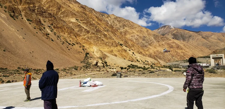
You fly into Lukla on a small mountain aircraft. The landing is short, steep, and unforgettable. When the engine cuts and the mountain air hits you, the shift is immediate. The Khumbu doesn’t feel like the rest of Nepal. It feels higher, older, quieter in a different way.

This 11-day trek follows the classic Everest Base Camp trail as far as Namche Bazaar, the main Sherpa town of the region. But instead of rushing through, this itinerary gives you time. Time to adjust to the altitude. Time to sit in teahouses. Time to actually experience the rhythm of the trail.

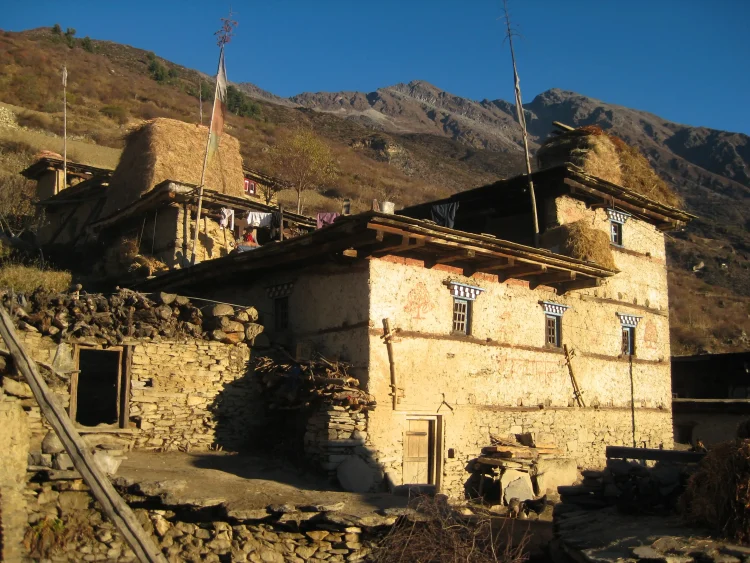
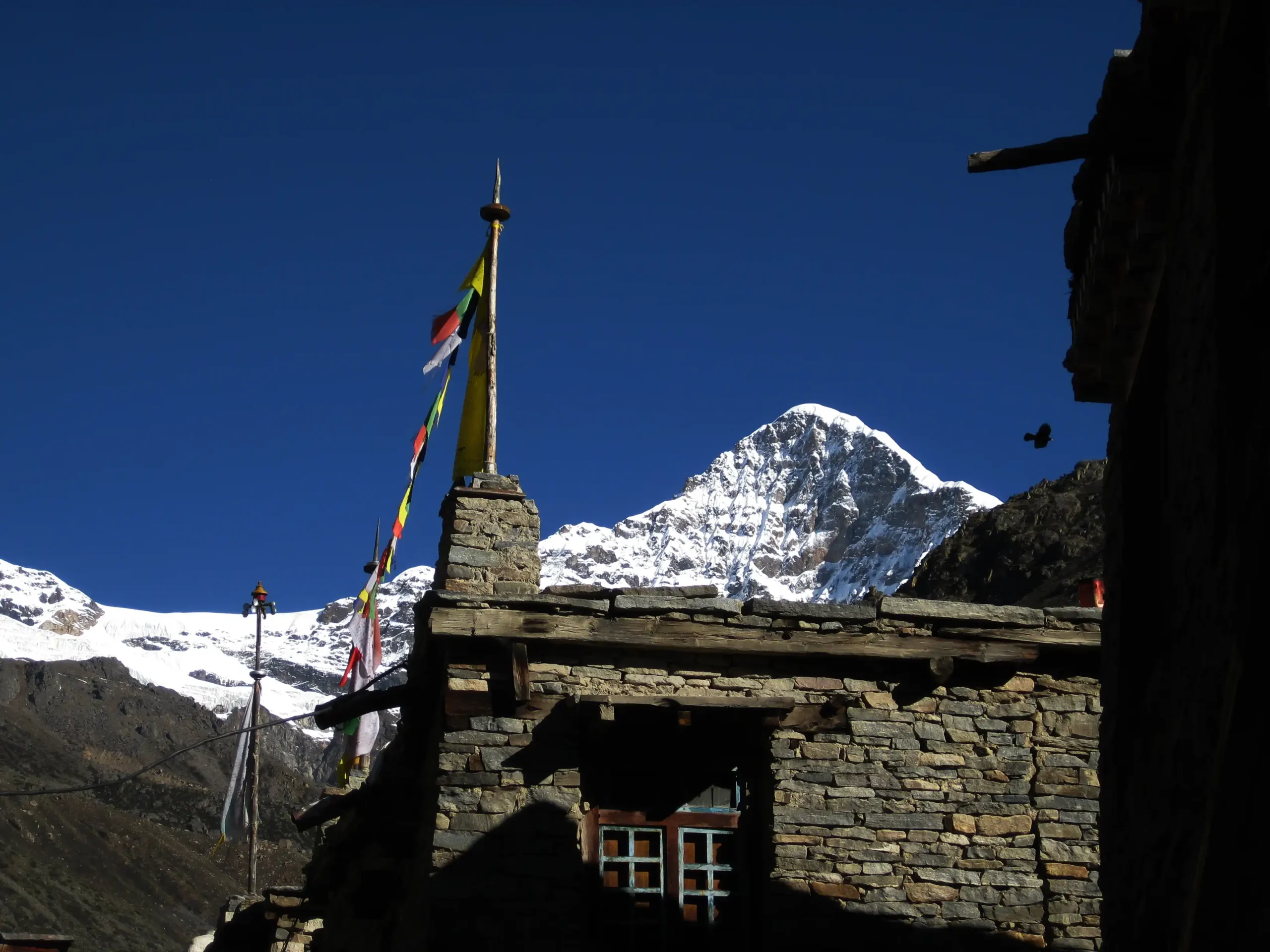
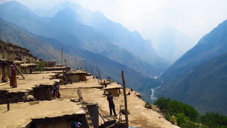
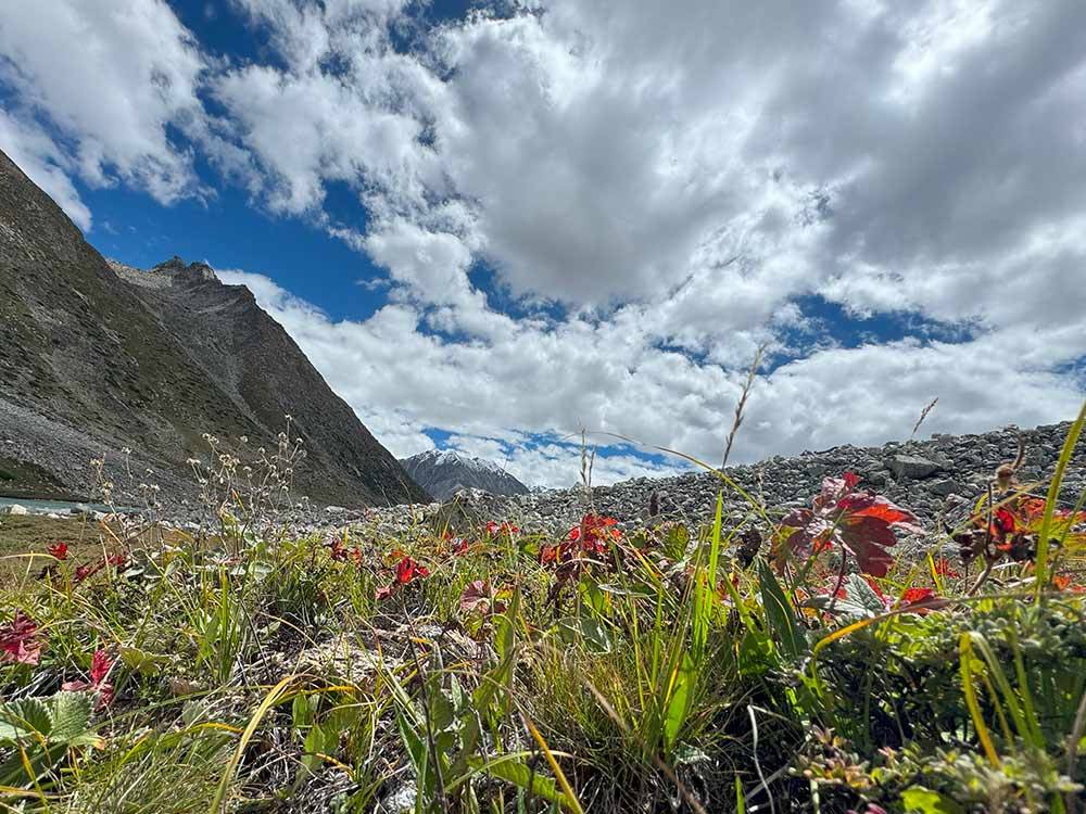
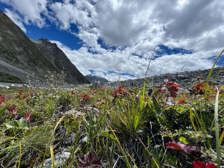
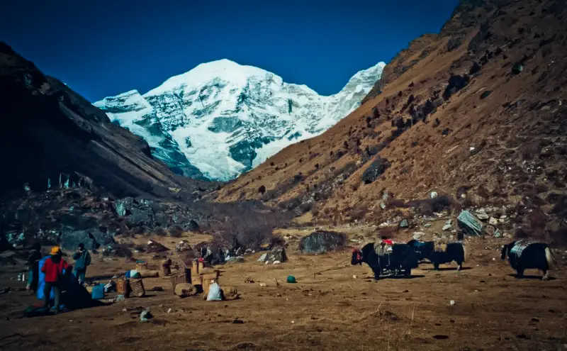
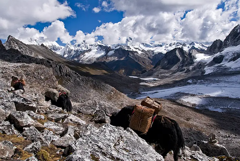
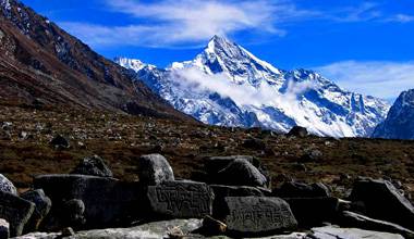
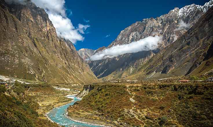
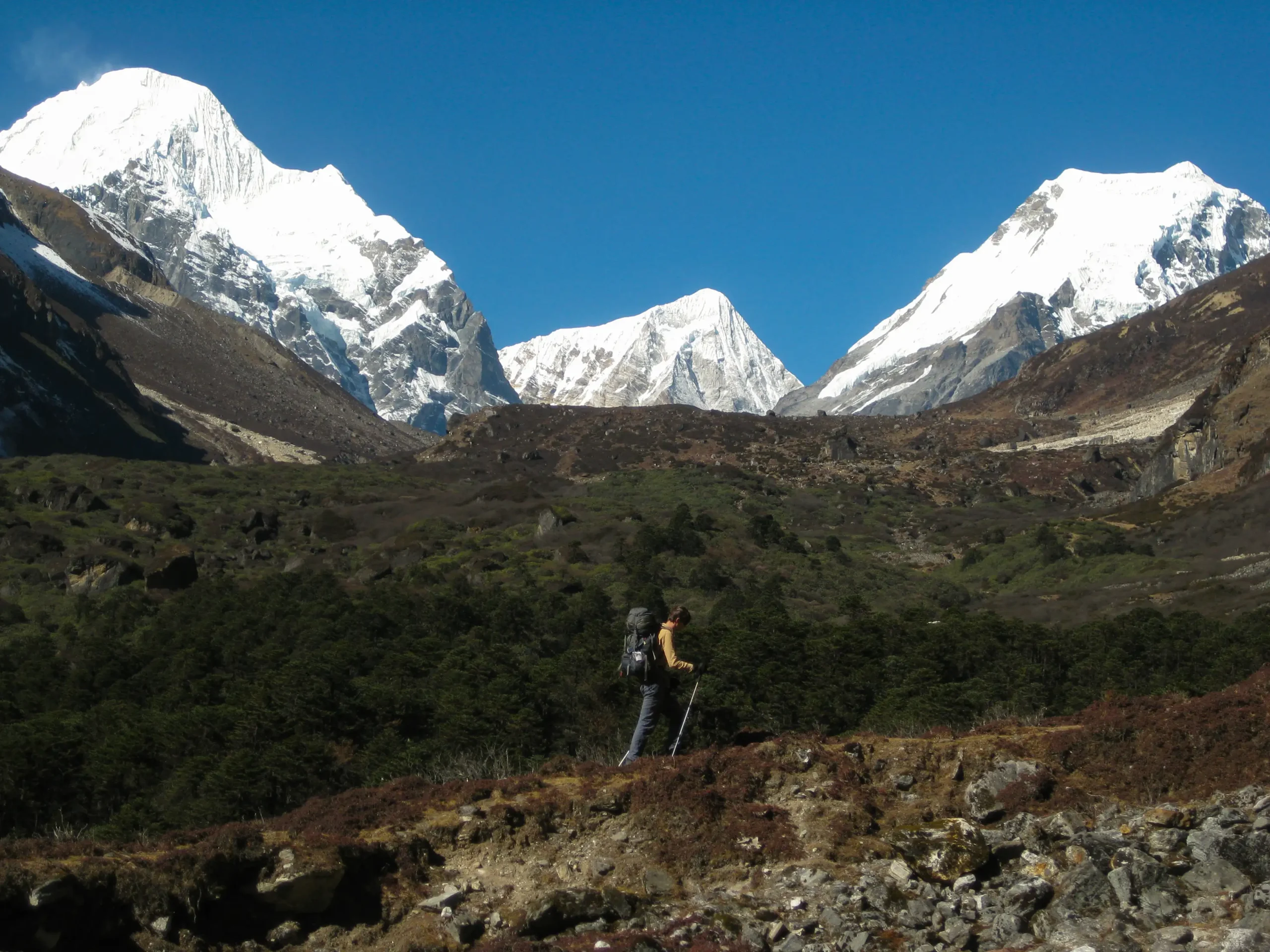
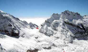
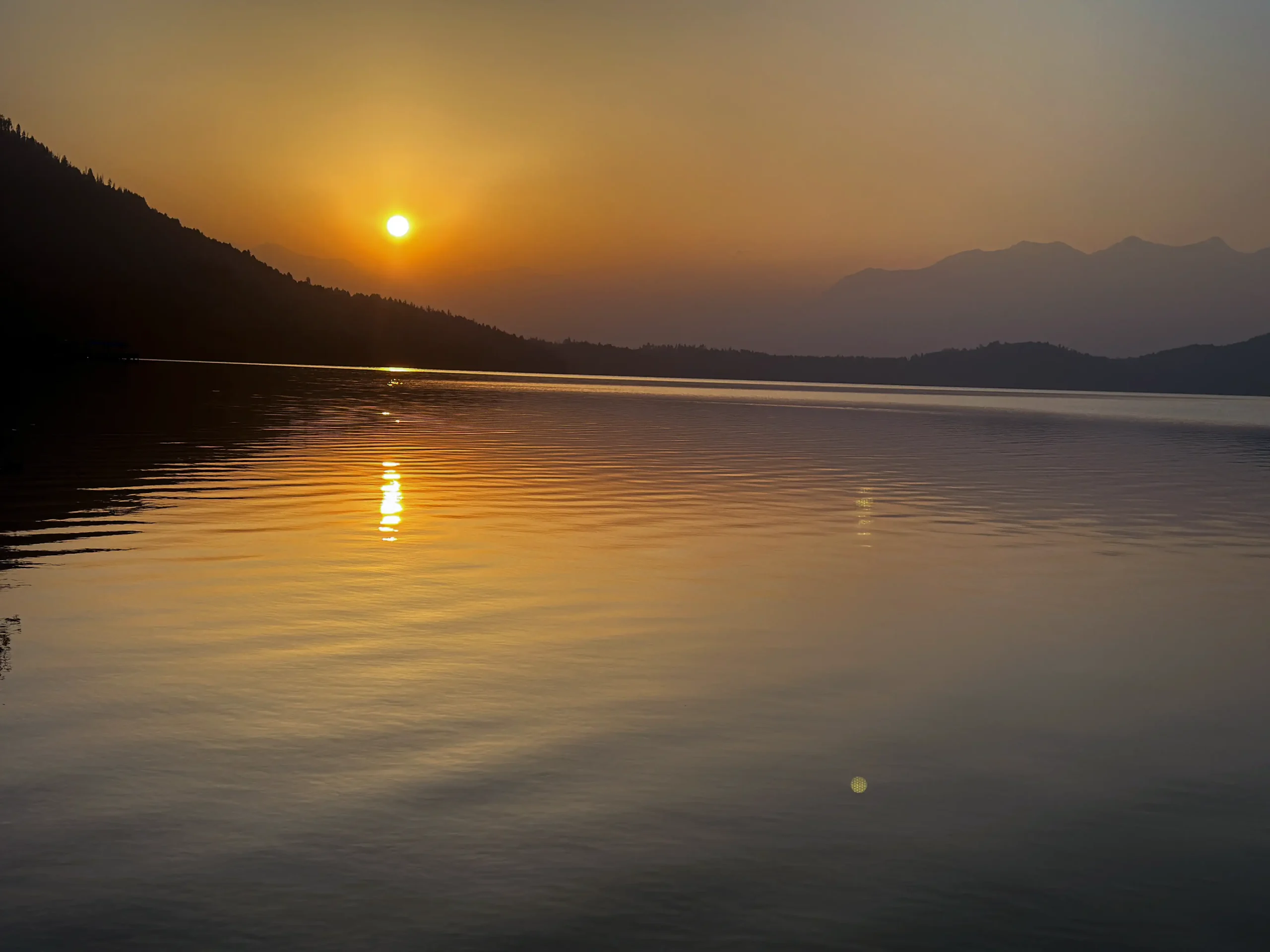
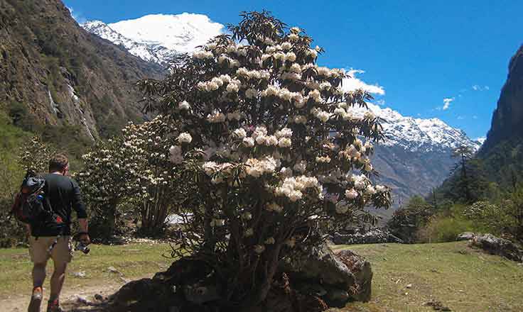
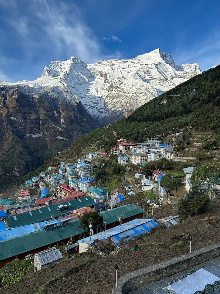
From Lukla, the path follows the Dudh Koshi River through small villages like Phakding, across long suspension bridges, and into Sagarmatha National Park. The forests grow denser. The air gets thinner. The climb to Namche is steady and demanding, but when you reach the amphitheater-shaped town at 3,440 meters, it feels earned.

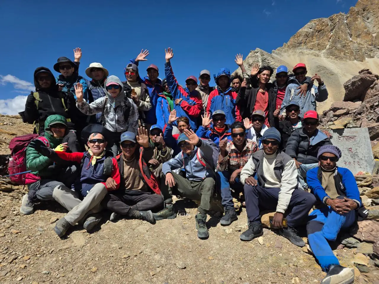
Many trekkers pass through Namche in a hurry on their way to Everest Base Camp. This trek doesn’t rush. You stay. You explore. You walk higher to Khumjung Valley at 3,880 meters, where the views open wide and the crowds thin out. You continue to Thame, a quieter village tucked into a side valley, known for its monastery and deep mountaineering history.

The Lukla to Namche Trek is rated moderate. The trails are well-established, and the lodges are comfortable by mountain standards. Still, you should arrive prepared. The altitude is real, and the uphill days require steady pacing rather than speed.

Why Choose the Lukla to Namche Trek?

The Everest Region Without the Full Commitment

Not everyone has three weeks for Everest Base Camp. This route gives you the essential Everest experience in eleven days: the flight to Lukla, the famous bridges, Sherpa villages, and Himalayan views without pushing into extreme altitude.

For many trekkers, this is enough. You see the culture. You feel the terrain. You understand the scale of the mountains.

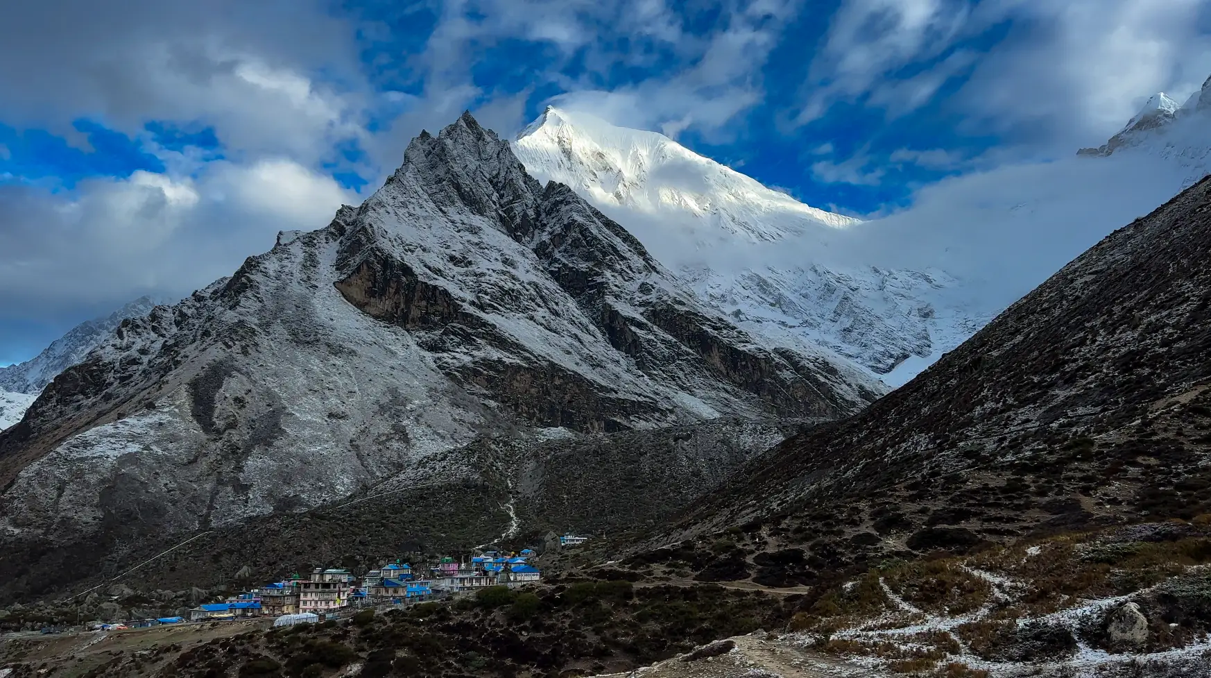
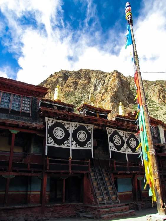
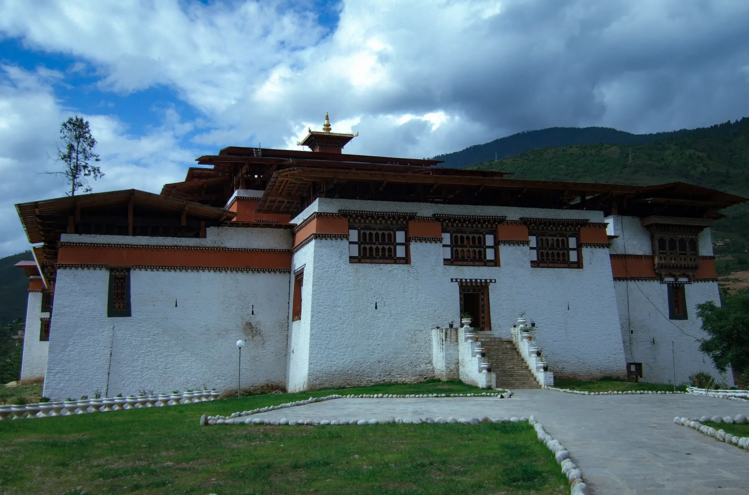
Namche Bazaar Is More Than a Stop

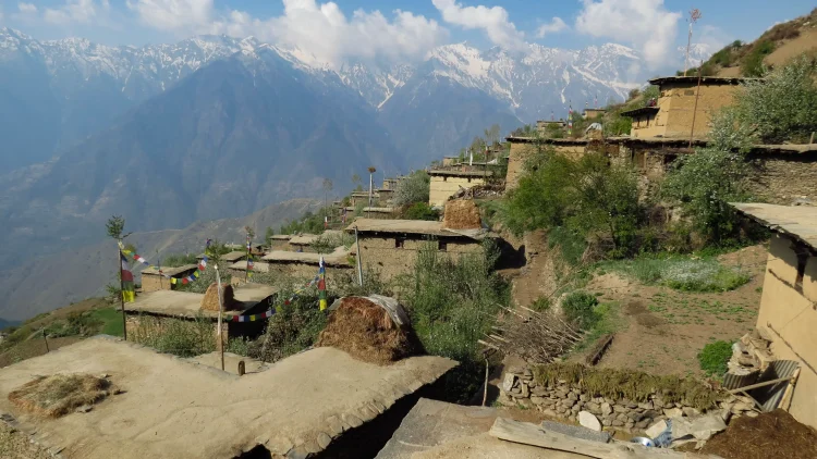
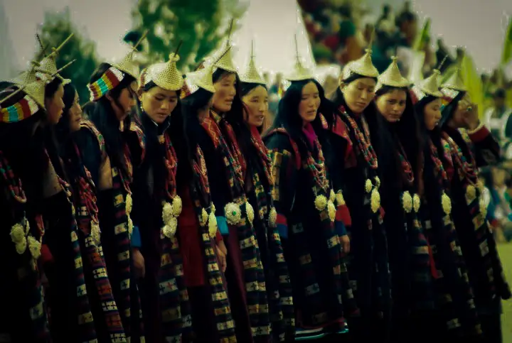
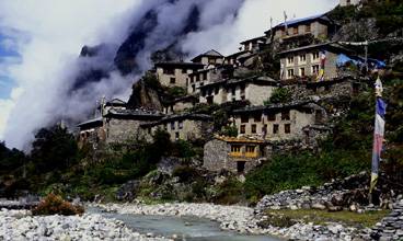
Namche Bazaar surprises people. It is not just a village; it feels like a small mountain town built into a hillside. There are bakeries, gear shops, a weekly market, and museums dedicated to Sherpa mountaineering history.

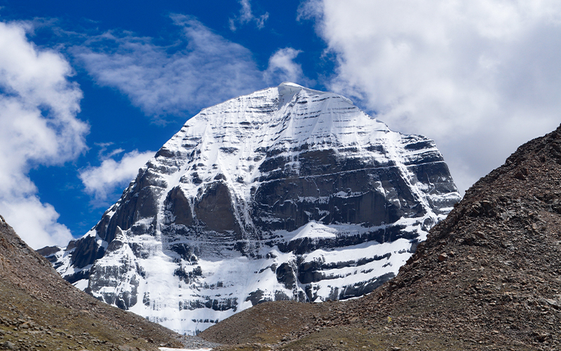
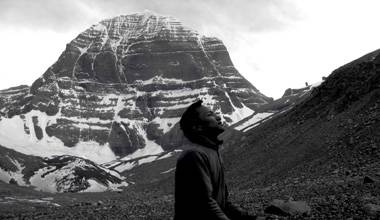
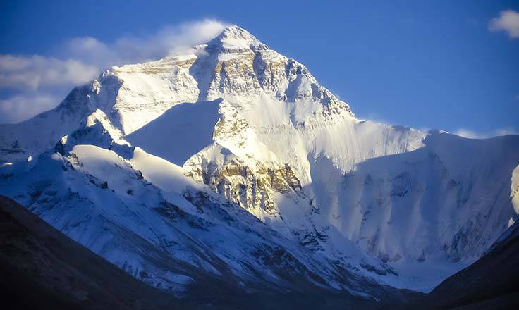
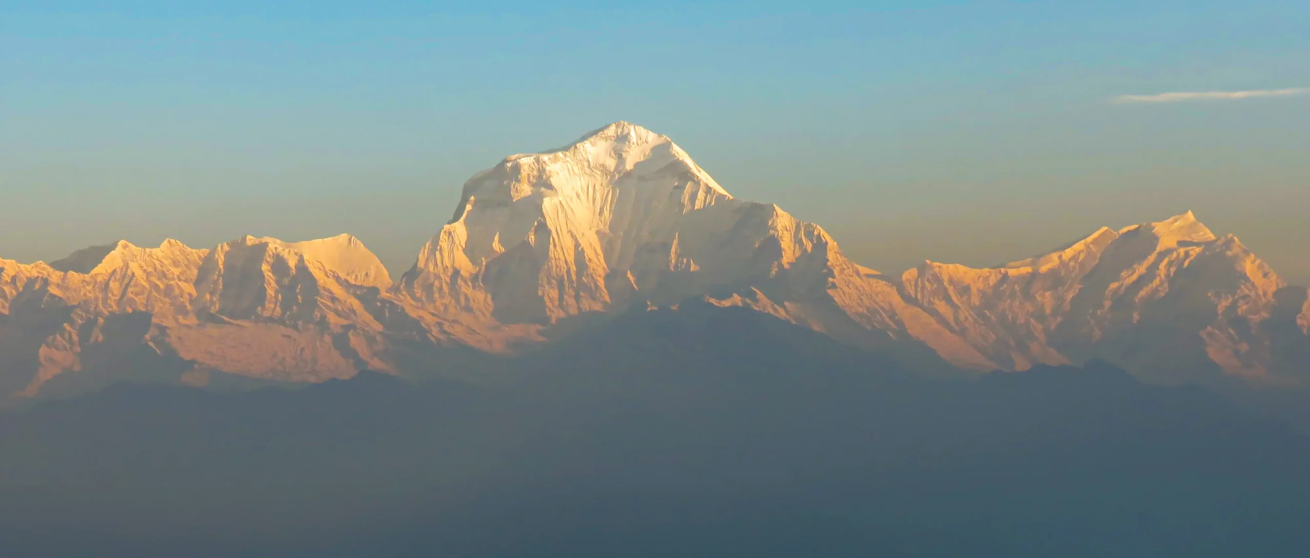
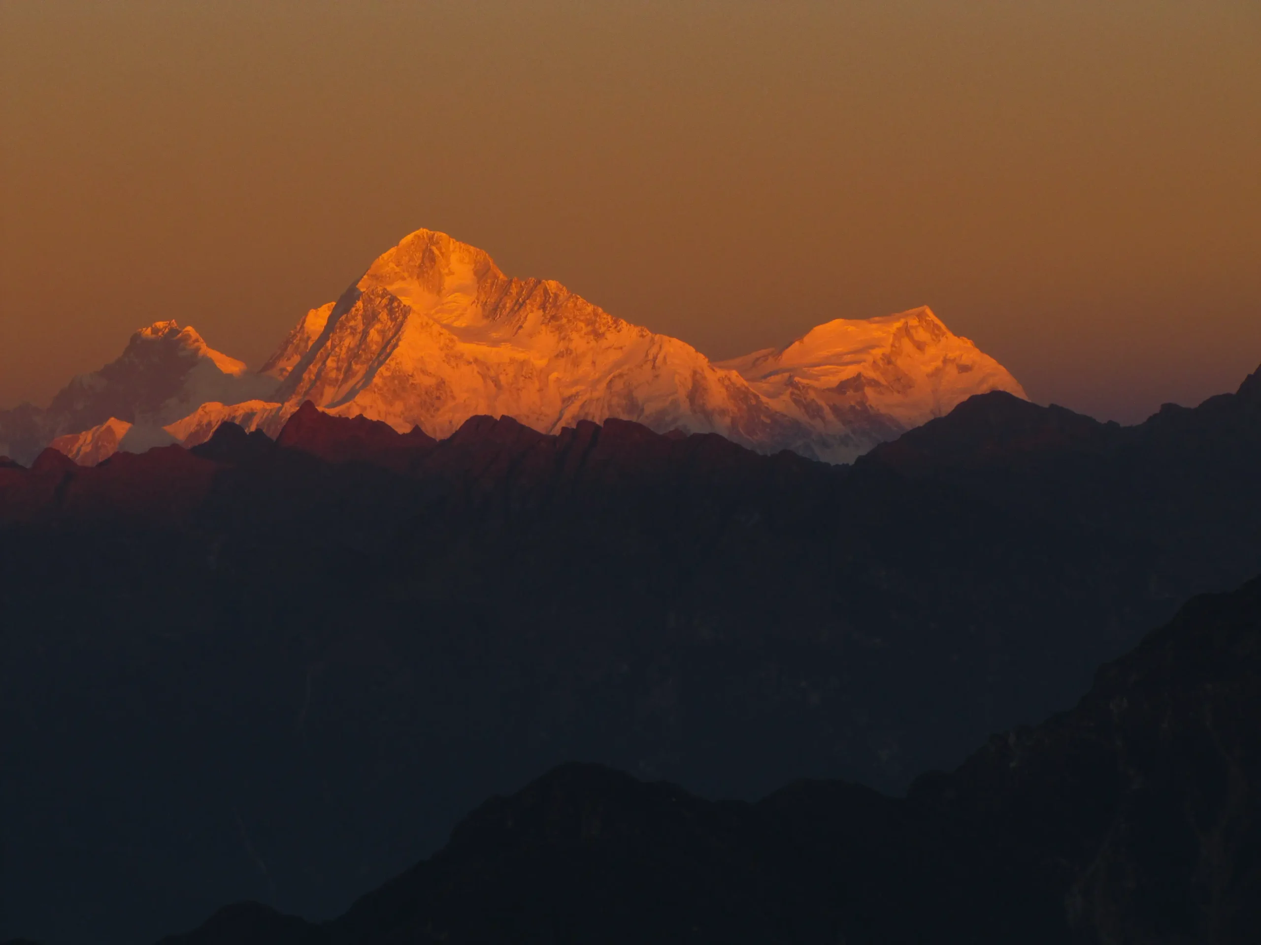
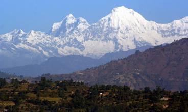
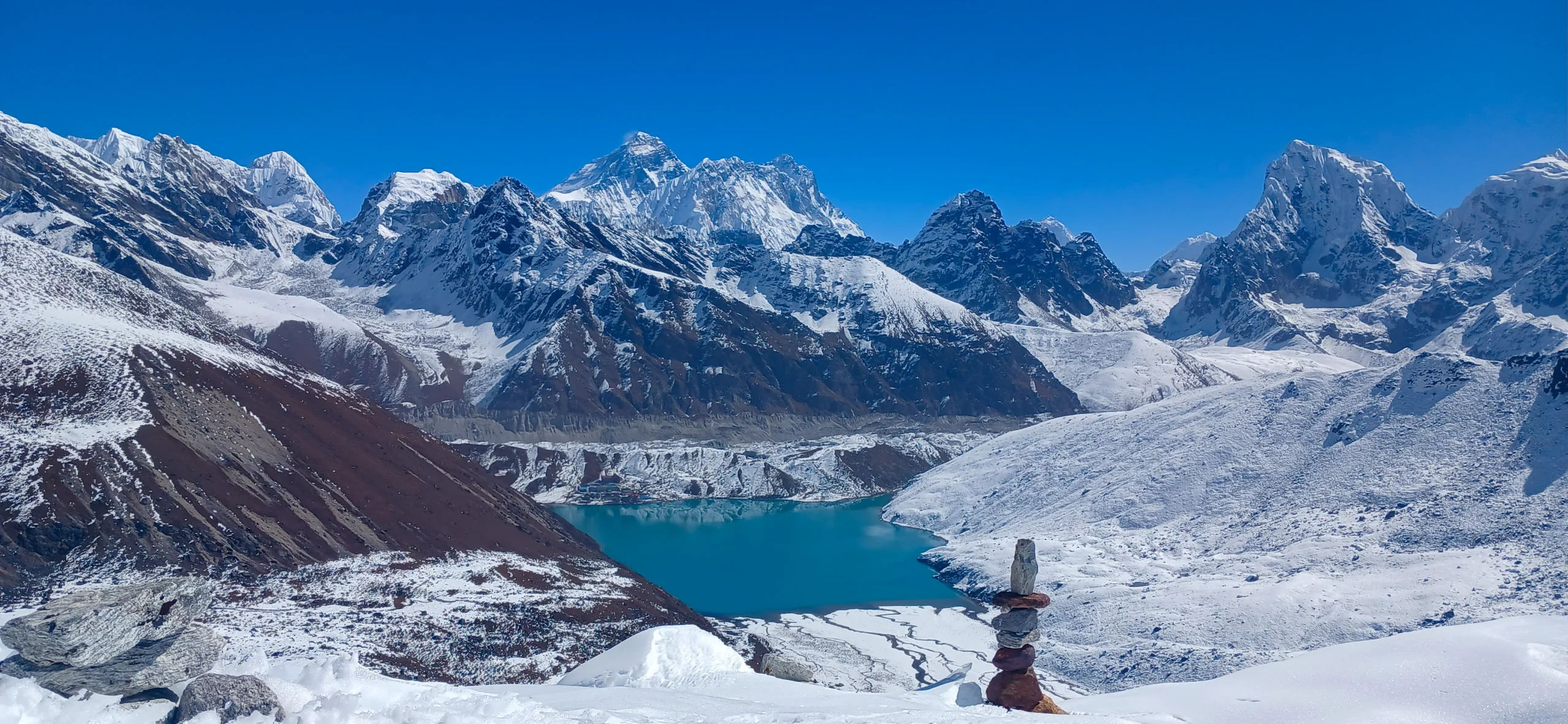
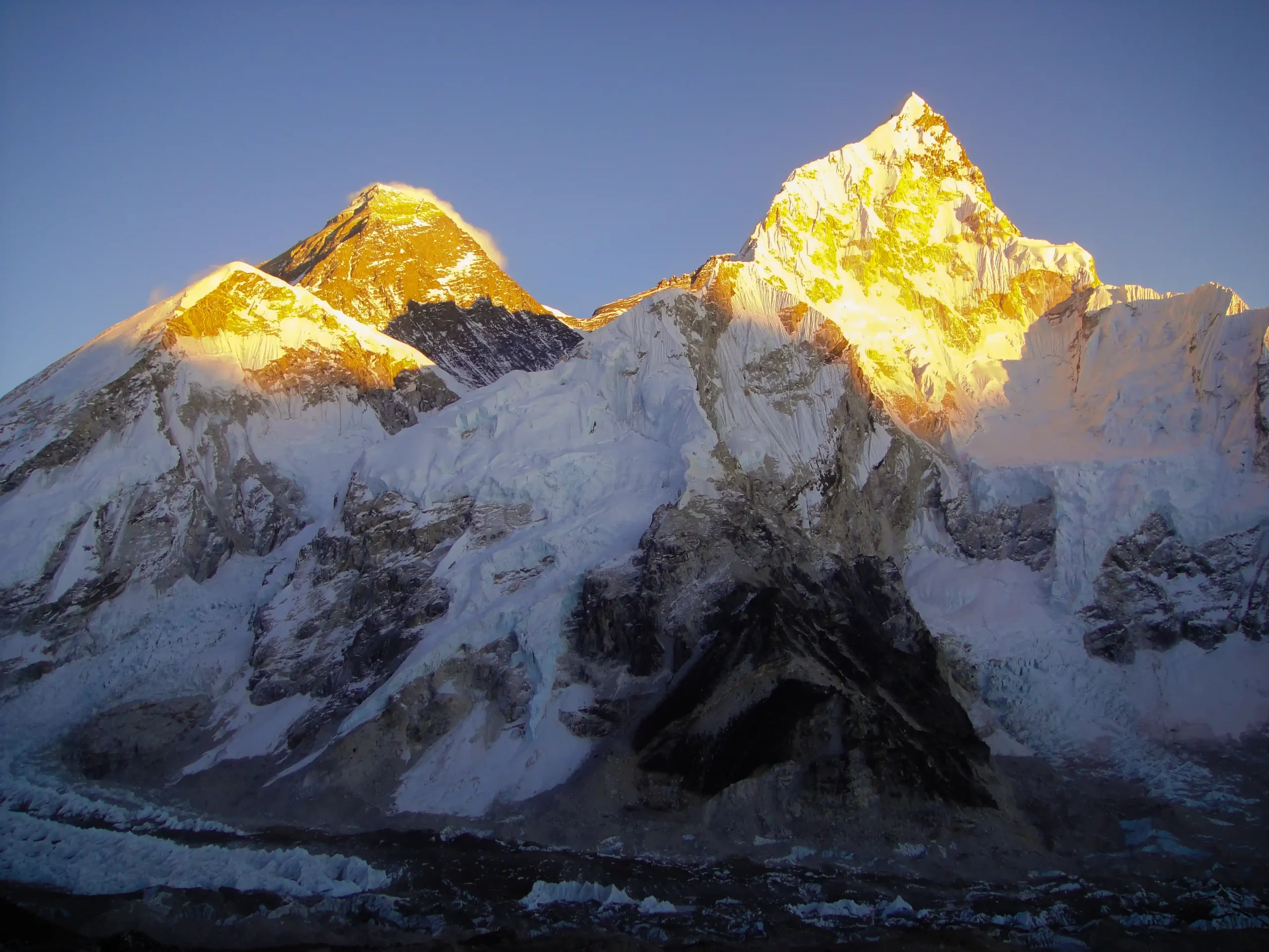
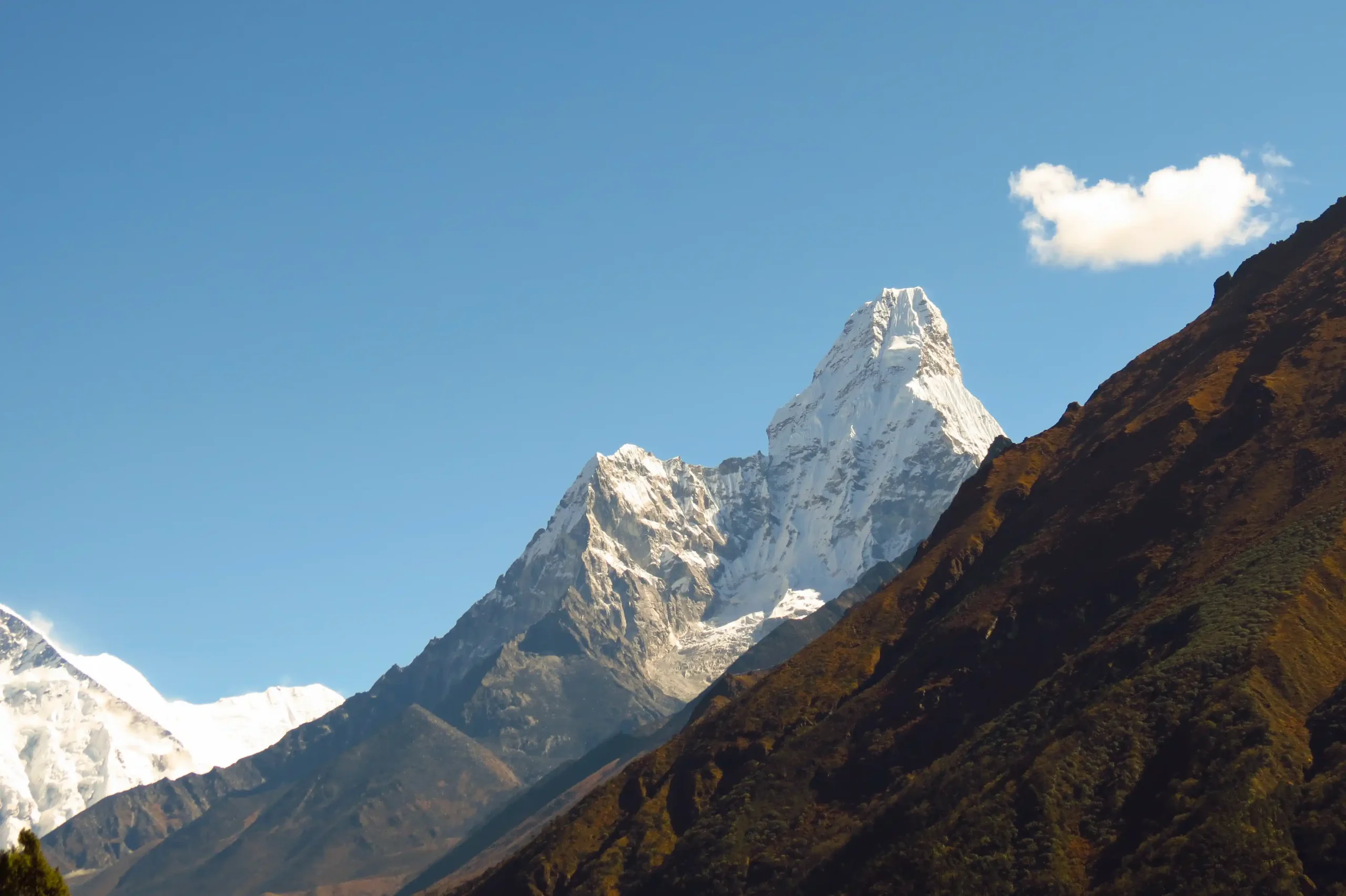
Above town, on a clear morning, you can see Mount Everest, Lhotse, and Ama Dablam rising beyond the ridges. It’s often the first real view of Everest for trekkers, distant but unmistakable.

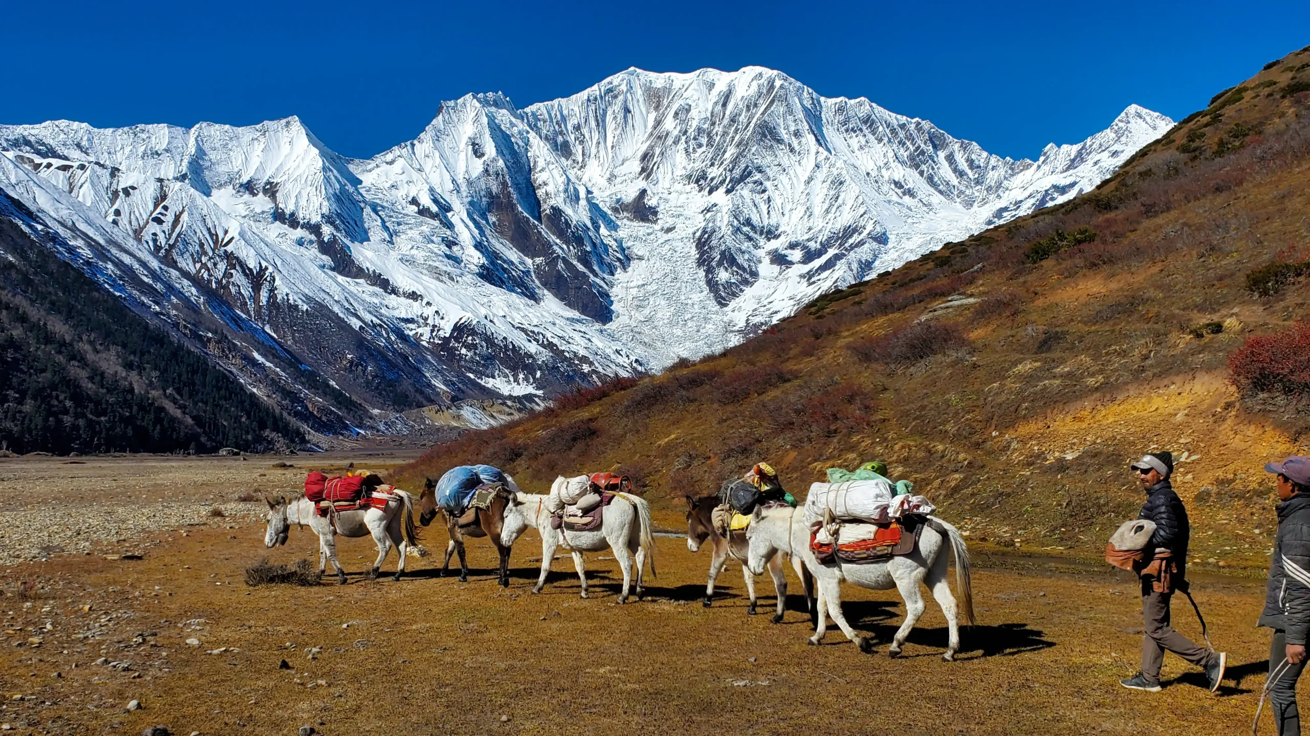
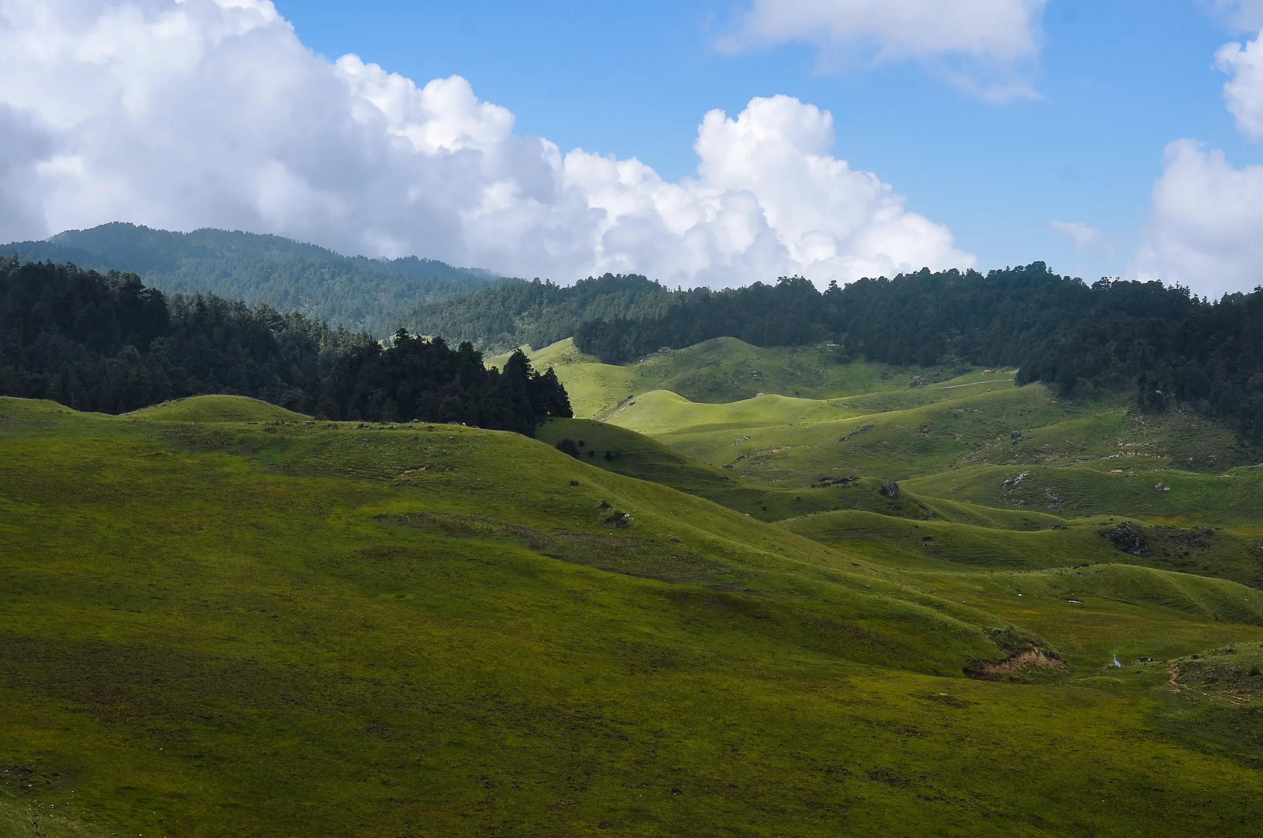
Khumjung and Thame: The Quieter Side of Khumbu

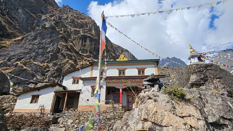
The extension to Khumjung and Thame changes the character of the trek. Fewer groups. Slower mornings. Stone houses and old monasteries.

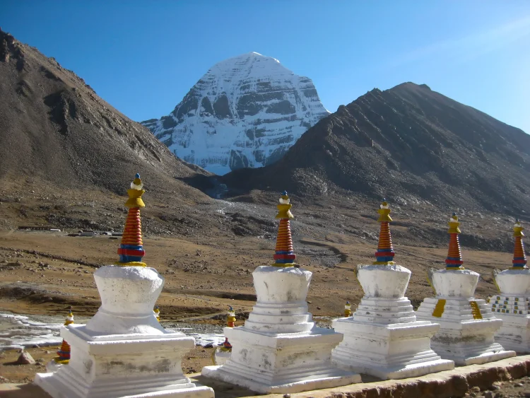
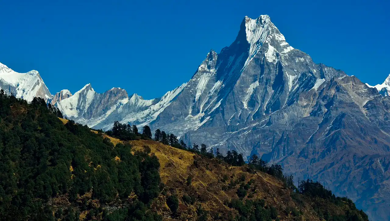
Khumjung sits high above the valley with wide views and open pastureland. Thame feels even more remote, historically connected to the Nangpa La trade route into Tibet. These villages are part of the Everest region, but they feel less commercial and more rooted in daily mountain life.

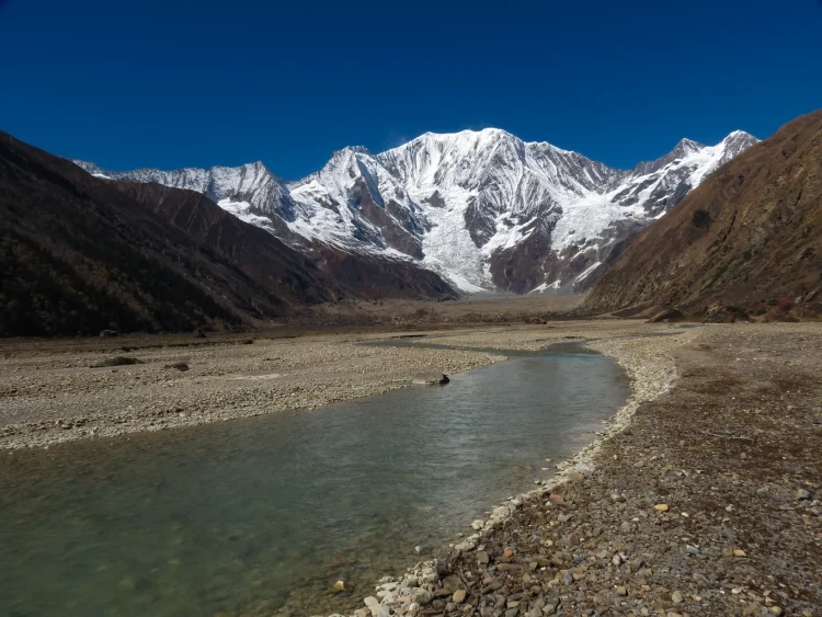
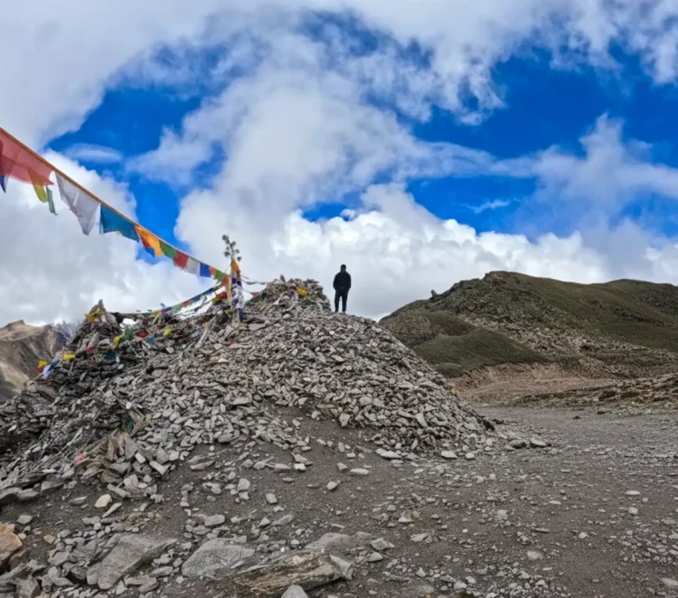
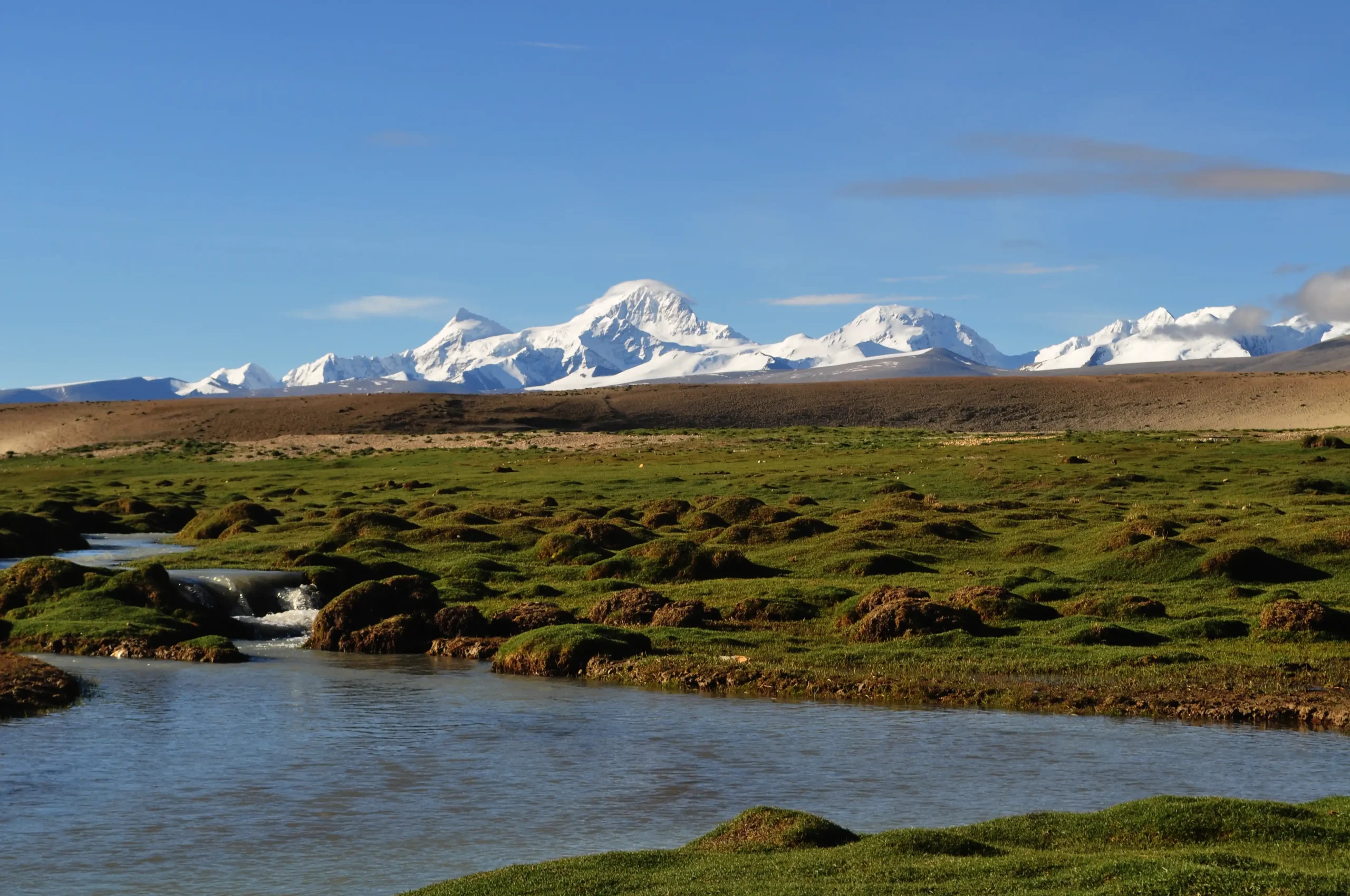
A Protected Himalayan Landscape

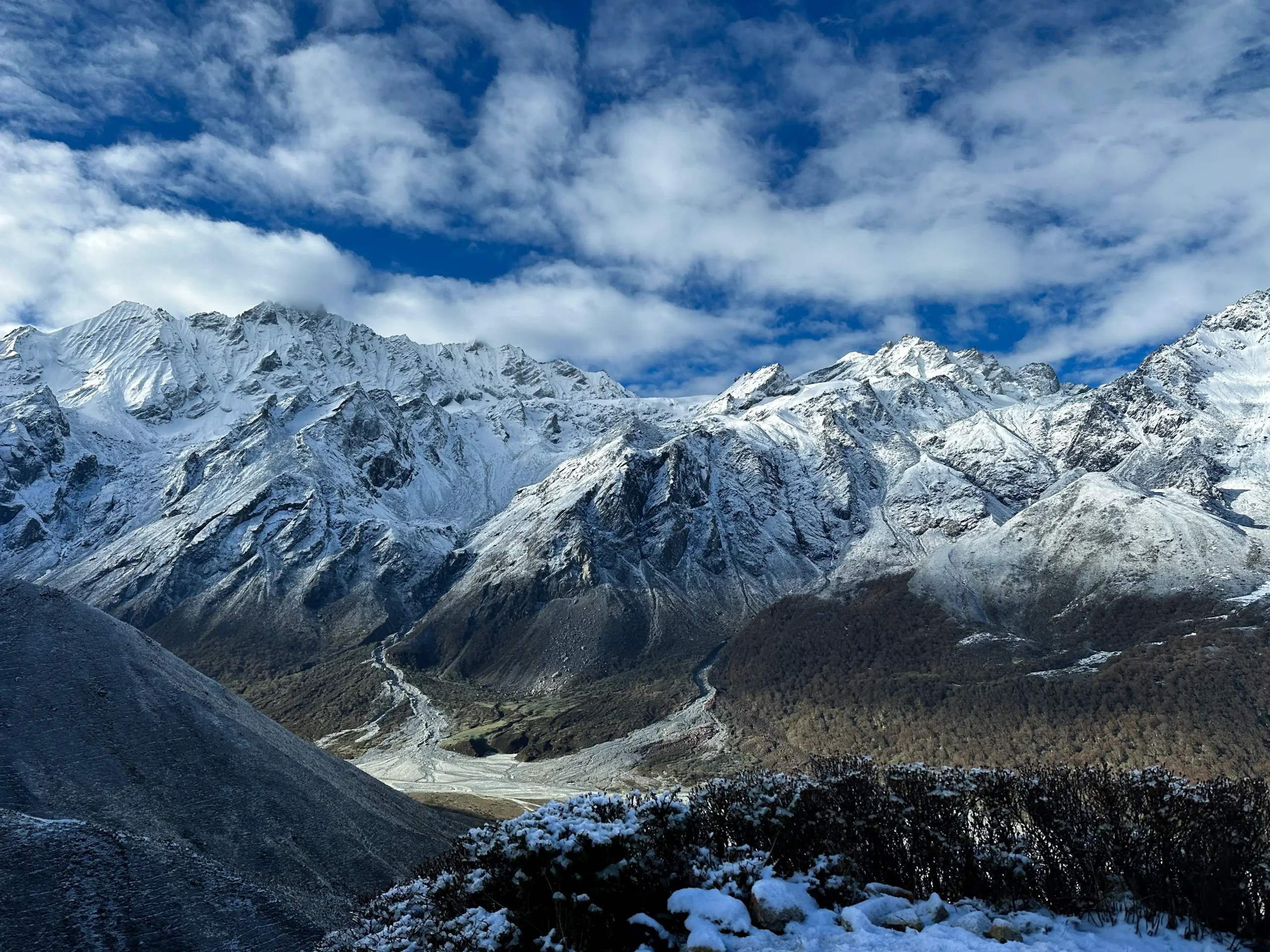
Once you pass Monjo, you enter Sagarmatha National Park, a UNESCO World Heritage Site. The forests below Namche are home to Himalayan tahr, musk deer, and the colorful Danphe, Nepal’s national bird.

It’s easy to focus only on the high peaks, but the lower elevations of the Khumbu hold just as much character, with pine forests, river valleys, and the constant sound of the Dudh Koshi moving below the trail.

Langtang Valley Trek

Overview

The Langtang Valley Trek is one of Nepal’s most beautiful and accessible Himalayan journeys. Nestled just north of Kathmandu, the valley combines stunning alpine scenery, lush forests, cascading waterfalls, and traditional Tamang villages. The trail offers panoramic views of Langtang Lirung, Yala Peak, and Dorje Lakpa, along with opportunities to experience local culture, monasteries, and wildlife. This trek is ideal for first-time trekkers and those seeking a moderate yet rewarding Himalayan adventure. Firante Treks ensures that your journey is safe, immersive, and tailored for comfort, with experienced guides and support staff at every step.

Highlights

  • Panoramic Himalayan views including Langtang Lirung and Yala Peak
  • Trek through traditional Tamang villages and local monasteries
  • Stay in comfortable lodges and teahouses along the trail
  • Explore Kyanjin Gompa, the spiritual and cultural center of the valley
  • Optional challenging hike to Tserko Ri for spectacular summit views
  • Scenic drives to and from Kathmandu with opportunities to see rivers, terraces, and mountain scenery
  • Wildlife sightings including langur monkeys and, occasionally, red pandas
  • Flexible pacing and guidance from experienced Firante trekking guides

Everest Base Camp Trek

Everest Base camp trek is  one of the trendy trekking routes of the Himalayas. Adventure, thrills, beautiful scenery along with the excitement of reaching the base camp of the hightest mountain of the world makes this trek very popular amongst hikers.

The journey is a remarkable one that provides wonderful experience of exploring the surrounding SoluKhumbu region and the Sagarmatha National Park while enjoying the pure Sherpa culture. Our path crosses through multiple villages of the region, hiking up and down the captivating landscape with new experience each day.

The journey starts from a scenic flight to Lukla from Kathmandu. The trek begins from a hike to beautiful village of Phakding and then to Namche Bazaar, Tengboche, Dingboche, Lobuche and so on.
We also ascend to Gorakshep and finally the base camp of Everest.

After the base camp, we trek up to the famous Kala Patthar viewpoint and pass Gorakshep. As the trails wind through many hills and valleys, you will walk along the Dudh Koshi River, crossing wooden and suspension bridges. We will pass many chortens and Gompas along with the famous Tengboche Monastery. At regular intervals, Mani stone wall carvings and colorful prayer flags decorating the region can also be seen.

The views of mountains such as Everest, Thamserku, the Kongdi RI, Ama Dablam, Tawache, Nuptse, the Kusum Kangraru, Pumori, Makalu and many others will constantly show you the way. You will spend time in Namche, also known as the “gateway to Everest”,  explore the Sherpa Museum in Namche Bazar along with some sightseeing the village upclose.

The Everest Base Camp trek is an incredible combination of Khumbu’s natural charm and unique way to experience the tradition of people living in the Himalayan region.

Saipal Base Camp Culture Trek

If you’re craving a true off-the-beaten-path Himalayan adventure, the Saipal Base Camp Cultural Trek delivers in every way. This 17-day journey takes you deep into Far West Nepal to the base of Mt. Saipal (7,031m), the region’s second-highest peak, famous for its striking pyramid shape and sacred aura. Far from the crowds of the Everest or Annapurna region, it’s a rare chance to explore pristine wilderness while connecting with communities whose traditions have barely changed in centuries.

Mt. Saipal (7,031m) rising above the remote Far West Nepal landscape during the Saipal Base Camp Cultural Trek
Mt. Saipal’s striking pyramid peak dominates the untouched landscape of Far West Nepal

You don’t need previous high-altitude experience for this trek, just solid fitness, an open mind, and a love for genuine discovery. We start in Simikot (2,910m), the gateway to Humla, and soon enter the historic Nyin Valley. For generations, this valley served as a vital trade corridor between Nepal and Tibet, with yak caravans hauling salt, wool, and grain over high passes. Walking these same ancient trails today feels like stepping back in time, as local life still revolves around the rhythms of the seasons and the land.

Meeting the Nyinba People & Their Living Traditions

In the upper Nyin Valley villages, you’ll stay with Nyinba families, warm and welcoming people whose Tibetan Buddhist culture remains remarkably intact. Some households still follow the tradition of fraternal polyandry, in which brothers share a wife to keep family land and resources together in this tough, high-altitude environment. It’s a rare glimpse into a way of life that’s faded across much of the Himalayas. Visit ancient monasteries like Raling Gompa (around 4,000m), share butter tea and stories with elders, and witness daily rituals that feel deeply spiritual and timeless.

Traditional stone houses in a Nyinba village, upper Nyin Valley
A Nyinba village where traditional stone houses reflect centuries of Himalayan life

Diverse Villages, Landscapes & Daily Life

Lower down, along the Karnali River, Chhetri and Thakuri communities welcome you into their homes for authentic homestays. Their days center on traditional farming and herding, tending fields, milking yaks, and weaving stories around the fire. The trail itself is a highlight: winding through old-growth deodar and blue pine forests, blooming rhododendron in spring, open alpine meadows alive with grazing yaks, rushing rivers, and vast pastures under endless skies.

The Thrill of Sakya La Pass & Epic Views

The physical highlight comes when you cross Sakya La Pass (5,030m). The 360-degree panorama unfolds: Mt. Saipal dominating the foreground, flanked by Chang La, Crystal Peak, and distant glimpses of India’s Nanda Devi range. It’s one of those moments that makes every step worthwhile. On the return, we visit Yalbang Monastery. In one of Humla’s most important Tibetan Buddhist centers, you can join morning prayers, spin prayer wheels, and soak in the peaceful atmosphere after days in the mountains.

Why This Trek Feels Like a Hidden Shangri-La

What sets the Saipal Base Camp Cultural Trek apart is how uncrowded it stays. No long lines at viewpoints, no rush-hour trails. Just you, the mountains, and genuine encounters with locals who share their lives openly. Many who join us call it Nepal’s last true hidden gem: unspoiled nature paired with deep cultural connection, all in meditative solitude.

In the end, this 17-day journey is more than a trek. It’s a window into a vanishing Himalayan world, blending breathtaking scenery, meaningful cultural exchanges, and real wilderness adventure. If you’re seeking remoteness, authenticity, and something far from the mainstream paths, the Saipal Base Camp Cultural Trek stands out as one of the most rewarding experiences in Nepal’s far western Himalayas. Ready to step off the map?

Humla Limi Valley Trek: Nepal’s Hidden Tibetan Cultural Gem

The Humla Limi Valley Trek is one of the last truly remote trekking journeys in Nepal, created for travelers who want cultural depth as much as mountain scenery. Opened to foreign trekkers only in 2002, this route enters Humla’s restricted region near the Tibetan border, where Tibetan Buddhism, seasonal migration, and traditional village life continue much as they have for centuries.

Located in Nepal’s far northwestern corner, the Limi Valley Trek in Nepal follows sections of the upper Karnali River before climbing into wide alpine valleys and crossing high Himalayan passes. The trail links the historic villages of Halji, Til, and Jang, settlements shaped by ancient salt trade routes between Tibet and Nepal. Even today, these villages remain largely untouched by modern infrastructure, making this a true off-the-beaten-path trek in Nepal.

Unlike popular teahouse routes, this trek is quiet and physically demanding, often supported by camping logistics. On clear days, trekkers may glimpse distant views of sacred Mt. Kailash across the Tibetan plateau, adding a spiritual layer to a journey already rich in history and tradition.

Why Choose the Humla Limi Valley Trek?

Authentic Tibetan Buddhist Culture

The Tibetan cultural experience in Limi Valley is among the most genuine found anywhere in Nepal. In Halji village, the Rinchenling  Monastery, founded in the 10th–11th century by the renowned translator Rinchen Zangpo, still functions as an active religious center rather than a preserved monument.

Daily life follows a slow and traditional rhythm. Women continue hand-weaving carpets using wooden looms, children assist with yak herding, and prayer flags line stone houses built generations ago. Religious rituals, mani walls, and seasonal festivals are part of everyday life, not performances for visitors.

Halji Rinchen Ling Monastery 11th century Tibetan Buddhist gompa Limi Valley Nepal
11th-century Halji Rinchen Ling Monastery, Limi Valley’s most important religious site.

High Himalayan Passes and Open Landscapes

The trek crosses two major Himalayan passes, Nara La (4,580m) and Nyalu La (around 5,000m), the highest point of the journey. These crossings are physically demanding but reward trekkers with vast, silent landscapes that define remote trekking in Humla.

The terrain shifts constantly, from pine and juniper forests to alpine meadows, yak pastures, and deep river gorges carved by the Karnali River system. From Nyalu La, weather permitting, distant views of Mt. Kailash can sometimes be seen across the border, making this a rare Mt. Kailash view trek within Nepal.

Nyalu La Pass 5000m highest point Humla Limi Valley Trek with distant Mt Kailash view
Nyalu La Pass (5000 m) – Highest point on the Humla Limi Valley Trek with distant panoramic view of Mount Kailash.

Rare Wildlife and an Intact Natural Environment

The Humla restricted area permit zone protects one of Nepal’s least disturbed mountain ecosystems. While wildlife sightings are never guaranteed, trekkers often see blue sheep (bharal), Himalayan yak grazing on steep slopes, along with marmots and high-altitude bird species.

Higher ridgelines are known habitats for snow leopards, while forested areas may shelter Himalayan black bears and musk deer. Limited human activity helps preserve the raw, untouched character of the region.

wildlife sighting Humla restricted area Nepal
Wildlife spotting in Humla Restricted Area, Nepal – glimpse rare Himalayan animals in the wild!

The Historic Simikot to Hilsa Trek Route

The Simikot to Hilsa trek follows ancient trade and pilgrimage routes once used to exchange Tibetan salt for grain from lower Nepal. These paths shaped the settlement patterns and culture of the entire region.

Although short sections of jeep track now exist in lower areas, much of the trail remains unchanged. Long walking days, river crossings, and high passes preserve the expedition-style feel of the trek, with camping beneath clear night skies and days spent moving between isolated villages.


Cultural Immersion Experiences

🏛️

Ancient Monasteries

Visit Halji Rinchen Ling Monastery with pristine 10th-11th century murals and Buddhist artifacts.

🧵

Living Traditions

Watch women hand-weave carpets, children herd yaks, and witness centuries-old customs in daily life.

🏘️

Remote Villages

Explore Halji, Til, and Jang where less than 100 foreign trekkers visit annually.

Must-Visit Cultural Sites:

  • Halji Rinchen Ling Monastery – 10th-11th century gompa
  • Rinchenling Cave – 11th-century meditation site
  • Traditional Carpet Weaving – Live demonstrations
  • Yak Herding Culture – Meet nomadic families
  • Buddhist Monasteries – Functioning gompas in villages
  • Mani Walls & Prayer Flags – Ancient pilgrimage markers

Kailash and Upper Humla Circuit Trek – Remote Route via Simikot

There are treks, and then there are journeys that change how you see the world. The Kailash Upper Humla Circuit Trek is firmly the second kind.

This is not your typical Himalayan trail. There are no busy teahouse lodges, no crowds at the viewpoints, no phone signal to distract you. What you get instead is raw, unfiltered Nepal, the kind that most people never see. Ancient monasteries are still humming with daily prayer. Pine-forested gorges carved by the thunderous Karnali River. High-altitude passes where Tibet suddenly appears on the horizon like a mirage. And at the end of it all, the sacred pyramid of Mount Kailash (6,638 m), rising alone on the Tibetan plateau, is one of the holiest mountains on Earth.

Starting and ending in Simikot,  the remote district headquarters of Humla, this 27-day circuit combines two extraordinary experiences in one unforgettable journey: the Upper Humla Circuit through the legendary Limi Valley, and the Kailash Kora, the 53 km circumambulation that Hindus, Buddhists, Jains, and Bon pilgrims have walked for over a thousand years.

If you have ever dreamed of walking somewhere that truly feels untouched, this is it.

North Face of Mount Kailash seen from the Kailash Upper Humla Circuit Trek route
The North Face of Mount Kailash, the spiritual heart of the Himalayas.

WHY THIS TREK IS DIFFERENT

Most people who come to Nepal have heard of Everest Base Camp. Some have heard of Annapurna. Very few have heard of Humla, and that is exactly the point.

Humla is Nepal’s most remote district. For most of its history, the only way in was by air, a short mountain flight from Nepalgunj, a 45-minute hop in a small prop plane that skims over ridgelines and drops into Simikot’s narrow airstrip. In recent years, a rough unpaved track has been carved through the mountains, making it technically possible to reach Humla by road — but “possible” is doing a lot of heavy lifting in that sentence. The route is rugged, seasonally unreliable, and an adventure in itself. For most trekkers, the flight remains the practical and far preferable choice. From the moment you land at Simikot, you feel it regardless of how you arrived: this is somewhere genuinely different.

Campsite in Upper Humla during the Kailash Upper Humla Circuit Trek
Camping in Upper Humla along the Kailash circuit, surrounded by vast landscapes and complete silence.

The Upper Humla Circuit takes you deep into the Limi Valley, a hidden Himalayan world that Nepal trekking pioneer Steve Razetti once listed among the Top 10 Treks in the World. It is a place where ancient Tibetan Buddhist culture has survived almost completely intact. Where monasteries built between 400 and 1,000 years ago still receive monks every morning, where yak caravans move through high passes exactly as they have for centuries.

And then you cross into Tibet. You walk the Kailash Kora. And you understand why millions of pilgrims across four religions consider this mountain the spiritual centre of the universe.

This is not a holiday. It is a pilgrimage. And it will stay with you for the rest of your life.

THE KAILASH KORA — WHY IT MATTERS

Mount Kailash has never been climbed. Not because it is technically impossible, several mountaineers have studied the routes. But by deep, cross-cultural agreement, it remains unclimbed out of respect. It is the one great summit that humanity has collectively decided to leave alone.

Four major religions claim it as sacred. Hindus believe Lord Shiva meditates on the summit, with Goddess Parvati beside him. Tibetan Buddhists consider it the throne of Demchok, representing supreme bliss. Jains revere it as the place where their founding teacher Rishabhadeva attained liberation. The ancient Bon religion, Tibet’s pre-Buddhist tradition, calls it the nine-storey Swastika Mountain, the central pillar of the world.

Walking the Kora, the 53 km circuit around the mountain, is said to wash away the sins of a single lifetime. Walk it 108 times, and you reach enlightenment. Most of us will be satisfied with once.

The route crosses Dolma La Pass at 5,630m, the trek’s highest point, where prayer flags fill the sky, and exhausted pilgrims weep from altitude, emotion, and sheer relief. Below lies a glacial lake of startling blue, and the descent brings the full south face of Kailash into view — four near-perfect walls of dark rock and snow rising into a sky that feels closer here than anywhere else on Earth.

Nyin Valley Cultural Trek – Remote Cultural Journey in Humla, Nepal

The Nyin Valley lies in the northwestern corner of Nepal, close to the Tibetan border. It is one of the least-visited trekking areas in Humla. Unlike commercial trekking routes, this valley remains quiet and culturally intact.

The journey is less about high passes and more about people. The Nyinba community, originally of Tibetan origin, continues to follow traditions shaped by geography, isolation, and seasonal living. In some villages, the traditional polyandry system still exists. It developed as a way to manage farmland and family property in a harsh mountain environment.

This trek offers cultural understanding rather than spectacle.

Village Life and Local Traditions

The trail passes through villages such as Buraunse, Baragaun, Torpa, and Nimatang. Stone houses are built close together to protect from winter winds. Barley and buckwheat fields line the hillsides during the growing season.

Older residents still speak about the salt trade routes that once connected Tibet and Nepal. Families worked as traders, farmers, and herders. Life moved with the seasons, and in many ways, it still does.

Stories are shared in kitchens over butter tea. They are not preserved in museums.

“In winter, cooperation is everything,” says Tenzin, a local Nyinba guide from Burause. “Visitors who walk slowly and listen understand our valley better.”

Traditional Nyinba stone houses in Buraunse village during Nyin Valley trek
Traditional stone-built homes in Buraunse village

Raling Gumba and Sacred Sites

Raling Gumba, located at around 4,100 meters, is one of the most important monasteries in this part of Humla. It belongs to the Nyingma school of Tibetan Buddhism and remains spiritually active.

During Saga Dawa, villagers gather for prayers, rituals, and the raising of prayer flags. Long horns echo across the valley. Families travel from surrounding settlements to participate.

Near the trekking route lies Kharpunath, a sacred Hindu pilgrimage site dedicated to Lord Shiva. Pilgrims visit during Janai Purnima. Nearby natural hot springs provide rest after long walking days.

In Humla, Buddhism and Hinduism exist side by side. The boundaries are not strict.

“Saga Dawa is a community event first,” explains Dorje, one of our senior guides. “Guests are welcome, but respect is important.”

Raling Gumba monastery in Humla
Raling Gumba, an important Nyingma monastery in Humla

Thehe Village and Shamanic Practice

Thehe is one of the larger villages in this region, with nearly 800 traditional stone houses. Alongside Hindu rituals, ancient shamanic practices are still respected.

Local healers conduct ceremonies when requested by villagers. These traditions are part of everyday life rather than cultural performances.

The coexistence of belief systems makes this region culturally distinct even within western Nepal.

Thehe village during the Nyin valley cultural trek in western Nepal
Karnali River view from the Thehe village

Landscape and Walking Experience

Although this is a cultural trek, the natural scenery is impressive. Views of the Changla Himal range accompany much of the route. Trails pass through river valleys, terraced slopes, juniper forests, and suspension bridges.

Daily walking hours range between 5 to 7 hours depending on the section. The highest point of the trek reaches approximately 3,930 meters, making it suitable for trekkers with reasonable fitness and gradual acclimatization.

Electricity is limited in some villages. Internet access is unreliable. Conditions are basic but welcoming.

Access and Logistics

Reaching Nyin Valley requires flights from Kathmandu to Nepalgunj and onward to Simikot. Weather conditions may affect flight schedules, especially during the monsoon and winter.

Permits are required for Humla region trekking. Local coordination is essential due to limited infrastructure.

Why Trek the Nyin Valley with Firante Treks & Expeditions

Humla requires careful planning. Flight timing, permits, local communication, and accommodation arrangements must be organized in advance.

Firante Treks works closely with Nyinba families and local guides from the region. This ensures responsible tourism practices and direct local benefit.

Our team focuses on:

  • Experienced regional guides
  • Small group management
  • Cultural sensitivity
  • Flexible scheduling for weather conditions

Humla Changla Valley Trek

This trek takes you into one of Nepal’s most isolated corners, upper Humla district, right on the Tibetan border. It’s a restricted area, so you need special permits, and it’s full camping the whole way after the early villages. No teahouses, no crowds, just high valleys, old yak trade routes, and the Phyajang La Pass at 5,496 m. Everything starts in Simikot (2,910 m), Humla’s main hub, where flights often get delayed by weather and life moves on foot or yak.

Why This Trek Feels Different from Everest or the Annapurna region?

Most people know the busy trails around Everest Base Camp or the Annapurna region loop. Humla Changla Valley is the opposite; very few trekkers come here each year. It’s raw, logistically trickier (camping gear, porters, or mules needed), and physically demanding with altitude and long days. But you get solitude, real local life up close, and landscapes that haven’t been commercialized. If you want something that actually feels off-the-grid in the Himalaya, this is it.

Humla Changla Valley trek landscape views
Beyond the teahouses. Beyond the crowds. This is the Changla valley, Nepal few will ever see.

Starting Point: Simikot and the Early Villages

You fly into Simikot (weather permitting, delays are common). From there, the trail heads east, passing through traditional settlements like Bargaun, Thehe, and Dojam (one of the bigger ones in the area).

These villages have layered cultures:

  • Bargaun and Dojam mix Tibetan Buddhism with older shamanic (Bon) practices.
  • Thehe blends Hinduism with similar local traditions.

There’s now a rough jeep track linking Dojam to Shambayok (not much used) and another dirt road from Takchi to Dhiga, but the area stays peaceful, no real traffic, no bustle.

Simikot town green valley Humla Nepal gateway Changla Valley trek
One of Nepal’s most isolated mountain towns, wrapped in green. Welcome to Simikot, Humla.

Following Ancient Trade Routes

Centuries ago, this valley was part of a real caravan path between Nepal and Tibet, salt heading north, wool and grain south, all carried by yaks. Local herders still move animals along these same seasonal routes today. You’ll hear yak bells in the distance and see people living much like before. Walking here puts you right into that ongoing history.

Wilderness After Dojam: Camping and Wildlife

Past Dojam the trek changes, no more villages for long stretches, no lodges at all. It’s pure camping expedition from here: tents, cook crew, open valleys, rocky slopes, high pastures.

This section (especially around Takchi to Chhorten Chhobu) is good for wildlife spotting:

  • Blue sheep on steep cliffs
  • Wild yaks in meadows
  • Herds of kyang (Tibetan wild asses) crossing open ground

The silence hits hard, mostly wind, footsteps, and occasional animal sounds. Nature feels in control.

Crossing Phyajang La Pass (5,496 m): The Trek’s Highest and Toughest Point

The climb to Phyajang La is long and steady, thin air above 5,000 m makes it tough, but the path is gradual with big views over the Changla Valley. At the top (prayer flags usually flapping), you look back across Humla’s wide spaces and ahead toward Tibet’s plateaus and distant ranges. It’s a solid payoff after the effort, not crowded, just you and the wind.

Descent follows, leading toward the final settlements.

Arrival in Dhiga: Back to Human Presence

After days in empty high country, Dhiga comes as a quiet relief. It’s a small Buddhist village, only a few households, stone houses, smoke from kitchens, small fields under cultivation. Simple daily life feels meaningful after so much open wilderness. It’s a gentle way to ease out of the isolation.

Is the Humla Changla Valley Trek for You?

This isn’t a famous-landmark trek; it’s about remoteness, culture without the tourism gloss, wildlife, and walking old paths in one of Nepal’s quietest Himalayan pockets. Expect strenuous days, altitude challenges, full camping logistics, and permit hassles. The best months are usually May–June and September–October (avoid the monsoon).

If you’re fit, patient with weather/delays, and want a genuine frontier experience far from the standard routes, this one stands out. Few people do it, so stories from here stay rare.

Chang La Valley Trek – Via Tangin

There are treks you finish, and then there are journeys that stay in your memory for years. The Chang La Valley Trek via Tangin is one of those rare journeys that feels meaningful long after you return home.

Located deep in Humla in far-western Nepal, this 15-day trek goes into a region where roads still do not reach and tourism remains very limited. Life here depends on seasons, farming, and livestock, and the pace is noticeably slower than in Nepal’s popular trekking areas. Facilities are simple, but the experience feels honest and grounded.

Your trip starts in Kathmandu, a busy city where temple bells, traffic, and street life all blend together. From there you fly west to Nepalgunj and then continue to Simikot, the small hill town that serves as the main entry point to Humla. Once you leave Simikot, there are no roads ahead. Walking becomes the only way to move between villages.

The trail follows old trading routes once used by caravans transporting salt, wool, and grain between Tibet and the lower valleys. You cross wooden bridges, walk through terraced fields and open pastures, and follow ridgelines with wide views in every direction. On some days you may walk for hours without meeting other trekkers.

As you move deeper into the Chang Valley toward Tangin, the sense of isolation becomes stronger. Villages grow smaller, houses are built from stone and earth, and long prayer walls mark the entrances to settlements. Tibetan Buddhist traditions guide everyday life here. Inside monasteries, butter lamps burn quietly. Outside, prayer flags flutter above passes and yak bells can often be heard from distant slopes.

Trekking crew resting with pack horses and expedition gear in a high alpine meadow of Changla Valley under bright mountain sun
A quiet midday halt in Changla Valley: staff, supplies, and pack animals pause in a vast Himalayan meadow before continuing deeper into the remote wilderness.

This trek is considered difficult, mainly because of altitude and remoteness. The route reaches above 4,300 metres, trails can be rough, and accommodation in higher areas is basic. However, these same conditions help preserve the region’s natural and cultural environment. Trekkers sometimes see Himalayan blue sheep on cliffs, large birds riding mountain winds, or fresh animal tracks after a cold night.

The Chang La Valley Trek via Tangin is not for travellers looking for comfort or luxury. It is better suited to those who appreciate quiet landscapes, genuine cultural encounters, and the feeling of being far from modern crowds. For many people, that sense of remoteness becomes the most memorable part of the journey.

Why Choose the Chang La Valley Trek?

A Rarely Visited Region

While popular trekking areas continue to attract large numbers of visitors, Humla remains one of the least visited districts in Nepal. Villages, rivers, and mountain landscapes here still function largely without outside influence.

Authentic Local Culture

In Tangin and nearby settlements, hospitality comes from tradition rather than tourism. Meals are home-cooked using local ingredients such as barley, potatoes, and dairy products. Visitors are usually welcomed into family homes, which creates more personal interactions.

High-Altitude Wildlife

The remote terrain supports wildlife adapted to harsh mountain conditions. Blue sheep are frequently seen, and the area is considered potential habitat for snow leopards. Birdlife includes large raptors and colorful species such as the Himalayan monal.

A Genuine Physical Challenge

This trek requires preparation and stamina. Walking days are long, the air is thin at altitude, and support services are limited. Many trekkers find that completing such a remote route brings a strong sense of achievement.

A Deep Cultural Landscape

Ancient stupas, mani walls, monasteries, and prayer-flag-covered passes reflect a living Buddhist tradition that still shapes daily life. Travelling respectfully through these valleys offers insight into a way of life that has changed little over generations.

Wild alpine flowers and grass in the high mountain landscape of Changla Valley with rocky slopes, river, and dramatic Himalayan clouds
Tiny alpine blooms brighten the rugged terrain of Changla Valley, where harsh altitude and raw beauty meet under ever-changing Himalayan skies.


Humla Trekking: Chang La Valley and Hilsa Border Adventure

Humla trekking begins long before you set foot on the trail. It starts with the flight into Simikot, a small aircraft threading through steep ridges before landing on a short mountain airstrip. When the engine shuts off, the quiet feels immediate and unfamiliar. No traffic, no crowds, no busy trekking hub. Just a trail heading north into one of Nepal’s most isolated regions.

This 20-day journey explores two rarely visited areas of far-west Nepal: the wide, wind-carved Chang La Valley and the remote route to Hilsa on the Tibetan border. The trek crosses Phyajang La Pass (5,496 m), the highest point of the journey, reached gradually over several days of steady ascent.

These trails were not built for tourism. For centuries they were trade routes linking the Tibetan Plateau with lower Nepal. Even today you’ll see traces of that past, old mani walls, stone villages designed for harsh winters, and paths worn smooth by generations of traders and pilgrims.

In the Limi Valley, the village of Halji is home to Rinchenling Gompa, an 11th-century monastery of the Drikung Kagyu tradition. This is not a staged attraction; it’s an active religious place where local people still pray daily. Visitors are welcome, but respectfully so.

Hilsa marks Nepal’s northern frontier, where the Karnali River flows out of Tibet. Traders, pilgrims, and locals cross here with little ceremony, continuing a movement that existed long before modern borders. Standing at Hilsa, you don’t feel like you’ve reached a dramatic endpoint, more like you’ve quietly walked to the edge of a map.

This is a difficult trek. Days are long, the terrain is remote, and facilities are minimal in the high sections. Above 4,000 meters there are no teahouses, roads, or reliable communication. What you gain instead is a rare sense of space and silence; the feeling of being somewhere truly far from everything else.

Humla trekking via Chang La Valley and Hilsa is best suited to travelers who value authenticity over comfort and solitude over popularity.

Trekkers crossing the suspension bridge at Hilsa in Upper Humla near the Nepal–Tibet border.
Hilsa, a remote trekking gateway in Upper Humla near the Nepal–Tibet border.

Why Choose Humla Trekking via Chang La Valley?

Nepal has many famous trekking regions, but Humla offers something increasingly rare: true remoteness.

One of Nepal’s Least-Visited Trekking Areas

Compared with busy routes like the Everest Base Camp or the Annapurna Region, Humla receives very few trekkers. Access is difficult, flights are limited, permits are restricted, and there are no roads beyond Simikot. These challenges help preserve the region’s original character.

Phyajang La Pass; A Real High-Altitude Crossing

At 5,496 meters, Phyajang La Pass is physically demanding but incredibly rewarding. The climb is long rather than technical, and the views stretch across barren ridgelines toward the Tibetan Plateau. On exceptionally clear days, distant glimpses of Mount Kailash are possible.

Living Tibetan Buddhist Culture

Villages in the Limi Valley; Halji, Til, and Jang, maintain a deeply rooted Tibetan Buddhist lifestyle. Monasteries, prayer flags, and mani walls are not tourist decorations but part of everyday life.

Wildlife in an Undisturbed Environment

The high valleys support populations of Himalayan blue sheep and are known habitat for snow leopards, though sightings are rare. Large birds of prey are common, and lower elevations host species such as the Himalayan monal.

Following the Karnali River

Much of the trek follows the upper Karnali, Nepal’s longest river. Here it is raw, fast, and remote, nothing like the calmer stretches downstream. Walking beside it adds a constant sense of movement to the journey.

Best Season for Humla Trekking

Timing in Humla is not flexible.

In Everest or Annapurna, bad weather costs you comfort. In Humla, it costs you days. Sometimes your flight. Sometimes your pass crossing. Everything here is connected, and when one-part shifts, the whole plan adjusts.

There are really only two workable seasons.

April to May

Spring comes slowly in western Nepal. The lower valleys start turning green. Rhododendron shows up in patches. Higher up, the grass returns and the yaks spread out again.

Snow usually stays firm on Phyajang La in April. By May, it begins to soften but crossings are still stable in the mornings. Afternoons can cloud up. That’s normal. You start early anyway.

Temperatures are more forgiving than autumn. Camps feel less harsh at night.

If you prefer slightly warmer air and don’t mind a bit of afternoon weather movement, spring works well.

September to October

Autumn is cleaner.

After the monsoon clears out, the air feels sharper. In October, especially, the visibility can be startling. You see distance properly. Layers of ridgelines that don’t show themselves in other seasons.

But nights are cold. Once the sun drops behind the ridge, temperatures fall quickly. Sleeping gear matters.

Most experienced trekkers choose autumn. Conditions are simply more predictable.

Both seasons work. If you can travel in either, choose the dates that give you more buffer days. That matters more than the month.

Difficulty and Physical Preparation

Let’s be direct. This is a hard trek.

Not technical. Not mountaineering. But physically and mentally demanding in a way that popular routes are not.

Altitude

Phyajang La tops out at 5,496 meters.

At that height, you move more slowly whether you want to or not. Appetite drops. Sleep gets light. Small climbs feel longer than they should.

We build the itinerary to acclimatize properly. Still, altitude does not negotiate. You respect it, or it sends you down.

Anyone joining this trek needs to understand the symptoms of Acute Mountain Sickness and report them immediately. There is no prize for silence.

Daily Walking

Expect 5 to 9 hours most days.

Some trails are clear river paths. Others are rough, stony, and feel older than maps. There are no road exits once you are deep in the route.

If someone needs evacuation, it happens by helicopter if the weather allows. If not, it happens slowly.

That reality changes how you approach preparation.

Fitness

You do not need ropes. You do not need ice tools.

You do need endurance.

Three months of consistent training is a realistic minimum. Long hikes with weight. Stair climbs. Sustained cardio.

If you can comfortably walk seven hard hours at home and feel ready to go again the next morning, you’re on the right track.

If that sounds excessive, this is not the right trek.

The Mental Side

Cold mornings. Basic food. No signal for days. Wind that doesn’t stop.

Some stretches feel longer than they look on the map.

But this is also the reason people remember Humla differently from other treks. It doesn’t entertain you. It doesn’t cushion you. It gives you space and asks you to deal with it.

Trekkers who arrive expecting comfort struggle.

Trekkers who arrive expecting effort usually leave changed.


Mt Kailash view Trek via Changla Valley Humla

The Mt Kailash Trek via Changla Valley Humla is one of Nepal’s most remote and spiritually powerful trekking journeys, offering rare views of Mt Kailash and Lake Manasarovar from Nepal without entering Tibet. This 25-day expedition moves deep into the far-west Himalayan frontier of Humla, a restricted region known for its untouched valleys, ancient monasteries, and traditional Tibetan-influenced villages.

Beginning with scenic flights to Simikot, the trail follows old trade routes through Dojam, Sabakong, and Dhumling, gradually gaining altitude toward the isolated Changla Valley. The journey reaches its highest point at Phyajang La Pass (5,496m), one of the most challenging and rewarding crossings in the region. Beyond the pass, the route enters the culturally rich Limi Valley, home to historic villages such as Takchi and Halji, where life continues much as it has for centuries.

A major highlight of the trek is the day hike to Lapcha La Viewpoint, a rarely visited ridge offering clear-day views toward Mt Kailash and Lake Manasarovar from the Nepal side. This moment alone makes the expedition unique, especially for trekkers and spiritual seekers who wish to experience Kailash without crossing into Tibet.

The trek is fully supported and camping-based, designed for experienced trekkers seeking solitude, cultural depth, and raw Himalayan landscapes. Best undertaken during the summer months (June to September), Humla’s rain-shadow climate provides relatively stable trekking conditions while much of Nepal experiences monsoon rains.


Badimalika Trek

The Badimalika Trek is located in Nepal’s far western region. This journey, located in Nepal’s far western area, is absolutely pristine, untouched, and spectacular trekking in Nepal. Badimalika is the religious god situated high in the mountains of the Bajura district in Nepal’s Seti Zone. Many pilgrims visit Badimalika each year, but because to the limited traffic during the festival, it is kept a secret from outsiders. The Badimalika magnificent spiritual ambiance is a divine experience in Nepal.

High mountain passes, ancient valleys, caves, breathtaking Himalayan views, cultural and traditional practices, lifestyle, and spirituality covering an excellent spectrum of natural beauty are the main attractions of the Badimalika trip. The beauty of the wilderness in the midst of unspoiled nature is breathtaking, and it is ideal for keen trekkers. The adventure in this area is worth exploring and gives a once-in-a-lifetime experience because the trekking in the far western region is relatively unknown and under-visited.

Bhagwati, a Hindu goddess, is honored in the Badimalika temple. It is a religiously significant site and a spiritually significant location. The trek’s main highlights are its remote beauty and unspoilt culture and traditions. Remote campsites, rivers, mountains, passes, Himalayan views, and magnificent green hills can all be explored. The Badimalika trek, a hidden jewel, is the ideal way to discover the mountain’s breathtaking grandeur. The wonderful grandeur of the Bajura in Nepal’s west-northwest region awaits explorers. Badimalika temple is located on a small hillside. The spiritual Badimalika trek’s main attraction is this. Furthermore, the trek provides the greatest views of the Api and Saipal mountain ranges.  During the Badimalika trip, you can learn about the local people’s untouched culture and traditions.

The Badimalika temple is located around 4200 meters above sea level. Technically, this trek is not difficult, but the high-altitude sickness makes it difficult in this area. It’s difficult to trek because of the floral smell and the high altitude. The expedition isn’t entirely a camping excursion. However, because there is no human habitation in the upper section of the Bajura area, trekkers must remain in camps. Local teahouses and lodges can be found in the lower areas of the Bajura district for accommodation. The natives’ hospitality is second to none.

The trek to Badimalika begins with a flight to Dhangadi in western Nepal’s plains. Dadeldhura is a short drive from Dhangadi, the far west’s urban hub. You’ll continue on to Jadanga and Budha Krodh, two of the most pure and lovely settlements in the area. Badimalika is a little distance ahead of Triveni. You will visit the temple and take a tour of the magnificent grazelands and mountains. You will trek to Dhawalpur Lake from Badimalika. From the peak, the magnificent views of the Api and Saipal mountains are breathtaking.

Dhawalpur Lake is a wonderful lake to see in this region, nestled within the lush forest. You will trek to Lamagadh after exploring the lake. One of the most popular temples in the neighborhood is the Natyeshwari temple, which is located along the road. The Natyeshwari temple will be your destination. On the trip to Silgadhi, you will also have the option to see the Saileshwari temple. A drive from Silgadhi will take you to Dadeldhura and Dhangadi. You’ll fly from Dhangadi to return back to the Kathmandu Valley.

Spiritual Lhasa Mt. Kailash & Lake Mansarovar– Khasgar Tour

Experience a journey across Tibet and Xinjiang that blends spiritual reflection, adventure, and cultural discovery. Starting with a flight from Kathmandu to Lhasa, travelers explore the heart of Tibetan Buddhism, visiting landmarks such as Potala Palace, Norbulingka Palace, and Barkhor Square. The route continues through historic towns like Gyantse and Shigatse, home to centuries-old monasteries and cultural treasures, before reaching the sacred Mount Kailash and the pristine Lake Manasarovar.

The itinerary includes a three-day trek around Mt. Kailash, offering the chance to soak in the spiritual atmosphere and breathtaking Himalayan scenery. After completing the circuit, the journey proceeds toward Khasgar, an ancient Silk Road hub where Uighur, Tajik, and Kyrgyz cultures converge. This tour combines pilgrimage, trekking, and cultural exploration, with flexibility to adjust the route according to personal interests and available time.

Highlights

  • Explore Lhasa’s Spiritual Heritage: Visit Potala Palace, Norbulingka Palace, Barkhor Square, and immerse in the vibrant Tibetan Buddhist culture.
  • Historic Monasteries & Sites: Discover Drepung Monastery, Sera Monastery, Kumbum Stupa, Pelkor Chode Monastery, and Tashilhunpo Monastery.
  • Sacred Mt. Kailash & Lake Manasarovar: Complete a three-day trek around Mt. Kailash and enjoy the tranquil beauty of Lake Manasarovar, sacred to Hindus, Buddhists, Jains, and Bon followers.
  • Silk Road Adventure to Khasgar: Travel along ancient trade routes and high plateaus before reaching Khasgar, a historic commercial and cultural center.
  • Cultural Immersion: Explore Tholing and the Guge Kingdom, witnessing traditional architecture, local rituals, and everyday life.
  • Flexible Itinerary: Adjust the trip based on pace, duration, or interest in additional destinations across Tibet and Xinjiang.
  • Scenic Landscapes & Remote Drives: Cross the Tibetan plateau, high mountain passes, and serene valleys.
  • Pilgrimage Meets Adventure: Perfect for travelers seeking both spiritual experiences and trekking challenges in one journey.

Tibet Cultural Tour 10 Days

The Heart of Tibetan civilization Tour 10 Days

This Tour covers Tsedang and Samye, the ancient capital of Tibetan Kings, from where the Tibetan civilization once flourished. We will visit the first building built in Tibet (Yongbulagong) and the ancient Tombs of former Tibetan Kings. En route to Lhasa we will stop at the famous Monastery (Mindoling) of Samye. After a two days sightseeing tour within Lhasa, we make a day trip to Ganden (Ganden Monastery) at 40 km east from Lhasa. Ganden surely is one of the most spectacular sites of Tibet. Built in 1490, it once was the residence of over 4000 monks. This tour departs on Tuesdays and Saturdays from Kathmandu. The tour can be commenced from mainland China (Chengdu and Beijing) too


Snowman Bhutan Trek

This trek goes to the remote lunana district and considered as the most difficult trek in Bhutan. The attributes those make it a tough trek are; distances, altitudes, weathers and remoteness.

Season: The Snowman trek is frequently closed because of snow and is almost impossible during winter. The recommended season for this trek is mid June to mid October.


Add itin later

East Tibet Green Land Tour

The major section of the Tibet-Sichuan highway links Lhasa to Ningchi. Ningchi is a main town in Kongpo, a large district in southwest Tibet. In this eastern extremity of the Himalayas, the mighty Tsangpo makes an unexpected turn into itself. The uncommon congruence of high mountains and Tibet’s most powerful water course creates one of the deepest gorges in the world. It is a superb area for pilgrims and plant-hunters.

ITINERARY OVERVIEW

Day 1 :    Fly to Lhasa and Transfer to hotel – afternoon free
Day 2 :    Sightseeing tour in Lhasa. In the morning, we visit Potala Palace and we visit Jorkhang Temple & Barkhor street, Norbulinka in the afternoon.
Day 3 :    Drive Lhasa to Ningchi via Medro Gongkar, Kongpo Giamda & Mila Snow Mountain, view Nyiyang River en route (470 km). O/N in Ningchi
Day 4 :    Sightseeing tour in Ningchi on AM, we vitis visit Kushuk Demdrug-the sacred tree of Bon, a magnificent specimen (considered a juniper by Tibetans) perhaps 2,000-2,500 years old, locals believe it to be the Original Tree, as old as the universe. Then drive to Sekyimla Pass, view the great Mt. Namche Barwa (7,700m) from long distance. Afternoon reach Lulang Forest-Tibet’s Shangri-La, taste the famous Lulang Hot pot. Back to Ningchi. O/N hotel
Day 5 :    Drive back to Lhasa, if road and time permits, visit Basum Tso (famous with its colorful water- so called Tibet’s small Switzerland!). O/N Hotel
Tourist standard hotel in Lhasa
Day 6 :    Morning transfer to airport and fly back to your onward destination


Everest Base Camp Tour via Mainland China

The tour starts with a flight to Lhasa from Chengdu and can be started from Beijing or Shanghai. This is the shortest tour we operate into Everest Base Camp. It is designed for travelers with little time, but enough to have an impressive and memorable visit to Everest Base Camp. We have two options for this tour; fly into Lhasa and make an overland journey to Kathmandu via Everest Base Camp or vice versa. The tour consists of two days sightseeing in Lhasa. It runs from April to October. After this period, until March, there are no flights available between Lhasa and Kathmandu.

ITINERARY OVERVIEW

Day 1:     Fly Chengdu to Lhasa
Day 2:     Lhasa sightseeing tour
Day 3:     Lhasa sightseeing tour
Day 4:     Drive Lhasa to Gyantse
Day 5:     Drive, Gyantse to Shigatse
Day 6:     Shigatse to Xegar (New Tingri)
Day 7:     Xegar – Everest Base Camp
Day 8:     Everest Base Camp to Nyalam
Day 9:     Nyalam – Zhang-Mu – Kathmandu

Short Lahsa Tour via MainLand China

This tour is classed as the shortest tour we operate in Tibet. It starts with a flight to Lhasa from Chengdu and can be started from Beijing or Shanghai. The tour is designed for travelers with little time, but enough to experience the mystic- and beautiful atmosphere of this Buddhist city and former residence of the Dalai Lama.

ITINERARY OVERVIEW

Day 1:     Flight, Chengdu to Lhasa – transfer to hotel. Afternoon free
Day 2:     Sightseeing tour in Lhasa
Day 3:     Drive to Yangpacheng Hot Spring (92 km north of Lhasa). En route, we can see the magnificient views of Qiangtang Grassland and Nyancheng Tanggula Snow Mt. Range. O/N hotel
Day 4:     Early morning, transfer to Gonggar airport for your flight to owanward destination

Lhasa to Kailash Tour via Everest Base Camp

This epic adventure blends the best of Tibet’s three regions into one adventurous and spiritual journey is an awsome trekking pacakge from Firante Tours and Expedition.

The tour’s highlight is Everest Base Camp, where you can see truly breathtaking views of the world’s tallest mountain. On the other hand, Mount Kailash, with its staggering height of 6,638 meters, is more than just a mountain. It’s a spiritual adventure that will forever change your life. Panorama mountain views, gorgeous drives, old monasteries, colorful lakes, magnificent palaces and active Tibetan culture are all included in this tour. The mountainous Tibetan landscape, which is studded with characteristic nomadic tents and yak herds will take your breath away.

The Lhasa Everest Base Camp Kailash Tour begins in Kathmandu then to Lhasa which includes visits to architectural masterpieces of Lhasa such as the Potala Palace and Norbulinka Palace, which were both past residences of the Dalai Lama, as well as tours of prominent monasteries and the bustling Barkhor Bazaar.
We will continue our journey across the parched Tibetan plateau to Shigatse, Sakya, and Rongbuk, where we visit the intriguing monasteries and fortresses of the towns. Rongbuk Monastery is the world’s highest monastery, located at the base of Mount Everest. The route travels from Lhasa to Everest Base Camp and then to Mount Kailash, passing through Tibet’s capital city of Lhasa and its numerous historic monasteries and temples, as well as the picturesque alpine lake of Yamdrok Tso and Tibet’s most famous glacier, the Karo La Glacier. Tashi Lhumpo Monastery, one of Tibet’s largest monasteries, is located in Shigatse, Tibet’s second largest city.

The Lhasa EBC Kailash Tour also includes a visit to Mt. Everest’s base camp, the world’s highest peak. We’ll then go to Manasarovar, Asia’s holiest lake, and Mount Kailash, Asia’s holiest mountain. You’ll spend three days trekking around Mt. Kailash, a Hindu and Buddhist pilgrimage site. The Kailash trip draws Buddhist pilgrims from all around Tibet and offers stunning Himalayan views. Following the Mt Kailash Manasarovar Tour, you will travel to Lhasa for one last night before boarding your aircraft back to Nepal.

Hinduism, Buddhism, Bon – Tibet’s traditional religion – and Jainism all regard Mount Kailash as the world’s center. Mount Kailash has symmetrical sides and is formed like a pyramid. This holy Kailash Manasarovar Tour between Lhasa and Kathmandu through Everest Base Camp is the center of worship for four sects of religions, including Buddhism, Hinduism, Jainism, and Bon and is also the Mount Olympus in the east, a fascinating destination for tens of millions of people.

Mount Kailash Saga Dawa Festival Trek via Simikot 2026

The Mount Kailash Saga Dawa Festival Trek via Simikot 2026 is a rare spiritual journey that combines one of the holiest Buddhist festivals with the most authentic and scenic route to Mount Kailash. Taking place during the sacred Saga Dawa Festival—the month that marks Lord Buddha’s birth, enlightenment, and parinirvana—this pilgrimage holds exceptional religious importance, especially in the Horse Year 2026, believed to multiply spiritual merit many times over.

This journey follows the Kailash Mansarovar Yatra via Simikot, Nepal’s most remote and culturally rich gateway to Tibet. Opened after the Nepal–China border agreement in 1993, the Simikot–Humla route is considered the shortest and most gradual approach to Mount Kailash, making it ideal for proper acclimatization and a deeper spiritual experience. Unlike busier routes, this path allows pilgrims to walk ancient trade trails, cross high Himalayan passes, and slowly transition into the vast Tibetan Plateau.

The trek begins in Simikot (2,910m), reached by flights via Nepalgunj, and continues on foot and by drive through the upper Humla region toward the Nepal–Tibet border at Hilsa. Along the way, travelers cross the Nara La Pass (4,530m) and experience dramatic landscapes shaped by time, faith, and nature. The slower pace of this route is especially valued during Saga Dawa Festival at Mount Kailash, allowing pilgrims to arrive physically prepared and mentally grounded.

Upon entering Tibet, the journey continues to Lake Mansarovar and Mount Kailash, where pilgrims witness grand Saga Dawa celebrations—prayer flags raised, monasteries alive with chanting, and thousands of devotees performing sacred rituals. For many, performing the Kailash Kora during Saga Dawa is a once-in-a-lifetime spiritual calling.

This Kailash Yatra 2026 via Simikot is ideal for pilgrims seeking authenticity, spiritual depth, and a less commercialized route—whether traveling traditionally on foot or opting for support options such as horse or helicopter assistance from Simikot where available.

Mount Kailash Saga Dawa Festival Tour via Zhangmu 2026 | 14-Day Overland from Kathmandu

If you’re dreaming of a once-in-a-lifetime spiritual journey to Mount Kailash, 2026 is the year to make it happen. This is the Tibetan Year of the Horse—a cycle that comes around every 12 years, and believers say the merits from walking the kora multiply in ways that feel almost magical. Add the Saga Dawa Festival peaking on May 31, 2026 (the full moon day celebrating Buddha’s birth, enlightenment, and Parinirvana), and you’ve got one of the most powerful times to be there. Pilgrims from everywhere gather at Tarboche for prayers, flag-raising, and that electric energy you only feel in sacred places like this.
Our 14-day Mount Kailash Saga Dawa Festival Tour via Zhangmu starts right here in Kathmandu—easy for anyone flying in. We take the classic overland route across the Kodari-Zhangmu border (also called the Friendship Bridge), climbing steadily through lush Nepali valleys into the wide-open Tibetan plateau. It’s a scenic drive with dramatic changes: green hills one day, high desert the next. We build in extra time at Nyalam for proper acclimatization so the altitude doesn’t catch you off guard—trust me, that’s key at 3800m+.
Along the way, you’ll reach the holy Lake Manasarovar for quiet rituals and maybe a dip if the weather cooperates, then head to Darchen for the three-day Kailash kora—that unforgettable 52km loop with the north face views at Dirapuk and the tough but rewarding climb over Dolma La Pass (5630m). We handle everything: Tibet group visa and permits, comfortable 4WD Land Cruiser rides, simple guesthouses, vegetarian meals, English-speaking guides, and porters/yaks for the trek days.
This isn’t just a tour—it’s a pilgrimage that leaves most people changed. We’ve run this route for years from our base in Kathmandu, and every group comes back talking about the silence on the plateau, the festival vibes, and that sense of completion after finishing the kora. Fixed departures timed for late May 2026—small groups, personalized feel. Ready to join? Drop us a message, and let’s get you sorted.

Kharta Valley & Khangshung Face Trekking

The trek from Kharta valley to Kangshung, the eastern face of the Everest, is one of the most magnificent in the world. The entire region from the Kharta to the Kama Valley, extending to the Arun Valley in Nepal, is part of the blessed land of Guru Rinpoche, also known as “Belyul Khebalung” or the Hidden Valley. The region is famous for its untouched wilderness, beautiful lakes and superb views. Here you can admire the views of Mt. Makalu (8463m) and Mt. Karma Changri (6289m), along with the enormous Khangsung glacier hanging from the East face of the Mt. Everest.

We start this trek from the Kharta valley, which is situated 140 kilometer south-east from Xegar. From here we trek ahead to the Khangsung face via the Kamma valley. The Kamma valley offers spectacular views of the rocky giants such as Makalu, Chomo, Lhotse and Mt. Everest itself. The trek is approaching the highest trekking territory on earth, with passes getting up to 6000 meters.

We can start this trek driving from Zhang-mu or flight to Lhasa from Kathmandu or from mainland China. The best time for trekking to the Kharta valley and khangsung face is between May and September.

ITINERARY OVERVIEW

Day 01:     Transfer airport – fly Lhasa – transfer hotel
Day 02:     Lhasa sightseeing
Day 03:     Lhasa sightseeing
Day 04:     Drive, Lhasa / Gyantse
Day 05:     Gyantse / Shigatse
Day 06:     Shigatse / Xegar
Day 07:     Xegar / Kharta. Overnight camp
Day 08:     Trek to Yueba
Day 09:     Yueba / Base of Langma-La
Day 10:     Langma La / Cave
Day 11:     Cave / Pethang
Day 12:     Pethang / Pethang Ringmo
Day 13:     Pethang Ringmo / Sharlung
Day 14:     Sharlung / Sharo
Day 15:     Sharo / Yueba
Day 16:     Yueba / Kharta
Day 17:     Drive / Xegar
Day 18:     Xegar / Nyalam
Day 19:     Nyalam/Zhangmu/Kathmandu – transfer hotel

A Trek to Lapchi Region

Lapchi lies to the southwest of Tingri and east of Nyalam. Milarepa, the famous Tibetan saint, poet & singer from the 12 th century, lived and died in this region.       This made this region one of the most sacred destinations in the Tibetan Himalayas. People usually know about Milarepa’s Cave near Nyalam, but there are various other cave hermitages in Lapchi.

We start our trekking from Pelgyeling, a village near Nyalam, which is situated on the friendship highway. From Pelgyeling, we trek to Tashigang (the cave of Sang Phuk) and Jamgang La, eventually reaching Lapchi. In Lapchi we take an extra day to explore the region before returning to Nyalam via the same route.

ITINERARY OVERVIEW

Day 01:      Flight Kathmandu to Gonggar airport – meet at the airport and transfer to Lhasa – Evening, free.
Day 02:      Sightseeing in Lhasa: We visit Potala Palace, Jorkhang Temple & Barkhor street
Day 03:      Sightseeing in Lhasa: We visit Drepung Monastery, Sera Monastery and Norbulinka Palace.
Day 04:      A full day sightseeing trip to Ganden Monastery. Evening come back to Lhasa
Day 05:      Drive to Tsurpu Monastery, o/n guest house in Yangpacheng or Tsurpu
Day 06:      Tsurpu Monastery
Day 07:      Drive back to Lhasa. Free in the afternoon
Day 08:      Drive Lhasa/Gyantse via Yamdrok Lake, o/n in Gyantse
Day 09:      Visit Pelku Chode and Kumbum, drive to Shigatse, o/n in Shigatse
Day 10:      Visit Tashilunbo Monastery, drive to Tingri, o/n in Tingri
Day 11:      Drive to Nyalam, free.
Day 12-14: Commence trekking from Nyalam-Tashigang-Jamgangla-Lapchi, visit Milarepa’s Caves. En route, we will camp.
Day 15:      Back to Nyalam
Day 16:      Drive to Zhangmu, cross border then drive back to Kathmandu.

Annapurna Base Camp Trek

Annapurna Base Camp is a natural ringed by Annapurna South and Annapurna I, Varahashikhar, Gangapurna and the holy mountain Macchapucchre (Fish Tail). The first few days are spent traveling through quaint Gurung villages and lush forests before reaching more barren and rugged terrain.

The trail to Annapurna Base Camp threads up the valley into the sanctuary where it gradually gives way to a gray screen and scrub before reaching snow fields, there are no villages to speak of for five days. Annapurna Base Camp trek is a wonderful trek with some tremendous views, from base camp a labyrinth of mountains tower almost vertically above with Annapurna I in dominance.

An hour or two is spent here taking in the high mountains before commencing the return journey. Five further days are taken returning to Pokhara. Annapurna Base Camp trek is a good introduction to higher altitude without being too strenuous.

Annapurna Circuit Trek

The Annapurna Region is the most popular and highly diverse trekking region in Nepal. Annapurna circuit trek route takes you around the whole Annapurna massifs along with crossing the highest pass at Thorung La (5,416 m), strolling through the Kaligandaki gorge, deepest gorge of the world, witness the sunrise from Poonhill over the Himalayas, and a major pilgrimage site Muktinath temple.

The trek is not too demanding, suitable for everyone, and is fun that stretches to the historic Mustang district. Rather than the other remote trekking area of Nepal, you can spend nights in convenient lodges where food is good and fresh here.

We get the chance to learn about the Tibetan way of life, which is prevalent in the Mustang valleys. We also have a modest chance of witnessing a snow leopard as well as blue sheep in Yak Kharka.

Due to the construction of roads, the western part of the trek route is accessible to vehicles. Over the years, it has changed the typical nature of this trek. It is still a beautiful trek which can be accomplished in a distinct way. It can be a customised short 9-day trek to a maximum of a month-long journey.

After a picturesque drive from Kathmandu, the trek to Annapurna Circuit begins in Bhulbhule and follows the Marsyangdi River valley to Jagat, Dharapani, Chame, and Pisang.

We walk to Manang, where we will rest and acclimate before climbing the Thorung La pass. We proceed on the trail from Manang to Yak Kharka. We climb up to Thorong Phedi the next day. Also, between Thorong Phedi and Thorong La Pass (5,416 m/17,769 ft). We descend to Muktinath after traveling across the Thorong La pass, which is a sacred Hindu and Buddhist pilgrimage site.

We then drive from Muktinath to Tatopani and spend the night there. The next day, we drive to Ghorepani, Poon Hill and Berithanti before returning to Kathmandu via Pokhara.

This Annapurna circuit trip is for trekkers who want to go on a more challenging tour in Nepal’s Himalayas and see the Annapurna circuit’s diverse scenery, topography, and climate zones. The ideal seasons to trek the Annapurna Circuit are in the spring and fall season. It’s only in the winter that there are problems, as the Thorung La pass is frequently closed due to heavy snowfall.

Teahouses are provided throughout the Annapurna Circuit, as like other Nepalese treks and all meals, snacks, and water can easily be purchased along the way.

Annapurna Royal Trek

A short trek starting from near Pokhara named after Prince Charles of England after he chose this for his trekking destination. This trek offers excellent mountain views of Annapurna and Dhaulagiri range. This trek is less traffic and is a lovely walk. This trek ends at Begnas Lake and transport awaits to transfer you to hotel. With this trek you have added option of wild life safari in Chitwan National park.

Poon Hill Trek

Poon hill, a hilltop situated at an altitude of 3192 meters is perhaps the highlight of this journey provides some some excellent views of both the Annapurna to the east as well as the Dhaulagirito the west. The experience of sunrise views one can get from Poon Hill has become very famous among trekkers.

Mainly traveling through a Gurung culture practicing villages, some of these old villages on route has lush forests of bamboo, oak and rhododendron particularly very apparent in the spring.

This trek is the most popular short trek in Nepal. It provides stunning scenery and opportunities to get closer to the ways of mountain life. The lodges on the way are with good facilities, hot showers and good food.

Khopra Danda Trek

Overview

The Khopra Danda Trek is a peaceful and less-crowded trekking experience in Nepal’s Annapurna region, ideal for travelers seeking spectacular mountain views away from the busy trails. This trek takes you through traditional Gurung villages, dense rhododendron forests, high alpine pastures, and scenic ridgelines, leading to the breathtaking Khopra Danda Ridge.

Unlike classic Annapurna routes, the Khopra Danda Trek offers a quieter and more authentic journey, combined with comfortable teahouse and community lodge stays. From the ridge, trekkers are rewarded with panoramic views of Dhaulagiri, Annapurna South, Nilgiri, and Machhapuchhre. Starting from Kathmandu and passing through Pokhara, this itinerary is well-paced, culturally immersive, and suitable for trekkers with a moderate fitness level.

Khopra Danda Trek Highlights

  • Scenic Khopra Danda Ridge (3,660 m) with panoramic Himalayan views
  • Peaceful and less crowded trekking route in the Annapurna region
  • Authentic Gurung villages such as Ghandruk and Swanta
  • Rhododendron forests, alpine meadows, and high mountain pastures
  • Community lodge experience supporting local villages
  • Stunning views of Dhaulagiri, Annapurna South, Nilgiri, and Machhapuchhre
  • Well-balanced itinerary starting from Kathmandu via Pokhara
  • Ideal alternative to busy Annapurna Base Camp and Poon Hill treks

Mohare Danda Community Trek

A meaningful short trek through local villages and quiet Himalayan viewpoints

The Mohare Danda Community Trek is a perfect introduction to trekking in Nepal. Designed around community lodges and local villages, this trek offers peaceful forest trails, Magar culture, and one of the finest sunrise viewpoints in the Annapurna region—without the crowds.

This itinerary starts with arrival in Kathmandu, continues to Pokhara, and then gradually enters the trekking route, following Firante’s belief in slow, responsible, and locally connected travel.

The itinerary includes both drive and flight options between Kathmandu and Pokhara, depending on your time and preference.

Why Choose Mohare Danda Trek with Firante?

  • Community lodges that support local villages
  • Quiet, less-crowded trekking route
  • Ideal for beginners and first-time trekkers
  • Authentic Magar culture and local food
  • Guided by local experts who know the trail

Tsum Valley Trek

Tsum Valley, located in northern Gorkha, is a sacred Himalayan pilgrimage valley. Ancient art, culture, and religion abound. The locals are Tibetans who speak a dialect of their own. The untouched beauty of one of the most isolated Himalayan valleys adds to the enjoyment and pleasure of the trek. The landscapes and mountains such as Ganesh Himal, Shringi Himal, and Boudha Himal are all visible from the valley. Because access was prohibited until 2008, the Tsum valley does not have the same level of publicity as other trekking sites. Many holy monasteries, such as Rachen Gompa and Mu Gompa, are located in the valley since it is rich in Buddhist culture. Not only is the culture wonderful, but the biodiversity is as well, with numerous woods, rivers, caverns, and other natural wonders.

The trek begins with a picturesque drive to Arughat, which is followed by a trip to Soti Khola. We’ll ascend the Budhi Gandaki valley upstream, passing through a variety of green terrains and numerous communities. We’ll pass through rhododendron and pine forests on our journey. We will continue our trip from Jagat to Lokpa, where the trail will take us to Tsum valley, which is home to Tibetans. Many prayer flags and mani walls will be visible along the road, indicating Buddhist culture. Along the way, we’ll see glacial rivers, stunning waterfalls and the natural splendor of the valley. On the route, we’ll stop by the Piren Phu cave, which is one of the valley’s most revered caverns. We may spot native wildlife along the journey, such as Himalayan Thar or blue sheep.

We will stop at monasteries along the trip, such as the Mu Gompa and the Rachen Gompa. We will arrive in Gumba Lungdang after over multiple suspension bridges, where we will spend the night before trekking to the Ganesh Himal base camp. This thrilling journey to the camp is truly worthwhile. Then it’s back on the trail to Lokpa and then down to Jagat. The next day, we will drive back to Kathmandu through Arughat Bazaar after passing over several bridges and villages. The Tsum Valley Trip is an adventure journey that takes you off the main path to learn about Tibetan culture, see natural beauty and have a nice trek.

Tsum Valley provides trekkers who are captivated by Tibetan culture as well as mountains. It provides the chance to see Tibetan Buddhist people in their villages, monks and nuns in their various religious orders, and stunning Himalayan views in an almost pilgrimage-like trek into this hidden valley.

Namcha Barwa and Tsangpo Gorge Trek

Mt. Namcha Barwa (7756m) is situated in the lush forested valleys of South-Eastern Tibet. It was first climbed by a joint Chinese-Japanese team on 30 October 1992.    The Tsangpo River flowing to the east is the world highest river. Before reaching India, the river has to make several huge loops in this beautiful mountainous landscape.

This trek starts in Lhasa through Samye and Tsedang; Close to the disputed Indian border area we follow the Tsangpo River and arrive at the village of Lusha near the big bend in the river. Passing through villages of the Loba people (a Tibetan minority group), we make our way through the forested region of Pei to the Namcha Barwa Base Camp.

The relatively low altitude of the base camp area (1600m.) offers amazing views of the vertical snow capped peak of Namcha Barwa. After a circumambulation of the holy mountain of Atsom Neh, we continue to the Gyala monastery. We make our return to Lhasa via Gongbu Jiangda and Ganden.

We can also operate this trek in reverse.

ITINERARY OVERVIEW

Day 01:     Fly, to Lhasa. We meet you at the airport and transfer to Hotel in Lhasa
Day 02:     Lhasa Sightseeing tour
Day 03:     Lhasa Sightseeing tour
Day 04:     Ningchi – Ningchi is 420 Km far from Lhasa, on the way you will be cressed through the Mang Shung La (5000 m) high pass. Over night a
Day 05:     Drive to Lusha then start trek to Punkar
Day 06:     Pungkar to Pe
Day 07:     Pe to Tripe
Day 08:     Tripe to Beach Camp
Day 09:     Beach Camp to Gyala
Day 10:     Gyala to Kumang ( 09 km)
Day 11:     Kumang to Nyuk Sang (13 km)
Day 12:     Nyuk Sang to Senge Dzong (12 km)
Day 13:     Pemako chung Monastery
Day 14:     Back to Sange Dzong
Day 15:     Sange Dzong to Nyuk Sang
Day 16:     Nyuk Sang to Kumang
Day 17:     Kumang to Gyala
Day 18:     Gyala to Beach Camp
Day 19:     Beach Camp to Tripe
Day 20:     Tripe to Pe
Day 21:     Pe to Pungkar
Day 22:     Pungkar to Lusha
Day 23:     Lhasa
Day 24:     Kathmandu

Shisapangma Base Camp Trek

Shishapangma, or “God of the Grasslands” in Tibetan, is the lowest of the world’s fourteen 8,000-meter summits. It’s also the only 8000-meter mountain entirely within Tibet, and international climbers have only been allowed on it since 1978. Shishapangma, at 8,027 meters (26,289 ft), is a fantastic introduction to high Himalayan peaks that is accessible by ski or snowshoe. In 1964, a Chinese expedition led by Xu Ching climbed it by the northern route for the first time. It’s one of Tibet’s best-kept trekking secrets, as well as one of the best high-alpine treks in the country.

The Shishapangma base camp trek is an excellent chance to see Tibet’s rural farm life, which includes cattle herding and the breeding of yaks, cows, sheep, goats and Tibetan ponies. We have created and organized the Shishapangma base camp trek to take you to hidden valleys and high Tibetan hills located north of the Nepalese Himalayan ranges of Langtang and Jugal Himal, which extends to Tibet sides adjacent to Mt. Shishapangma. It will be an exclusive trip where only a few foreign and local Tibetan’s travel around the magnificent and beautiful locations south of Mt. Shishapangma, which stands at 8,013 meters and 26,289 feet and is the world’s 14th highest mountain.

This journey is one of the few in Tibet that does not include a pass crossing, making it a little easier than our other Tibet treks but no less rewarding. Trekking upstream along the Tsongdupu-chu valley from Nyalam provides excellent views of the Langtang Himalayan peaks to the southeast. From June to early September, the monsoon from the Indian subcontinent manages to cross the Jugal Himal, bringing rain on most evenings. The majority of the days will be clear, with nutritious lush meadows and a spectacular display of wildflowers high in the mountains.

March through May is the best period for clear views until late afternoon, when wildflowers are in bloom and the views of the mountains are spectacular. It provides a lovely day with cool mornings and evenings. Another good period for clear views of peaks with short daylight days is October to November. Depending on altitude and overnight stays, it can be bitterly cold in the morning and at night. Tibet, while being under a rain shadow, is less affected by the monsoon’s wet and heavy rains in July and August. However, due to its proximity to Nepal’s topography and climate, monsoon rain still affects the region and the trekking route on this journey, which is located near the Nepal/ Tibet Mountain ranges of Langtang and Jugal Himal.

Kanchenjunga Base Camp Trek

The Kanchenjunga Base Camp Trek is one of the main Himalayan paths that runs through Nepal’s eastern region. In Nepali, the word “Kanchenjunga” means “clear sky.” Kanchenjunga (8586m) is the world’s third highest mountain and is also known as the “Five Treasures of the Great Snow,” which include gold, silver, precious stones, grain and the Holy Scriptures. Kanchenjunga is a renowned mountain in Nepal’s north-east region, bordering India’s Sikkim. Kanchenjunga can be seen from India, Bhutan and Tibet because the peak is partially in Nepal and partly in India.

The trek to Kanchenjunga Base Camp passes through the Arun Valley, which is regarded as one of Nepal’s most attractive trekking areas. The Kanchenjunga Conservation Area, which encompasses an area of 2035 square kilometers, is one of the trek’s key highlights. The area is home to a diverse range of flora and fauna, as well as species such as Himalayan black bears, musk deer, snow leopards, wild boar, red panda and other animals. From alpine grasslands to subtropical woods, low river valleys, glacial moraine, and rocky scree slopes, the route to basecamp presents a diverse landscape.

Trekkers can enjoy breathtaking panoramic views of enormous mountain peaks such as Lhotse (8516m), Everest (8848m), Kanchenjunga (8586m), Makalu (8481m), and many others throughout the journey. The trip ascends through the gorgeous and cultivated foothills into the great mountain fortress of peaks such as Jannu, Kumbhakarna, Rathong, and, of course, Kanchenjunga, delivering some of the Himalaya’s most awe-inspiring and majestic views on the way to South Base Camp (5143m). Until recently, the trek could only be completed by asserting considerable effort in transporting all of life’s necessities, such as food and camping gear, but with the addition of tea houses along the journey in response to its increasing popularity, the supply chain of the journey has become significantly easier.

The Kanchenjunga trip is for those seeking adventure, a desire to explore lesser-traveled trails, and the resolve and conditioning to face the demands of a physically demanding route through one of Nepal’s most remote locations. The Kanchenjunga region is home to a mixed community of Sherpa, Rai, Limbu, and Gurung, providing trekkers with an opportunity to learn about their culture and way of life.

Makalu Barun Valley Trek

Mt. Makalu (8481 meters / 27,825 feet) is fifth highest peak of the world and Mt. Everest’s proud neighbor. It’s presence graces throughout the trek. The Makalu Barun National Park established in 1992 is 1500 square kilometers of unexplored land in eastern Nepal. The Barun Valley stretches east from Solukhumbu National Park, passing through Tibet’s high plateau and a deep sub-tropical gorge formed by the Arun River. As a result of a bilateral agreement between Nepal and China, this distant territory is classified as an International Protected Area. Solukhumbu and Sankhuwasabha are the two districts that make up the Makalu Barun National Park.

The Barun Valley trek begins in Tumlingtar and travels down the Barun River Valley, passing through various villages and over high altitude passes like as Shipton La Pass (4220m), Keke La Pass I (4150m) and the midnight blue Kalipokhri Lake. Makalu Base Camp is the highest point on this trek (5000m). The adventure begins in the center of Makalu-Barun Valley National Park. There are so many different sceneries on the trail that no two days are the same. High waterfalls cascade into deep valleys and lush forests are nestled between massive rocky outcroppings. Colorful alpine flowers flourish in broad fields of rock and rubble at higher elevations. Much of the trail is desolate, requiring tent camping. Sleeping outside in the shadow of the Himalayas offers an extra layer of adventure. You will have a more intimate encounter with Mother Nature. Recognize that you do not exist in isolation from nature, but rather in partnership with it.

The track gradually ascends from broadleaf forests to highland shrub and meadow environment. The great range of plants and animals in the Barun Valley will be presented to you as you embark on this journey. Enjoy one of the 3,000 flowering plants (including 25 different rhododendron kinds!). Look out for some of the 440 bird species, as well as the endangered snow leopard, red panda, musk deer, wild boar, and other animals! Because certain species can only be found here and nowhere else on the planet, it has been dubbed a “living laboratory” for scientific research by certain scientists.

Trekking is available all year, but the finest seasons are spring (March to May) and autumn (September to November). The rhododendrons are blossoming in the Spring, while the skies are often clearer in the Autumn months. However, there are fewer tourists during the monsoon season. Each season has its own set of advantages. To avoid serious mountain sickness, the Barun Valley Trek requires moderate fitness or acclimatization.

Rolwaling Valley Trek

Rolwaling is a deep Himalayan valley hidden behind the massive snow mountain Gauri Shankar (7134m) and revered by the local Buddhists as a spiritual sanctuary. Rolwaling’s name means ‘valley carved by a plough,’ and its sheer cliffs resemble a plough-shaped furrow. The magnificent trees and scenery are some of the greatest in Nepal. This is a lightly trekked region with more basic facilities. It is a fantastic trek that begins in the beautiful Rolwaling Valley which is northeast of Kathmandu and west of the Everest/Khumbu region.

The Rolwaling trek path takes you on a fascinating journey via pristine glaciers, steep hills and snow-fed lakes. You will have an up-close interaction with the Tamang and Sherpa communities who live in this area. The pathways lead to a centuries-old monastery in Na Gaon, where Buddhist Guru Padma Sam bhava is said to have meditated for a long period, and then to Tsho Rolpa, a famous lake whose calm cannot be conveyed in words.

The starting point of this trek is Kathmandu. From Kathmandu, we will take a jeep ride to Jagat. It   is the starting point for the Rolwaling Valley trek. At Simigaon, you’ll be immediately treated with a breathtaking view of Mount Gauri Shankar. We will then trek through the nearby woodland to the Dongang village. The teahouses are right on the banks of the local river. In the valley, Beding and Na Gaon are typical Sherpa communities. A visit to the Beding monastery is worthwhile. You’ll spend a couple nights at Na Gaon for some fantastic day hikes. We will acclimate there and then the next day, we will trek to Tsho Rolpa Lake, which is higher up the valley. The views of the enormous Glacier from the lakeside will be breathtaking.

After that, you’ll trek back to Simigaon, a charming village passing through Beding and Kyalche. The Rolwaling Valley trek will come to end at this settlement. From Simigaon, you’ll trek to Chettchett and catch a bus to return back to Kathmandu, where our journey will officially end.

This grade of journey might take up to two (2) weeks to complete. Trails typically reaches altitudes of above 4000 meters, and you can anticipate to trek for 5 to 7 hours per day. It is the ideal venue for an introduction to Nepal’s moderate and demanding trekking. The activity level/physical rating is slightly higher than leisure, and there are some challenging days. Expect some ups and downs, as there will be hills to climb and the well-known ‘Nepali flat’, a little up and a little down.

Round Dhaulagiri Trek

The Dhaulagiri Round Trek is a demanding and exciting trek that takes you around the Dhaulagiri massif (8167m), the world’s seventh highest mountain. This region’s trekking is relatively tough, so you’ll need to be physically fit and have some prior trekking expertise. Only a true explorer can complete the trail, which passes through freezing glaciers, snow-covered hills and lateral moraines.

The Dhaulagiri Round Trek trail passes through terraced fields connected to mountain villages where you can view shops, tea houses and learn about the everyday lives and cultures of the Magar, Gurung and Thakali people. You’ll also pass-through rugged pathways, lush forests and suspension bridges on your way there. During this journey, you will be rewarded with spectacular views of Dhaulagiri I (8167m), Dhaulagiri II (7751m), Dhaulagiri III (7715m), Dhaulagiri IV (7661m) and Dhaulagiri V (7618m). As it reaches French Pass (5300m), the top of Hidden Valley and crosses Thapa Pass (5200), the trail is capped by snow and glaciers on many sections. The spectacular French Pass (5300m) is the trek’s highest point as well as a connecting point between the Dhaulagiri and Annapurna ranges.

Dhaulagiri Round Trekking begins with a drive from Kathmandu to Beni and after Beni the route is through farmed area connecting to mountain villages, allowing visitors to learn about the lives of Gurung, Chhetri, and Magar people. We will then follow the Myagdi Khola west to Darbang, then turn north on a little trail that winds through the woods to the high hills. We will cross The French Pass (5360m) and Hidden Valley (5200m) on our trail from where we can see the stunning views of the Dhaulagiri, Thorong and Annapurna summits, as well as the Kali Gandaki River (the world deepest gorge).

The trek passes through some of the Annapurna region’s most famous locations, including Marpha, Tatopani, Ghorepani, and Poon Hill, a popular vantage point for viewing the high Himalayas and witnessing a spectacular sunrise. Overall, the Dhaulagiri Round Trek offers a stunning blend of nature and adventure in an off-the-beaten-path setting that eager adventurer will enjoy. The best seasons to visit the Dhaulagiri pass are autumn and spring. This trek is not recommended during the monsoon or winter. Remember that the weather is made by the mountain, no matter what season you walk in Dhaulagiri.

Pach Pokhari Trek

This trek route is a new experience to five holy lakes through untouched traditional villages in spectacular Himalayan landscapes. This trek to Panch Pokhari at the base of Jugal Himal offers pristine mountain views, rich culture and genuine adventure. This area, northeast of Kathmandu offers a combination of rich cultural heritage, unsurpassed beauty and biological diversity. as you trek to a group of high altitude holy lakes, sacred to Buddhist and Hindu people.

Trekkers first travel by bus to Chautara, five hours northeast of Kathmandu towards the Tibetan border. We travel through a mixture of beautiful mountain scenery and the terraced fields and characteristic houses of rural villages from different ethnic groups. On your first night, you will experience life in the village homes of Sherpa and Tamang people and your guide will give a short talk on trekking, altitude sickness and the highlights of the trek. These include the holy Five Lakes, the incredible Himalayan scenery and the life style of nomadic people unchanged by time.

The unusual climatic and geographical mix makes this area a naturalist’s dream and a mecca for those who appreciate traditional cultures. This trek starts from 1,400m and goes up to 4,000m at Panch Pokhari, a seldom visited pilgrimage site where the Janaipurnima festival is held in August. Many Hindu and Buddhist pilgrimages visit this site each year. This is a very spectacular and spiritual trek.

The top of Panch Pokhari (4100m) offers an excellent view of Jugal Himal Range, Rolwalling Range, Gosainkund, Kanchenjunga and Makalu. This trek can be done all year round except for the monsoon months and can be combined with a rafting tour.

ITINERARY OVERVIEW

Day 01:      Arrival
Day 02:      Kathmandu valley sightseeing
Day 03:      Drive Kathmandu (1350m.) – Chautara (1200m)
Day 04:      Chautara-Phusre (2045m.)
Day 05:      Phurse-Kami kharka (2845m.)
Day 06:      Kami Kharka -Pauwa Bas (3000m)
Day 07:      Pauwa Bas-Hille Bhanjyang (3400m)
Day 08:      Hille Bhanjyang – Nasim Pati(3700m.)
Day 09:      Nasim Pati- Panchpokhari (five lakes) (4100m)
Day 10:      Panchpokhari- Nasimpati (3700m.)
Day 11:      Nasimpati-Dukang (2100m.)
Day 12:      Dukang – Dhap (1200 m)
Day 13:      Dhap – Melamchipul (800m)
Day 14:      Melamchi Pul Bazaar – drive to Kathmandu
Day 15:      Departure.

Ganesh Himal Trek

A trek in Nepal’s center eastern region, one of the Himalayas’ least-explored places, located between the most popular trekking sites of Langtang to the east and Manaslu to the west. A trip through the magnificent hidden valley that allows you to experience a diverse range of cultures and natural scenery. Ganesh is a Hindu god with an elephant head. The Peaks (Ganesh I, Ganesh II, Ganesh III, Ganesh IV), Mount Manasalu, Tibet range, Langtang, and Annapurna are all visible from this region, as well as views of the Tibet range, Langtang, and Annapurna. Traveling through the Ganesh Himal area allows you to photograph the beautiful scenery of mountains, waterfalls, Saint George, dramatic landscape paintings, towering cliffs, and stunning rock formations.

Ganesh Himal Trek covers the route just west of Langtang National Park, but your experience will be no different than any other trek in Nepal’s Langtang region. Ganesh Himal Trek is distinguished by its terraced hills, beautiful woods, diversified topography, and Tamang culture. In just one day, you’ll go through sub-tropical to alpine vegetation zones as you stroll along your trail. The colorful Tamang towns will provide you with some insight into the people, their unique culture and their customs. Ganesh Himal Trek is a wonderful joy of trekking along fewer traveled paths to a magnificent destination nestled amongst lush hills and woods against the backdrop of the Himalayan peaks.

After a short drive from Kathmandu, the trek begins in Balche. We will hike from Balche to Singla Pass, the highest point on the trail. The trail passes through a dense forest of bamboo, pine, and fir trees in the Himalayas. From Singla pass (4,200m/13,779ft), we will have a panoramic view of the Ganesh Himal massif (7,893m), Manaslu (8,156m), Annapurna (8,091m), and Langtang (8,091m).

The trail will descend to Sertung and Chalish after passing via the Singla pass. The next day, we will spend wandering through distant hills and mountains and relaxing at a hot spring on Ganesh Himal’s lap, before heading to Neber to witness the best scenery from the Ri Gaon of a town called Jharlang at the opposite end. We will arrive in Jyamrung Danda, the endpoint of this trip, after two days of trekking from Ri Gaon. This location allows us to visit a historical royal home and watch the sunrise before boarding a bus to Dhading Besi, from where we will travel back to Kathmandu.

The Ganesh Himal trek is suitable for people of all ages, as it allows you to experience a distant lifestyle through overnight trekking and watch the stunning landscape of mountains as well as the mix of ethnic groups living nearby, each with its own culture, traditions, and religious practices. Ganesh Himal trekking is great for people looking to get away from the more well-known Annapurna, Everest, and Langtang regions. It is known for its pristine Tamang culture, breathtaking mountain views and vibrant rhododendron forest.

Jugal Himal Base Camp Trek

The Jugal Himal Base Camp Trek is a stunning remote trekking location in Nepal’s eastern region. This trek brings you to a sacred pilgrimage destination through some gorgeous rural communities in the Himalayan environment. The name “Panch Pokhari” means “five lakes” (Panch means “five” and Pokhari means “lakes”). It receives its name from the region’s five glacial lakes. These lakes are nestled among lush green hills in a beautiful setting. They play a vital role in preserving the region’s local biodiversity.

Panch Pokhari is a very important holy site. In this temple, followers of the two divergent faiths of Buddhism and Hinduism pay their devotion to their gods. On the auspicious day of Janai Purnima in August, a large number of worshippers flock to this temple. This trek will provide you with a breathtaking view of the high central and eastern Himalayas. You’ll learn about historical customs and cultures. At the base of Jugal Himal, you will have a fantastic adventure and an unforgettable experience.

Nepal and Tibet are separated by the Jugal Himal Mountain Range. Dorje Lokpa and Jugal Himal, both towering over 20,000 feet, are the prominent peaks in this mountain range. The trail ascends gently through the Indrawati Valley to the Panch Pokhari (Five Holy Lakes) and then descends via the secluded Balephi Valley. At the Panch Pokhari, we reach a maximum altitude of 14,000 feet. We will meet villagers from the Tamang caste, among others, on the Jugal Himal Trek, which is an old trade route between Nepal and Tibet. This excursion will provide us an insight into the ancient and primitive culture of this distant part of Nepal, where we may feel as if we have stepped back in time hundreds of years.

The Langtang, Gauri Shankar, and Rolwaling Himalayan ranges are all visible from the Jugal Himal trek. After a six-hour drive from Kathmandu, we will arrive in Chautara. This expedition is not as difficult as the others, but it is still a thrilling adventure. This trek takes place in a reachable region, showcasing the village’s culture and demonstrating how Nepalese people live in the countryside. From Chautara we will trek to Syaule on the same day. From Syaule, we will head towards Choyochyo Danda via Kamikharka Danda.

From there we will hike towards steep ridge to reach Hile Bhanjyang and then to Nasim Patti. Early in the morning from Nasim Patti, we will head towards Panch Pokhari which translates in English as five ponds. We will also take a rest day at Panch Pokhari and stroll there for a day. From there we will head back to Nasim Patti and head towards west to Yarsa Kharka.  We will hike through oak and rhododendron forest to reach Yangrima Khola. From there to Laghang Gompa and Tarke Ghyang.

After a short trek, we will arrive in Tarke Ghyang from Laghang Gompa, which is a well-known Helambu hiking route, just a few days before the finish of your expedition. In Chisapani, we can witness a local Nepalese village with Buddhist and Hindu residents. We will walk down to Sundarijal after Chisapani and then back to Kathmandu. It will be a long journey of approximately 18 days.

Khaptad National Park Trekking

The Khaptad Trek, also known as the Khaptad National Park Trek, is one of Nepal’s least popular and isolated treks. This trek begins out easy, but as you progress, it becomes increasingly difficult. Khaptad National Park was formed in 1984 and is home to a diverse range of plants. The Park is rich in flora and wildlife, with 224 types of medicinal herbs, 270 species of birds, and a variety of animals, and it is estimated to house 11% of Nepal’s flowers.

Trekking in the Khaptad Region is a hidden Shangri-La in Nepal’s western region. This Khaptad region covers 225 km2 and is located within the Khaptad national park. This national park is located in the Seti Zone and spans Doti, Accham, Bajhang, and Bajura. The word Khaptad comes from a spiritual person who has spent many years in this region doing meditation and study. As a result of his fame, the national park was named after him. As a result, this region is well-known not just among trekkers, but also among pilgrims, researchers, and followers of Khaptad Baba.

Tourists come to see Khaptad Lake and the breathtaking views of the Api and Saipal Himal ranges. The Ganga Dashahara Carnival is conducted in Khaptad on the 14th Jestha of the Nepali month, which falls in the last week of May. The carnival provides guests with a unique opportunity to experience far western culture and lifestyle. Butchering, drinking and smoking are all prohibited in his area.

The journey begins with a flight from Kathmandu to Nepalgunj. The flight will be fantastic and you will be able to see that Nepalgunj has a more Indian-style lifestyle. As we leave Nepalgunj’s rush and bustle, we will see colorful people. However, we will drive from Nepalgunj to Buditola and then another trip the next day to the famed town of Silgadhi. It’s a long journey from Silgadhi to Jhigrana via Baglek and then to Bukipani via Bichpani. Along the trek, we will also reach Dharamsala (3020 m). We will arrive in Khaptad and visit Khaptad Baba’s Ashram and Triveni after resting for a while. Similarly, the following day, we will spend the entire day exploring Khaptad National Park. We will go to the Museum, Khaptad Danda, Patan (Meadow) and Tower. Finally, the road back to Silgadhi passes through Jhigrana. After going via Silgadhi, we alter our route to Nepalgunj, from where we will fly back to KTM.

The best part of Khaptad is that it can be visited all year round. Each season has its own set of benefits. You can appreciate the beauty of wild flowers during the monsoon season of Jestha – Ashadh, but you can view the splendor of the Himalayas if you visit Khaptad during the fall season of Ashoj – Kartik. Khaptad is covered in snow throughout the winter season of Poush-Magh, but when you arrive during Chaitra-Baishakh, the rhododendrons bloom, enchanting the traveler’s heart. The views of Api and Saipal mountains can be enjoyed from the crest of Khaptad.

Rama and Roshan Trekking

RamaRoshan, a lovely hill station with meadows and lakes, is located at a height of 2500 meters in Nepal’s Achham District. It is a famous tourism spot in Achham District, notable for its 18 patches of meadow (locally called as patans). It’s also the only place where Nepal’s national bird, the Danfe, can be found (Lophophorus). The Budhi Ganga valley, as well as the peaks of Mount Saipal and Mount Api, can be seen from here. Stiff rocky cliffs & lush forests, terraced hill slopes and lovely lakes surround the area. The abundance of brightly colored orchids and flowers along the path will make you fall in the beauty of nature.

The name RamaRoshan has been the subject of numerous stories. Some people say that ‘Rama’ and ‘Roshan’ are two flatlands separated by half an hour, from which the name RamaRoshan was derived. On the other hand, Rama is a term for several deities, and Roshan refers to scenic locations, hence the name RamaRoshan has stuck around since the deities used to visit that area. Similarly, some people believe that the name of the area is also taken from King Rama’s name. Rama used to arrive at a lovely place called Roshan, hence the name “Ramaroshan.” RamaRoshan is located 42 kilometers from Mangalsain, the district headquarters of Achham district, and is easily accessible via gravelled motorable road. Achham, Bajura and Kalikot are the three districts that make up the area.

The meadows (flatland) and the pond itself are the main attractions of RamaRoshan. Huge flatlands surround the hills and lakes, providing opportunities for hiking to nearby districts. A beautiful day begins with a trip to the pond and exploration of the surrounding hills. Aside from birds and animals, the area is home to a diverse range of plants as well as several large streams. The area near RamaRoshan is home to a diverse range of plant species. The Khaptad plateau has a broad variety of floras, ranging from subtropical forests at lower elevations to temperate forests at higher elevations. The area is home to Nepal’s national bird, the Danfe, as well as other birds like Munal, Kaalij and Dhukur, as well as wild creatures including tiger, deer, wild boar, beer, wild cat, musk deer and others.

The RamaRoshan Trek begins with a flight to Dhangadi, where we will stay for the night and explore Mohana Corridor and Tharu Village. We will drive to Safebagar the next day, which takes 7/8 hours across hilly terrain.  Autumn and spring are the finest times to go on the Ramaroshan Trek. We will either travel to Dhangadi, Surkhet, or Nepaljung after the trek as per your decision to catch a flight back to Kathmandu. We can return back from Nepaljung or Surkhet, but because Dhangadi is the largest city in the Far Western Region, we will suggest you that it will be worthwhile to visit the bustling town to witness their modern life.

Simikot Rara Lake Trek

(Listed on Steve Razetti’s Top 10 treks in the world.) Highest point: 4300m. This trek follows through the Southern Humla with incredible views of foothills, hills, mountains, lush forests to arid lands. The trail leads along the Karnali River, the longest river of Nepal touching various village settlements of ethnicities like Khasas, Thakuris, Brahmins, Byansis and occupational castes. It ends at Rara Lake, the biggest lake in Nepal which lies in the Rara National Park.

The area is a home for hundreds of species of trees, plants, birds and animals. This trek can also be done in reverse starting from Mugu or Jumla upwards. The alpine meadows and forests blended with the Khasa culture and village settings provide a unique experience of southern Humla where the Rara Lake adds spice making your trip memorable forever.

There is no direct air service from Kathmandu to Simikot, so travelers generally have to fly Simikot via Nepalgunj, the regional hub of Western Nepal. Nepalgunj-Simikot flight operates early in the morning, so we must stay a night in Nepalgunj to catch early.

Saipal Base Camp Trek

This is not just a trek — it’s a journey deep into one of the most untouched regions of western Nepal. The Saipal Base Camp Nature Trek takes you through ancient trails, high ridges, and remote villages where people still live closely with nature and tradition. Starting from Simikot, we walk through places like Nyin Valley( Burause, Nimatang, and Raling Gompa) following the Karnali River, crossing forested ridges, and stopping at peaceful campsites with mountain views.

Along the way, we’ll meet friendly locals — Thakuri, Lama, and Khas people — and taste simple but heartwarming mountain food. At Saipal Base Camp, the views of the mighty Himalayas open wide, offering a true sense of wilderness and solitude. This trek is perfect for those who want to stay close to nature, explore hidden parts of Nepal, and experience the warm soul of the mountains.

Jumla To Rara Trek

The Rara Lake Trek via Sinja Valley is a hidden gem in Nepal’s far-western Himalayas, offering raw beauty, peaceful trails, and a cultural journey into the heart of Karnali Province. This moderate trek blends alpine wilderness with ancient heritage, culminating at the pristine Rara Lake — Nepal’s largest and arguably most beautiful lake at 3,040 meters.

You’ll trek through enchanting pine forests, remote mountain villages, and unspoiled valleys where the rhythm of life follows centuries-old traditions. The trail through Sinja Valley, a historic seat of the Khas Kingdom, brings history alive with ancient temples, scripts, and untouched rural life.

This trek is perfect for trekkers looking for solitude, authentic local interaction, and a deep connection with nature — without the crowds. Expect breathtaking views, warm local hospitality, and the peaceful magic of Rara’s alpine beauty.

Jumla, Rara lake and Simikot Trek

This trek is offered as an extension to Trek Jumla to Rara, so this will add a further week to your trip. The journey north whilst rewarding in its beauty, is a difficult hike as one travels steeply up and then down from one gorge to another. This is the province of Humla, often referred to as the Hidden Himalayas and ups and down trails, will soon become your mantra.

The Great Himalayan Trail

The Great Himalayan Trail (GHT) runs across the length of Nepal from east to west through the high passes of the Himalayan range. The GHT covers a distance of 1700KM, divided into 10 sections and encompassing the different ethnic groups of this colourful, diverse country. The GHT trail in the far North West of Nepal, Simikot to Hilsa in Humla is the final part of the GHT trail. We feel proud to have been born and brought up in this region. As a native of this area it enables us to operate safe treks and give firsthand experience of the culture and people of the Humla region.

Itinerary at a Glance:

Section 1: Eastern Region (Kanchenjunga to Makalu)

Day 1-4 – Arrival and Preparation

  • Day 1: Arrival in Kathmandu
  • Day 2: Permit preparation and gear check
  • Day 3: Fly to Bhadrapur, drive to Ilam
  • Day 4: Drive to Taplejung (Suketar)

Day 5-18 – Kanchenjunga Base Camp Trek

  • Day 5: Taplejung – Mitlung
  • Day 6: Mitlung – Chirwa
  • Day 7: Chirwa – Lelep
  • Day 8: Lelep – Amjilosa
  • Day 9: Amjilosa – Gyabla
  • Day 10: Gyabla – Ghunsa
  • Day 11: Ghunsa (acclimatization)
  • Day 12: Ghunsa – Kambachen
  • Day 13: Kambachen – Lhonak
  • Day 14: Lhonak – Pangpema (Kanchenjunga North BC)
  • Day 15: Explore and return to Ghunsa
  • Day 16: Ghunsa – Selele La
  • Day 17: Selele La – Tseram
  • Day 18: Tseram – Oktang (South BC) and return

Day 19-29 – Kanchenjunga to Makalu via Lumba Sumba Pass

  • Day 19: Tseram – Ramche
  • Day 20: Ramche – Tortong
  • Day 21: Tortong – Yamphudin
  • Day 22: Yamphudin – Omje Kharka
  • Day 23: Omje Kharka – Thudam
  • Day 24: Thudam – Kharka Camp
  • Day 25: Kharka – Chyamtang via Lumba Sumba Pass
  • Day 26: Chyamtang – Hatiya
  • Day 27: Hatiya – Gola
  • Day 28: Gola – Hedangna Gadi
  • Day 29: Hedangna Gadi – Num

Day 30-42 – Makalu Base Camp Trek

  • Day 30: Num – Seduwa
  • Day 31: Seduwa – Tashigaon
  • Day 32: Tashigaon – Khongma Danda
  • Day 33: Khongma – Dobato
  • Day 34: Dobato – Yangle Kharka
  • Day 35: Yangle Kharka – Langmale Kharka
  • Day 36: Langmale – Makalu Base Camp
  • Day 37: Explore Makalu Base Camp
  • Day 38: Return to Langmale
  • Day 39: Langmale – Yangle
  • Day 40: Yangle – Tashigaon
  • Day 41: Tashigaon – Seduwa
  • Day 42: Seduwa – Num

Section 2: Makalu to Everest via Sherpani Col, West Col, Amphu Lapcha

Day 43-59 – Crossing High Passes to Everest Region

  • Day 43: Num – Khongma Danda
  • Day 44: Khongma – Dobato
  • Day 45: Dobato – Kharka Camp
  • Day 46: Kharka – Barun Valley Camp
  • Day 47: Barun Valley – High Camp Sherpani Col
  • Day 48: Cross Sherpani Col – West Col Camp
  • Day 49: Cross West Col – Amphu Lapcha High Camp
  • Day 50: Cross Amphu Lapcha – Chhukung
  • Day 51: Chhukung – Dingboche
  • Day 52: Dingboche – Lobuche
  • Day 53: Lobuche – Gorakshep
  • Day 54: Gorakshep – Everest Base Camp – back to Gorakshep
  • Day 55: Gorakshep – Kala Patthar – Dzongla
  • Day 56: Dzongla – Dragnag via Cho La
  • Day 57: Dragnag – Gokyo
  • Day 58: Gokyo Ri climb, explore Gokyo Lakes
  • Day 59: Gokyo – Renjo La – Lungden

Section 3: Rolwaling & Langtang Region

Day 60-75 – Rolwaling Valley and Tashi Labsta

  • Day 60: Lungden – Thame
  • Day 61: Thame – Marulung
  • Day 62: Marulung – Thengbo
  • Day 63: Thengbo – Na Gaon
  • Day 64: Na – Tsho Rolpa
  • Day 65: Tsho Rolpa – Tashi Labsta High Camp
  • Day 66: Cross Tashi Labsta – Kharka
  • Day 67: Kharka – Beding
  • Day 68: Beding – Simigaon
  • Day 69: Simigaon – Jagat
  • Day 70: Jagat – Shivalaya

Day 71-84 – Langtang and Helambu Trek

  • Day 71: Drive to Syabrubesi
  • Day 72: Syabrubesi – Lama Hotel
  • Day 73: Lama Hotel – Langtang Village
  • Day 74: Langtang – Kyanjin Gompa
  • Day 75: Explore Tserko Ri
  • Day 76: Return to Lama Hotel
  • Day 77: Lama Hotel – Thulo Syabru
  • Day 78: Thulo Syabru – Shin Gompa
  • Day 79: Shin Gompa – Gosaikunda
  • Day 80: Gosaikunda – Ghopte
  • Day 81: Ghopte – Kutumsang
  • Day 82: Kutumsang – Chisapani
  • Day 83: Chisapani – Sundarijal – drive to Kathmandu
  • Day 84: Rest in Kathmandu

Section 4: Central and Western Nepal (Manaslu, Annapurna, Mustang)

Day 85-100 – Manaslu Circuit Trek

  • Day 85: Drive to Arughat – Soti Khola
  • Day 86: Soti Khola – Machha Khola
  • Day 87: Machha Khola – Jagat
  • Day 88: Jagat – Deng
  • Day 89: Deng – Namrung
  • Day 90: Namrung – Lho
  • Day 91: Lho – Samagaon
  • Day 92: Samagaon acclimatization
  • Day 93: Samagaon – Samdo
  • Day 94: Samdo – Dharamsala
  • Day 95: Dharamsala – Larkya La – Bimthang
  • Day 96: Bimthang – Tilije
  • Day 97: Tilije – Dharapani
  • Day 98: Dharapani – Chame
  • Day 99: Chame – Pisang
  • Day 100: Pisang – Manang

Day 101-112 – Annapurna Circuit and Tilicho Lake

  • Day 101: Acclimatize in Manang
  • Day 102: Manang – Khangsar
  • Day 103: Khangsar – Tilicho Base Camp
  • Day 104: Visit Tilicho Lake – back to Khangsar
  • Day 105: Khangsar – Yak Kharka
  • Day 106: Yak Kharka – Thorong Phedi
  • Day 107: Cross Thorong La – Muktinath
  • Day 108: Muktinath – Kagbeni
  • Day 109: Kagbeni – Chele
  • Day 110: Chele – Syanboche
  • Day 111: Syanboche – Lo Manthang
  • Day 112: Explore Lo Manthang

Section 5: Upper Dolpo, Rara, Limi Valley, and Far West

Day 113-131 – Upper Dolpo to Shey Gompa

  • Day 113: Lo Manthang – Yara
  • Day 114: Yara – Tangge
  • Day 115: Tangge – Chharka Bhot
  • Day 116: Chharka – Norbulung
  • Day 117: Norbulung – Sangda Phedi
  • Day 118: Sangda Phedi – Sangda
  • Day 119: Sangda – Jomsom – Fly to Nepalgunj
  • Day 120: Fly to Juphal – Dunai
  • Day 121: Dunai – Chhepka
  • Day 122: Chhepka – Rechi
  • Day 123: Rechi – Ringmo (Phoksundo Lake)
  • Day 124: Rest day Phoksundo
  • Day 125: Ringmo – Forest Camp
  • Day 126: Forest Camp – Saldang
  • Day 127: Saldang – Shey Gompa

Day 128-136 – Shey to Rara Lake

  • Day 128: Shey Gompa – Namgung
  • Day 129: Namgung – Saldang
  • Day 130: Saldang – Dho Tarap
  • Day 131: Dho Tarap – Nawarpani
  • Day 132: Nawarpani – Tarakot
  • Day 133: Tarakot – Dunai
  • Day 134: Dunai – Juphal – fly to Jumla
  • Day 135: Jumla – Danphe Lagna
  • Day 136: Danphe – Rara Lake

Day 137-145 – Limi Valley and Hilsa

  • Day 137: Rara – Ghorosingha
  • Day 138: Ghorosingha – Gamgadhi
  • Day 139: Gamgadhi – Simikot
  • Day 140: Simikot – Dharapori
  • Day 141: Dharapori – Kermi
  • Day 142: Kermi – Yalbang
  • Day 143: Yalbang – Tumkot
  • Day 144: Tumkot – Yari
  • Day 145: Yari – Hilsa – Lapcha Syar

Day 146-150 – Return Journey

  • Day 146: Lapcha Syar exploration (Mt. Kailash viewpoint)
  • Day 147: Return to Hilsa – Simikot
  • Day 148: Simikot – Nepalgunj – Kathmandu (by flight)
  • Day 149: Kathmandu (rest and buffer day)
  • Day 150: Final Departure


Gokyo Lake & Renjo La Pass Trek

One of the most amazing treks in the Everest region is the Gokyo Lake Renjo La Pass Trek. It leads to one of the Khumbu’s high mountain passes. Renjo La Mountain Pass is located near Tibet. You can soak in the most refined version of the Everest region’s beauty. With this trip, you can immerse yourself in the Khumbu’s unique attractions.

On this trek, you’ll get to see a lot of ethnic Sherpa villages and settlements. It is both a naturally beautiful and culturally rich. There are numerous highlights on the Gokyo Lake and Renjo La Pass.

The trek begins with a flight to Lukla. You may appreciate the characteristics in the greatest possible way as you travel from one ethnic community to the next. The remoteness of the villages here, the villagers’ caravan-like passage down the mountain to do business in Namche and the massive glaciers all provide a new dimension to the conventional Everest Base Camp trek. The best time to go on this memorable journey is near the end of the monsoon season, when flowers blossom throughout Nagpala, giving trekkers the sensation of strolling across a teeming sea of flowers.

The Renjo-La Pass Trek begins with your arrival at Kathmandu’s Tribhuvan International Airport, followed by an incredible flight from Kathmandu to Lukla, with views of the Himalayas. The trail winds through steep terrain and beautiful Himalayan woods of juniper, rhododendron, fir and pine. The second day is when you arrive in Namche Bazaar, which is at a stunning location (3440m).

Namche Bazaar is the last stop for cash and other necessities before continuing on. On the sixth and seventh days of your adventure, you will rest at Dole(4038m) and Machhermo (4470). On day 8, you will arrive at the lovely Gokyo (4480m). Gokyo is a wonderful area with a small village and numerous lakes. The next day, you’ll explore Gokyo and Gokyo Ri (5357m), before heading to Renjo La pass (5435m) on day 10. On day 10, after crossing the Renjo La pass and sleeping in Lunden (4300), you’ll go to Thame (3800) on day 11 before returning to Namche Bazaar on day 12. You’ll be back in Lukla on day 13.

The Gokyo Renjo La Pass Trek allows you to take in the beautiful scenery and perspectives of the Everest Himalayas. Every region has a strong Sherpa culture and tradition. You can wander around little stupas and chortens while walking under colorful prayer flags. Immerse yourself in the Khumbu’s natural alpine woodlands.

The Sagarmatha National Park trail is a great place to walk. The contrast of the landscape is also very appealing. You’ll be able to see a variety of beautiful plants because to the large degree of elevation change. On your trip up, you may witness rare species such as Musk Deer, Wild Mountain Goat, Lophophorus, Snow Leopard, Pheasants, Mountain Hawk and Snow Duck.

This journey is also less well-known and, as a result, less crowded than the traditional base camp hike. With our knowledgeable guides by your side, you can be sure you won’t miss a single exciting surprise along the way.

ITINERARY OVERVIEW

Day 01: Arrival Kathmandu – transfer hotel – tour briefing
Day 02: Flight from Kathmandu to Lukla then trek to Phakding
Day 03: Trek from Phakding to Namche Bazaar
Day 04: Phakding / Namche Bazaar (3446 m.)
Day 05: Namche bazaar rest for acclimatization
Day 06: Trek from Namche Bazaar to Dole
Day 07: Trek from Machhermo to Gokyo
Day 08: Acclimatization Day at Gokyo
Day 09: Trek from Gokyo to Maruleng via Renjo La Pass
Day 10: Trek from Maruleng to Thame
Day 11: Trek from Thame to Namche Bazaar
Day 12: Trek from Namche Bazaar to Lukla
Day 13: Flight from Lukla to Kathmandu
Day 14: Flight Lukla to Kathmandu

Renjo La Pass Trek and EBC

The Renjo La Pass & Everest Base Camp trek is one of the most difficult and adventurous treks in the Khumbu region. This trip takes you across two high passes, Renjo La (5360m) and Cho La (5360m). You will be able to see magnificent scenery of the isolated valleys, majestic peaks, and stunning glaciers that surround the region from these passes. This trek is appealing not just because of the two high passes. You will pass through the most renowned trekking locations in this trek such as Everest Base Camp (5364m) and Kalapathar (5545m).

While on this journey, you will be rewarded with spectacular views of the world’s highest mountains as well as an insight into the Sherpa people’s distinctive lifestyle and culture. Sherpa people are known as world-renowned mountaineers. The kind and welcoming behaviors of the locals also adds to the enjoyment of this journey. Renjo La Pass is a new trail that has already been ranked as one of the best places to visit. Renjo La Pass, Chola Pass, and Everest Base Camp are all part of a remarkable trek itinerary developed by our firm.

The trek will begin from the Lukla airport and continues through Phakding, Namche bazar, Thame and Lungden before crossing the Renjo la pass to reach Gokyo Lake and then crossing another high pass, the Chola Pass, to reach Dzongla, Lobuche, Gorakshep and Everest Base Camp before descending to Gorakshep, Dingboche, Tengboche, Namche bazar and Lukla before flying back to Kathmandu. This trail will take trekkers past some breathtaking views of the Himalayan giants such as Mt. Everest, Makalu, Lhotse, Amadablam, Pumori, Nuptse, and many other summits. Aside from the mountainous landscapes, trekkers will also have the opportunity to see the gorgeous sceneries of the Gokyo valley as well as a number of sacred lakes.

This trek is appropriate for anyone interested in crossing high passes and exploring the beauties of the Himalayas. This journey is most commonly done on a Lodge basis/Tea house (where you eat and sleep at a teahouse).

Gokyo Valley Trek

Gokyo Valley trek adds some some extra value to the Everest Base Camp via 5 lakes of the Gokyo teritory. Gokyo is located immediately west of the Khumbu valley and is often much less traveled and developed than the main trail.

The Gokyo valley is dominated at its head by the massive Cho-Oyu (8153 meters). From Gokyo we ascend to Gokyo Ri (2 hours) for some spectacular views before retracing to Gokyo, then follow the south easterly trail to Thagnag Kharka.

The following two days are spent reaching Lobuche on the main Everest trail. Lobuche to Kalapatthar takes two more days via Everest glacier where there are spectacular high mountain views of Everest, Nuptse and Lhotse. Five more days are taken retracing to Lukla for the flight back to Kathmandu.

Manaslu Circuit Trek

Manaslu Round Trekking or Manaslu Circuit is a fascinating trip with great Himalayan view and a bit challenging at the same time. This route is not crowded at all. Exploring the highland villages of Nepal thrills a trekker to cross over a Larkya La pass which is the tough part of this trek.

Round Manaslu trekking is a blend of rich culture, adventure, scenic beauty and rudimental rural civilization that represents ancient Tibetan lifestyle. As we start trekking from Arughat of Gorkha, central Himalayan Range appears in the backdrop with layering green hills and view of sweeping Valleys.

As we head up towards the Mt. Manaslu, the trail reveals unexplored country inhabited by Gurungs. The trail eventually circumvents Mt. Manaslu crossing Larkya Pass (5,100m) and comes down to classical route of Annapurna. Here you can either continue trekking Around Annapurna crossing another arduous pass of Thorong La (5,416m) or come back to Kathmandu.

Upper Mustang Trek

Mustang region opened to foreigners in 1992, is by far Nepal’s most controlled trekking area. Mustang is an ancient Himalayan Kingdom which lies in the northern central part of Nepal and at the top of the Kaligandaki River and is a part of the Tibetan plateau, the Languages, culture and traditions are also similar to Tibetans. This area is consider as one of the most interesting and picturesque places in Nepal. This was a part of Tibetan Kingdom of Gungthang until 1830′s.

The medieval wall city of Lo Monthang, unofficial capital of Mustang still remains a kingdom. The history of Lo Monthang is based on myth and legend rather than the recorded detail. Mustang maintained its status as a separate principality until 1951. The king of Lo Monthang still retains his title and he has been given the honorary rank of Colonel in the Nepalese Army. The trek to Lo- Manthang is through high altitude desert country climbing in and out of the huge Kali Gandaki valley, the Kali Gandaki River runs through is the deepest in the world. This region is full of some of Nepal’s oldest Buddhist Monasteries, ancient and isolated villages with quaint white washed houses.

It’s a great privilege to trek generally in the upper region of Mustang. Mustang is also familiar with the name “The Last Forbidden Kingdom” because it had hardly any contact with Nepal and it remained hidden until their King was later acknowledged by Government of Nepal. Due to the fact that Mustang remained hidden, the natural and cultural heritage got preserved.

Trekkers require a special permit granted by the Government and should be accompanied by an official appointed by Government itself. Mustang has a complex, long and rich history which makes it an interesting place to visit in Nepal along with its stunning natural beauty.

The trek starts from Kagbeni, the gateway to start the journey to Upper Mustang. Trekkers will pass through the semi-arid desert and its stark landscape surrounded by the shadow of Dhaulagiri snow-capped mountain to Lo-Manthang. You will get the opportunity to gain knowledge about their culture, rock paintings, gompa, monasteries and also exploration of caves. The panoramic views of Dhaulagiri, Nilgiri and Annapurna Mountain is also the part of this thrilling journey. The culture, history and the myth combine flawlessly with the astonishing surrounding.

A visit to Tingkhar and Namgyal Gompa within Lo Manthang itself provides visitors to gain further more insight about cultural understanding of Mustang. Tingkhar is also the last main village of the northwest area and there is also the King’s Palace. Explorer will also be able to know about Amchi museum and school. Amchi are the ancient Tibetan doctors. We can know ancient healing art of Tibetan people and the adaptation of it in the modern-day requirements.
Gyakar, another place famous for its Gompa is few hours walk away from Lo Manthang. There is 1200 years old Ghar Gompa in Gyakar which is dedicated to Guru Rinpoche. The Gompa is also very well known for its rock paintings.

It is also believed that if we make a wish in this place, it will be granted. Upper Mustang trek is a high-altitude trek. The altitude is in between 3000 meters to 3800 meters. It is then intensified by the dry air present in the surrounding. It won’t be a major problem for those who are born at the higher altitude but it may be for people living in lower altitude. So, in order to avoid the altitude problems, the trek is carried out leisurely but, in a day, average walking is about 5 to 6 hours.

Lower Dolpo Trek

Lower Dolpo lies in the northwest region of Nepal. Dolpa is a high-altitude mesmerizing place which is occupied by dry desert surrounded by snowcapped mountains.

Lower dolpo trek is very exciting as well as adventurous. It is considered a hidden treasure of Nepal. The trek lets you discover remoteness and wilderness of Nepal Himayalas. It is very adventurous because it is composed of sloppy hills which are very steep and one needs to cross challenging passes to complete the track. It is well exciting because this region has breathtaking landscapes, rare wild animals, varieties of flora and fauna, Tibetan culture and ancient villages. Lower Dolpo Trek provides the opportunity of exploring completely preserved region, untouched nature, tradition, culture and its religion. A special permit is required for trekking in this region, granted by the government, as it is a protected place for its culture and nature.

Trek starts from Jhuphal. From there trekkers stroll towards to the headquarters of Dolpo which is Dunai. From Dunai, the route is towards the Thule Bheri River via Tarakot. From there the difficult phase of the trek starts where trekkers need to cross Numa La and Baga La to reach the final destination of the trek Shey Phoksundo Lake. It is the deepest lake of Nepal which has very clear blue water.

Trekkers will also be able to visit traditional villages of the Lower Dolpo region. Tarap, Dho and Tarakot are the name of the villages where they can find out the lifestyle of people, their rituals, experience their diverse culture and mainly customs of different ethnic groups of people. Some area of the region is protected by Shey Phoksundo National Park. The trekking route goes through the dense forest of Shey Phoksundo National Park which has different varieties of floras and faunas. The beautiful forest mainly consists deodar, blue pine, birch, spruce, cypress, fir and poplar. Trekkers can also have the chance to glance different species of animals in the dense forest like Himalayan weasel, Himalayan mouse hare, thar, black bear, Himalayan musk deer, rhesus monkey, goral, wolf, jackal, mountain goat, blue sheep and rarely found snow leopard.

Since Dolpo is the very remote area therefore trekkers may endure difficulties in this trek. A good trekking experience and high level of fitness is also a must have thing to complete this trek. Despite facing many hurdles in this trek, at the end trekkers will be rewarded by cultural and natural beauty of Lower Dolpo which will be worth every penny.

Upper Dolpo Trek

Upper Dolpo is located in north west of Nepal. It lies in between Dhaulagiri Mountain range and Tibetan plateau. It was a restricted area in the past but since 1989, it was opened up for tourism. However, we still need a permit for trekking in Upper Dolpo. It is yet an unexplored and rarely visited place. Upper Dolpo is situated at very high altitude above 4000 meters and has landscape like desert, which makes it a very challenging trek with steep ascents.

The Upper Dolpo Trek and Shey Gompa brings you into a mystical land where centuries old Buddhist and Bonpo traditions, interwoven with shamanistic influences, are still an important part of daily life. The villages, gompa’s and people you meet during this trek will leave an unforgettable impression on you. The landscapes here are even more desolate than on the Dolpa Circuit and the villages even more isolated and pure.

Shey Gompa, which is often referred to as the spiritual heart of Upper Dolpo is a magical place, situated at the base of Crystal Mountain. Crystal Mountain is visited by hundreds of pilgrims each year, who make a kora (circuit) around the mountain, Dolpo’s own version of Mount Kailash.

This is quite a strenuous hike. You have to cross three high passes, Nagdalo La of 5350 m, the Shey La of 5000 m and Jeng La of 5110 m. These crossings involve long climbs and long descends. Besides, you stay above 4000 meters for a long time. But the unforgettable landscapes, the views from the passes and the contacts with a very special untouched culture make it all worth it.

The trekking journey starts from Jhuphal (Dolpo) following the trekking route of western region, passing through settlements while gazing a beautiful mountain view. The trekking route passes through various mountain ranges and also meets a tiny territory of lower dolpo trek at a point of time.

The glimpse of the snow-capped mountains and forests gets to the Shey Phoksundo Lake, the deepest lake of Nepal which is located approximately 3600 meters above sea level. Kang La Pass which connects Shey Gompa and the Phoksundo valley is the peak point of the trek which is 4400 meters above sea level. The trekkers can view landscapes and perfectly textured mountains from the highest point of the trek which makes it more satisfying to look and enhance the beauty of it.
After exploring Shey Phoksundo Lake, the trek route is towards Shey Gompa. It is a holy place, a Buddhist monastery where visitors can observe the Bon Buddhist different culture. The trekking trail also bring towards Yangtser Gumpa and hidden Saldang, the two secrets of Upper Dolpa which no one talks about. They are the less known places.

Despite its amazing beauty and natural scenery of Upper Dolpo, it is recommended for those who has a lot of trekking experience and a high level of fitness. Trekking in the region of Upper Dolpo is for those who are anxious towards the incredibly tall and slender mountains, wild and remoteness.

Langtang Helambu Trek via Ganja La Pass

The Langtang Helambu Trekking via Ganja la pass is located at northwest of Kathmandu valley in the Langtang region. It is one of the most popular and challenging trekking destinations. It offers snow-covered high passes, spectacular mountain views, ancient religious villages, beautiful Langtang and Helambu valleys and abundant wildlife. This trek takes you from the crowded trails of Langtang to the quiet trails of Helambu across the icy Ganja La Pass (5130m), allowing you to be in the midst of pristine nature free of human disturbance.

The Langtang Valley is home to magnificent rhododendron and bamboo woods, beautiful waterfalls and snow-capped Himalayan peaks. One of the most diverse treks near Kathmandu is this one. This trek also allows you to visit Tibetan and Tamang villages, climb tiny peaks and view glaciers all while staying at a low altitude. The Langtang Helambu trek via Ganja La Pass is difficult yet rewarding, offering stunning views of nature and Tibetan tribal cultures.

The Langtang Valley is a compact, diversified and exciting trekking destination. You will travel across the lower Himalayan foothills in just a few days to reach active glaciers in the high Himalaya. Within the magnificent Langtang Valley, there are numerous options for side treks, circuit treks, high mountain pass climbs and peak climbing.

Langtang Helambu Trekking via Ganja la pass connects the stunning Langtang and Helambu valleys. If you go trekking in the spring, the forest along the trail is vibrant and full with Rhododendrons. Crossing the Ganja-La pass (5122m) from Langtang to Helambu valley is a hard effort that necessitates adequate equipment and local guides with experience.

Trekking through the Ganja la pass requires the use of advanced climbing equipment, which trekkers must be familiar with and willing to aid porters who are less well-equipped. With bad weather conditions, the climb to Langtang via Ganja La pass is one of Nepal’s most difficult treks.

This demanding trek starts with a magnificent 7-hour drive from Kathmandu to Syabrubesi. The trail will take us to the stunning Langtang valley, where we climb to Lama Hotel before continuing on to Mundu (3,403m) via the traditional Langtang village. We will continue on the paths to Kyangjin Gompa, where we will acclimate for a couple of hours. We can tour the valley and riverbeds surrounding Kyangjin Gompa, which are stunning. From here, we will hike to Tserko Ri (5000m), which offers a breathtaking panorama of the Langtang Himalaya ranges and peaks such as Langtang Lirung (7,246m), Kimshung (6,781m), and Yansa Tsenji (6,575m).

We then continue our journey to Ganja La Phedi, passing across the Ganja La Pass (5122m). As the elevation rises, the trip becomes more difficult. Langtang Lirung (8013m) and Shishapangma (8013m), both in Tibet, are visible from the pass’s summit. We will hike to Keldang and then to Yak Kharka before arriving at Tarke Gyang. Buddhism is practiced in these areas, and we will see several Buddhist stupas, monasteries and monuments.

Further trekking to Sermathang and finally Melamchi Pul Bazaar reveals the beauty of nature and the sight of communities. We will then return to Kathmandu after a 2-hour road trip.

Helambu Trek

The trek commences with an overland journey to Sundarijal and trek to Chisapani where we overnight. This short trek provides some beautiful scenery along with a wonderful vista of a large portion of the Nepal Himalaya from Chisapani, Thadepati. It also allows an opportunity to experience the local Sherpa culture. It is easily accessible from Kathmandu.

ITINERARY OVERVIEW

Day 01:     Arrival Kathmandu – transfer hotel – tour briefing
Day 02:     A full day Kathmandu sightseeing
Day 03:     Drive, Kathmandu to Sundarijal – trek Chisapani
Day 04:     Chisapani/Kutumsang
Day 05:     Kutumsang/Tharepati (3600 m.)
Day 06:     Tharepati / Tarke Ghyang
Day 07:     Tarke Ghyang / Kiul
Day 08:     Kiul / Pati Bhanjyang
Day 09:     Pati Bhanjyang – Melamchi – drive to Dhulikhel – transfer resort hotel
Day 10:     At leisure / wonderful sun rise/sun set views of the Nepal Himalaya.
Day 11:     Drive to Kathmandu – transfer hotel
Day 12:     At leisure in Kathmandu
Day 13:     Transfer airport – flight to onward destination

Jiri to Everest Base Camp

Classic Everest Base Camp Trek is anything you can’t afford to miss It is considered as one of the most wonderful hiking expericne with an easier route to follow. The entire path has lots of breathtaking views, thus the reason to be one of the best treks in the world.

The route is recommended for any trekker who wishes to visit the unparalleled views of the summit of the world. If you are also looking for the best trekking routes, this Classic Everest Base Camp Trek is an option for you. This classic Trek en routes the Everest Base Camp via Jiri. The Trek begins at Jiri after a drive from Kathmandu. Following The footstep of Tenzing Norgay Sherpa and Sir Edmund Hillary, we will do Everest Base Camp trek.

You will visit the most beautiful place on earth, which is the Khumbu region. In the Khumbu region, you will always be lead by the spectacular views of mountains. You will also visit the base camp of the world’s highest peak Mount Everest(8848m) and spectacular viewpoint at the Kala Patthar(5545m). Kala Patthar is an exceptional site to watch the sunrise view over the mountains. You will also get the spectacular panoramic view of Mt.Everest, Lingtren, Lhotse, Khumbutse, Pumori, Nuptse e.t.c.

The amazing spot Tengboche which is famous for the historical Tengboche monastery is also included in the trekking route. You will also visit the exceptional and diverse flora of the mountain. You will also pass through Sagarmatha National Park which is a habitat for endangered species such as Snow leopard, Red Panda and Himalayan Tahr. At the end of the trek, you will reach the world-famous Lukla and back to Kathmandu in flight.

This trek commences overland to the road heading to Jiri (6 hrs). We follow the original route of the early expeditions through some truly beautiful alpine scenery. This region is relatively underdeveloped compared to the trail from Lukla onwards.

The trek provides an insight into the many traditional aspects of the lives of the different ethnic groups of the area — Tamang, Kami, Brahmins, Kshetri & Sherpa. One of the highlights on the way to Lukla is the overnight stop at Junbesi, the oldest Sherpa settlement in the Solu Khumbu. An hour above Junbesi lays the monastery of “Tupten Chholing” with the villages of Mabung and Pangkarma, which are places to visit on route. The journey from Jiri to Lukla is up and down.

People usually arrive in Lukla in very good shape expecting next to come by. From Lukla we follow the itinerary as described in our Lukla for Lukla tour.

Everest Three High Passes Trek

The Everest Three High Passes Trek is one of the prominent and adventurous trekking trail situated in the Khumbu(Everest) Region.The main hi­­ghlights of this trek includes the  traversing of three highest passes which are named as the Renjo-La pass(5,446m),  Cho-La Pass(5,420m) and Kongma-La Pass(5,535m). Along with these passes it also includes the major valleys of the Everest region such as Chhukung valley, Thame Valley and so on.

The Everest Three High Passes Trek also offers other highlighted region such as the Gokyo Lakes and Gokyo Ri(5,357m)(the view point of the spectacular Gokyo Valley), Kalapatthar(5,550m)(where one can have the stunning nearby view of the majestic Mount Everest) and finally the Everest Base Camp(5,364m)(where one can observe the fantastic Khumbu icefall).Firante Treks and Expeditions is one of the perfect company which provides the best Sherpa guides to help you during your Everest Three High Passes Trekking.

Everest Panorama Trek

The Everest Panorama Trek is a fantastic short-term trek in Nepal, offering beautiful views of the mountains of the Himalayas, an insight into the culture of the Sherpas, as well as convenient teahouse style trekking at lower altitudes.

The 11-day Everest Trek itinerary includes some of the main areas of the Khumbu region, including Namche Bazaar, Khumjung and Syangboche, as well as spectacular views of the highest peaks of Mount Everest, Lhotse, Ama Dablam and Thamserku.

The Everest Panorama Trek is a perfect trek for beginner trekkers or people who have never trekked before. It consists of gentle walking days with adequate acclimatization days, making it an excellent choice for anyone looking to do a short trek in the Everest region. The trek also includes visits to historic monasteries, suspension bridges, alpine forests and many of the traditional Sherpa villages. You will spend the night in warm, comfortable teahouses,

If you are looking for a short trek in the Everest region, the Everest Panorama Trek would be an ideal option for an authentic Himalayan experience without the need to go to Everest Base Camp.

Gosainkunda Trek

North of Kathmandu, closest to the capital is the Langtang area, a natural paradise. The trek starts with an overland journey to Syabru Bensi where we stay overnight. The following four days are full of beautiful scenery with forests of oak, rhododendron and pine slotted between ancient settlements. Above the tree line the valley widens providing splendid views of Langtang Lirung (7400 meters).

It is mainly a gradual climb passing through the major settlement of Langtang and onwards to our trekking destination. An extra day is spent here for taking in the high mountain scenery and further exploration of the extensive glacier system. The terrain changes quite dramatically as we travel towards the Gosainkunda Lake with the landscape becoming more barren and scrub like.

A peaceful evening and early morning are spent in a lodge by one of the Sacred Lakes before we need to negotiate the Lauribina pass (4700 m). After crossing the pass there is a steep decent in the morning to lunch with some interesting little ups and downs in the afternoon towards Gopte cave. A final three days of trekking through the heart of the Helambu region, one of the highlights being a wonderful vantage point; a couple of hours on from Gopte cave for a tremendous vista of hundreds of miles of the Nepal Himalaya.

The trek goes all the way to Lauribina pass and eventually ends at Sundarijal.

ITINERARY OVERVIEW

Day 01:     Arrival Kathmandu – transfer hotel – tour briefing
Day 02:     A full day Kathmandu sightseeing
Day 03:     Kathmandu / Syabrubesi (8 hours drive)
Day 04:     Syabrubesi / Lama Hotel (2480 m.)
Day 05:     Lama Hotel / Langtang village (3541 m.)
Day 06:     Langtang village / Kyangjin Gompa (3900 m.)
Day 07:     A day hiking around Kyangjin Gompa
Day 08:     Kyangjin Gompa / Ghora Tabela (2950 m.)
Day 09:     Ghora Tabela / Bamboo (2100 m.)
Day 10:     Bamboo / Thulo Syabru (2200 m.)
Day 11:     Thulo Syabru / Sing Gompa (3580 m.)
Day 12:     Sing Gompa / Gosainkunda (4381 m.)
Day 13:     Gosainkunda / Gopte cave (3100m)
Day 14:     Gopte cave / Kutumsang (2700m)
Day 15:     Kutumsang / Chisapani (2400 m)
Day 16:     Chisapani / Sundarijal / drive to Kathmandu (1 hour)
Day 17:     At leisure
Day 18:     Transfer airport – flight to onward destination

Subscribe for
travel stories & fresh trails:

chat-in-website
Need Help? Chat with us
chat-in-website
Need Help? Chat with us