
Trip overview
The Upper Dolpo Trek is widely regarded as one of the most challenging, culturally immersive, and least-visited trekking routes in Nepal. Located in the far northwest of the country, between the mighty Dhaulagiri range and the Tibetan Plateau, Upper Dolpo offers a unique high-altitude desert landscape that feels strikingly different from the rest of the Himalayas.
Because it lies in a complete rain shadow and remains a restricted area, only a small number of trekkers reach here each year. Those who do often describe it as a once-in-a-lifetime experience, a journey into ancient Bon-Buddhist traditions, dramatic wilderness, and genuine Himalayan solitude.
Where Is Upper Dolpo and What Makes It So Special?
Upper Dolpo is located in Karnali Province, hidden behind the Dhaulagiri and Annapurna ranges. The high mountain walls block the monsoon rains, creating a barren, high-altitude desert above 4,000 meters. The region was completely closed to foreigners until 1989, and even today, independent trekking is not permitted. All trekkers must obtain a special Upper Dolpo Restricted Area Permit and travel with a registered agency like Firante Treks.
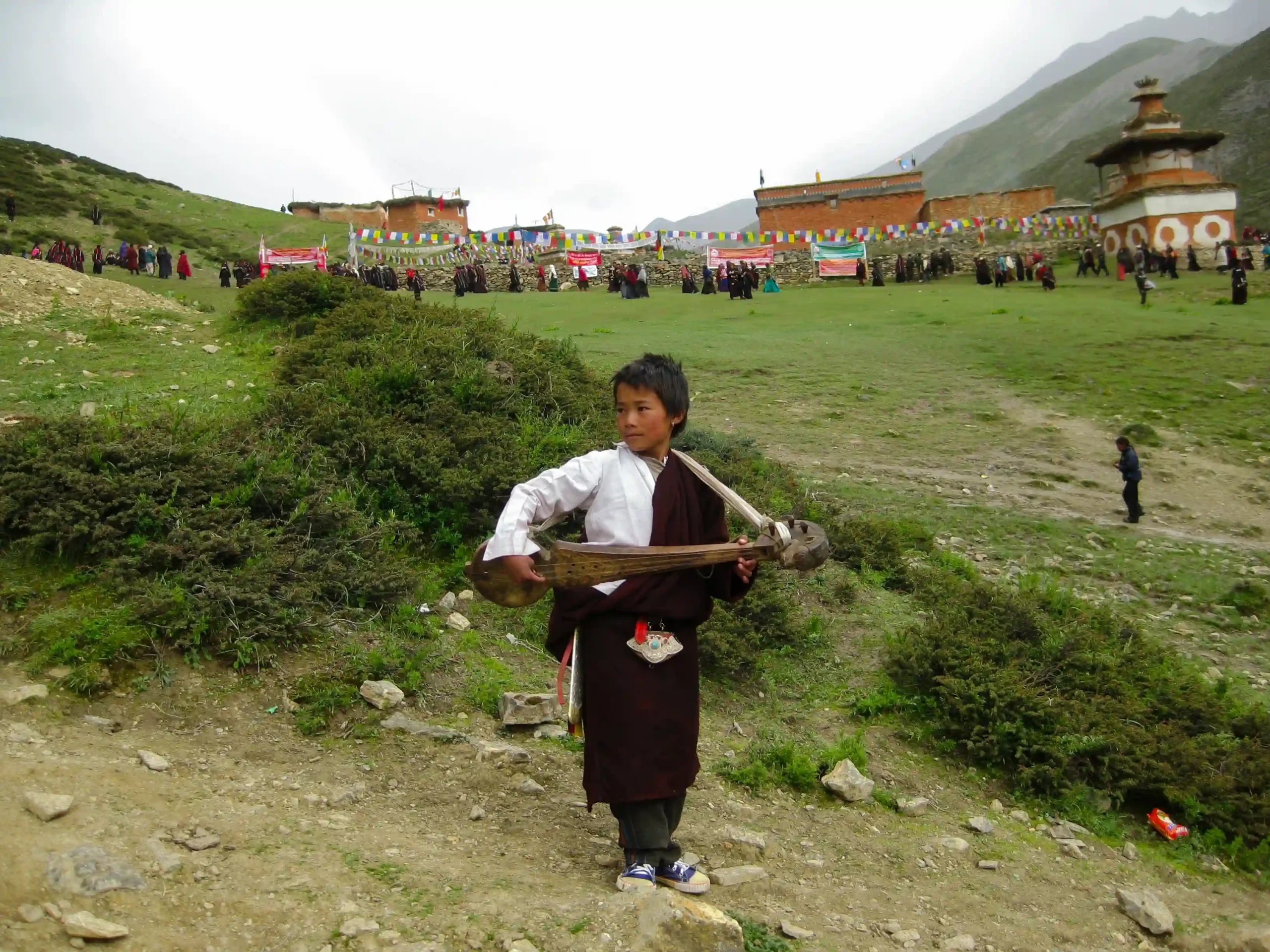
The local Dolpo-pa people have preserved their traditional Tibetan-influenced lifestyle for centuries. They speak their own dialects, practice seasonal migration with yak herds, grow barley on terraced fields, and follow a unique blend of Tibetan Buddhism and the ancient Bon religion. This deep cultural isolation is what makes every encounter here feel authentic and powerful.
Shey Phoksundo Lake: Nepal’s Deepest Lake
One of the most beautiful highlights of the trek is the dramatic arrival at Shey Phoksundo Lake (3,611 m). Nepal’s deepest lake is famous for its vivid turquoise color that contrasts sharply with the arid, rocky surroundings. The trail approaches through the narrow Suli Ghat gorge, passing Nepal’s tallest waterfall (167 m). The small Bon monastery in Ringmo village adds a serene spiritual touch to this already stunning landscape.
Shey Gompa: The Spiritual Heart of Upper Dolpo
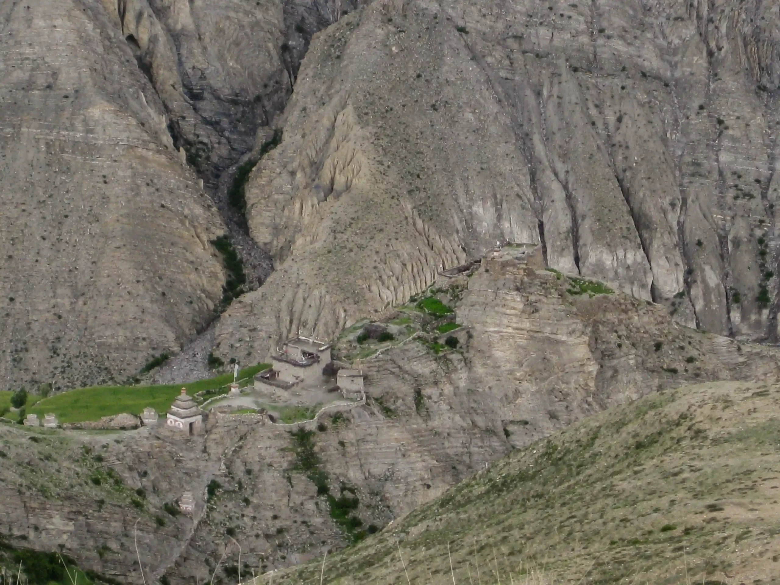
At the center of the trek lies Shey Gompa, an 11th-century monastery situated at the base of Crystal Mountain (Ribo Drukta) at approximately 4,200 meters. Legend says it was founded by the Tibetan master Drotob Senge Yeshe. The gompa contains ancient thangkas, sacred statues, and manuscripts revered by both Buddhists and Bon practitioners.
Crystal Mountain is considered Dolpo’s sacred peak, its own version of Mount Kailash. Pilgrims perform a kora (circumambulation) around the mountain to cleanse karma. Every 12 years, during the Tibetan Year of the Dragon, Shey Gompa hosts the rare Shey Festival. The most recent festival was held in 2024, with the next one expected in 2036.
The Three High Passes: What to Expect
The Upper Dolpo Trek involves crossing three demanding passes above 5,000 meters. These are long, tough days that usually require 7–8 hours of trekking. Starting early is essential to avoid afternoon winds.
| Pass Name | Altitude | Key Characteristics |
| Nagdalo La (Kang La) | 5,350 m | Long scree climb; marks the entry into inner Upper Dolpo; stunning views of Crystal Mountain |
| Shey La | 5,000–5,200 m | Gradual ascent across a high plateau; wide views toward Mustang and Tibet |
| Jeng La | 5,110 m | Often the most challenging pass, possible snow and ice, spectacular panoramic reward |
Bon-Buddhist Culture and the Hidden Villages of Dolpo
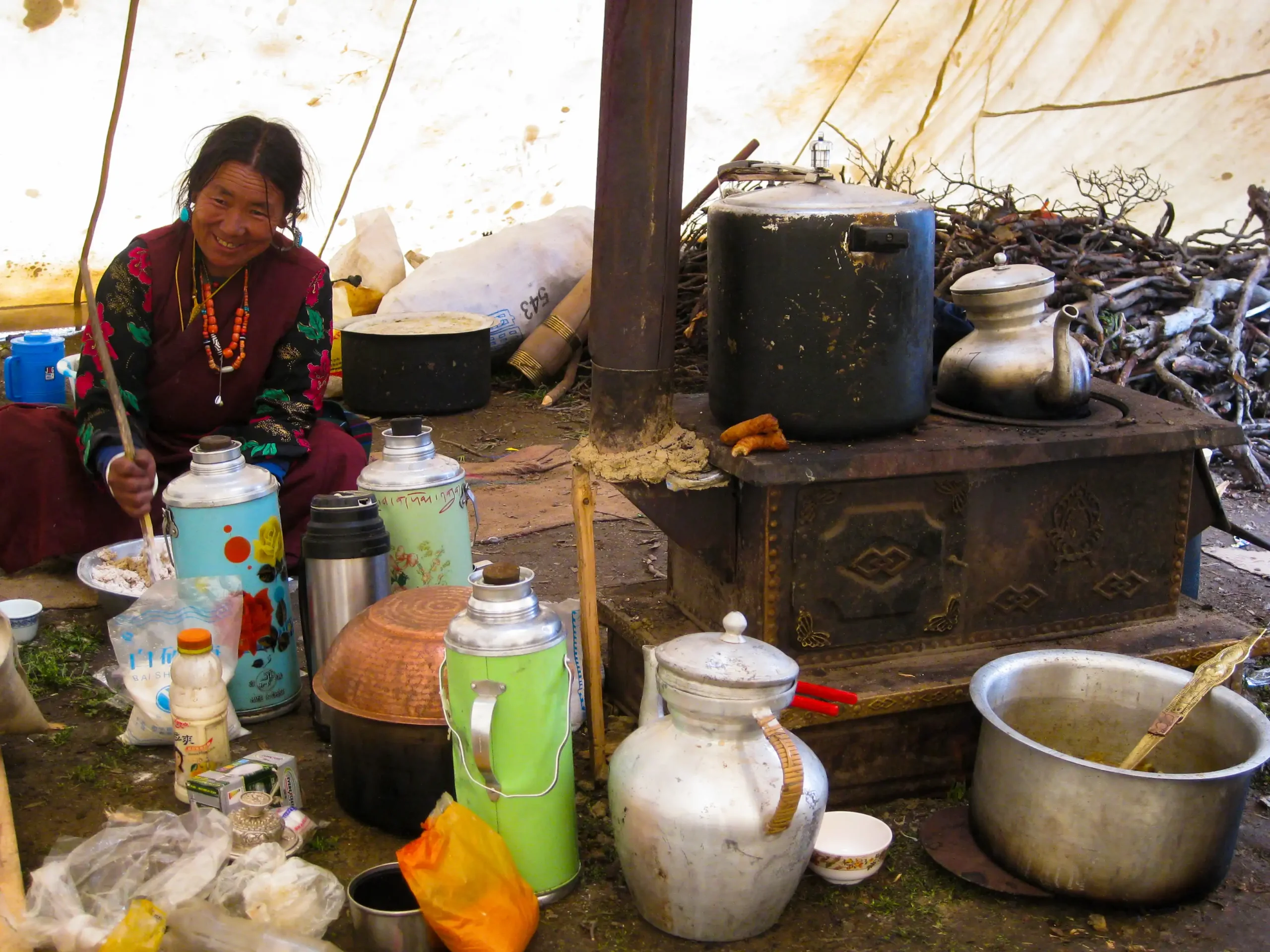
What truly sets this trek apart is the depth of cultural immersion. As a full camping trek, you walk straight through the daily life of communities that rarely see outsiders.
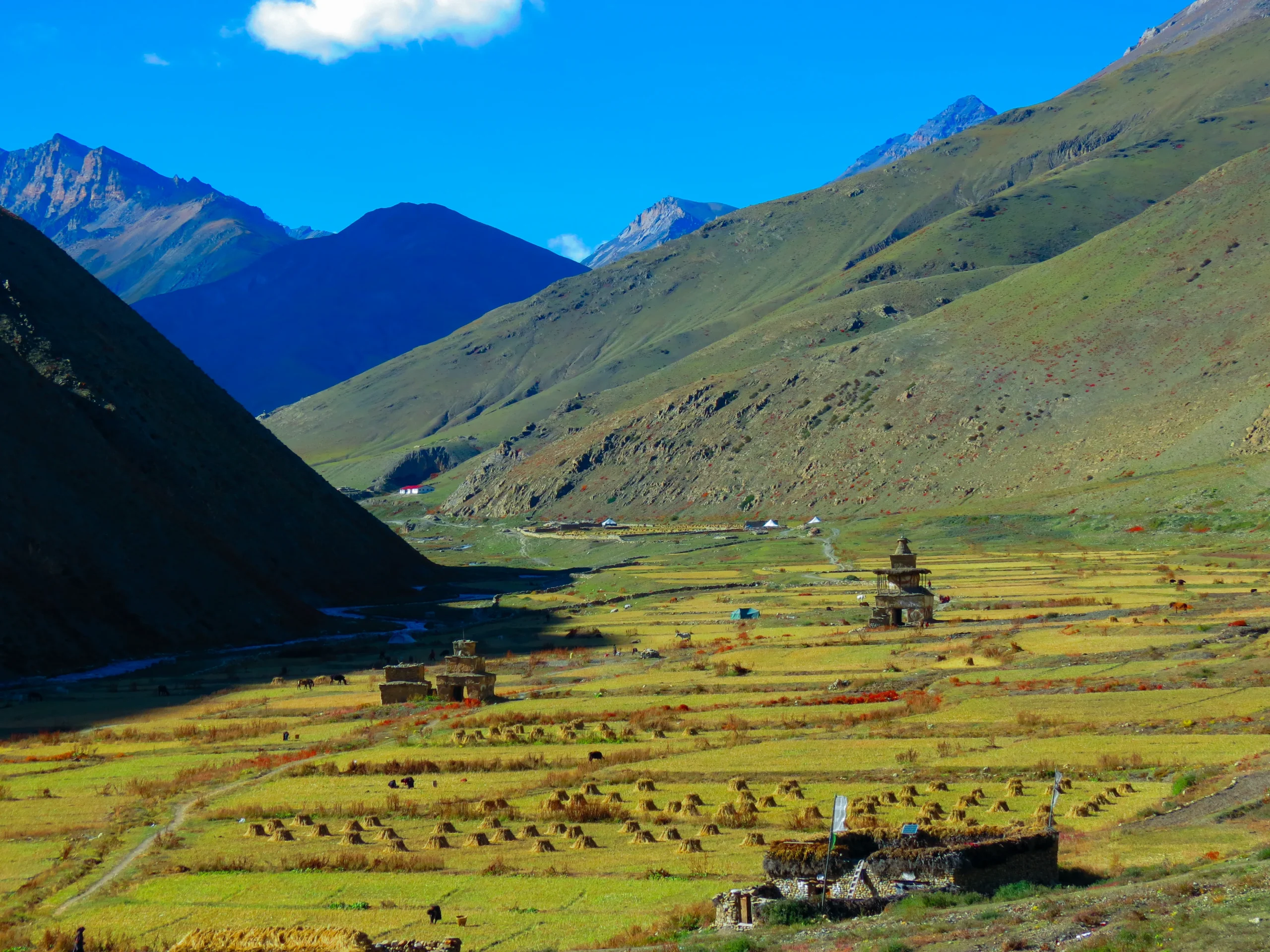
- Saldang: The largest and most important village in Upper Dolpo. Its stone houses, barley terraces, and ancient gompa offer a timeless Tibetan feel.
- Dho Tarap (4,070 m): A cultural bridge between inner Dolpo and lower valleys, with both Buddhist and Bon monasteries. A rest day here is highly recommended.
- Yangtser Gompa (Yangze Gompa): One of Dolpo’s least-known monasteries, perched on an open plateau. The sound of monks chanting in such isolation is an unforgettable experience.
Upper Dolpo Trek: Shey Phoksundo Lake & Shey Gompa Trek Highlights
- Stand before the breathtaking turquoise waters of Shey Phoksundo Lake
- Visit the sacred Shey Gompa at the base of Crystal Mountain
- Cross three high Himalayan passes, including Kang La at 5,350 m
- Explore remote villages of Saldang, Dho Tarap, and Yangtser Gompa
- Experience living Bon-Buddhist traditions and ancient Tibetan-influenced culture
- Trek through wild, untouched high-altitude desert landscapes inside Shey Phoksundo National Park
- Enjoy a profound sense of remoteness and solitude found in very few places today
Upper Dolpo Trek: Shey Phoksundo Lake & Shey Gompa Trek Itinerary
Expand AllArrival in Kathmandu (1,350 m)
Your Firante team meets you at Tribhuvan International Airport and transfers you to your hotel in Thamel. The evening is yours to explore: take a slow walk through the buzzing lanes, pick up any last gear, and let the altitude and energy of Kathmandu settle in. We will run through your permits and final briefing tonight.
Fly Kathmandu to Nepalgunj (150 m)
A morning flight takes you southwest to Nepalgunj, the gateway city to western Nepal. This warm, low-altitude city is your staging point. Use the afternoon to rest and confirm your gear is organized. Baggage limits on the onward flight are strict: 15 kg to Juphal.
Nepalgunj - Jhuphal (2,475 m) then trek to Dunai(2,140 m) (Mountain flight)
We will arrive in Jhuphal after taking a 40 minutes flight from Nepalgunj. Our crew members will be waiting for us with every necessary equipment’s. After reaching there, we will hike for 3 more hours to reach Dunai. Dunai is the capital of Dolpo district. The route to Dunai is through the terraced fields until we reach River Bheri Gorge. There will be time for us to have a short inspect of the town before it gets dark.
Dunai to Ankhe (2,896 m)
Dunai to Ankhe trail is upwards through the Thulo Bheri Valley before entering the Phoksundo River Valley. It takes almost 6 hours to reach Ankhe. On the way, there are a few villages to see as well as walnut groves to enjoy. There are also the mountains but Kagmara Peak can be seen clearly. Finally, the trail descends to Ankhe which is at the altitude of 2896 meters, through deep jungle-like greenery.
Ankhe to Sulighat (3,180 m)
The trail today takes us through trees and up and down a grassy incline above the river. Due to the complex pathway, it takes 6 hours to reach the destination. Continuing the route downwards, we descend a stone path to the river’s edge and head towards Sulighat which is at the altitude of 3,180 meters.
Sulighat to Shey Phoksundo Lake (3,611 m)
Today we get to Phoksundo Lake, which has wonderful, clean water. Phoksundo Lake is situated at an altitude of 3611m. We follow the valley route, which takes 4 hours to reach Phoksundo Lake passing by the Phoksundo and Pungmo rivers as well as pine trees. We get our first glimpse of the lake sparkling in the light below us from the top of a high mountain. One of Nepal’s highest waterfalls is also found here. The route is then towards the birch forests to Ringmo. Ringmo is a charming village on the edges of the Mountain.
Acclimatization Day at Phoksundo Lake (3,611 m)
Do not skip this day. You have been climbing steadily, and the next sections push higher. Walk to the upper end of the lake, visit the small Bon monastery at Ringmo village, or simply sit by the water. Your body needs this time. Your soul will too.
Phoksundo Lake to Phoksundo Khola (3,507 m)
We leave the lake today by following the trail west, passing through wooden bridge-like structures till we meet a grassland that leads to the Phoksundo Khola river bed which is at the altitude of 3,507 meters. The path leads us above the muddy ground towards the valley to the riverside, where we can all spend the night. It is a 5-hour trekking route from Shey Phoksundo Lake to Phoksundo Khola.
Phoksundo Khola to Phoksundo Bhanjyang (3,910 m)
Today, the trek is through a glacier valley to the Phoksundo Khola and another stream’s junction recognized by an old wooden bridge. Phoksundo Bhanjyang lies at the altitude of 3910 meters. We encounter a sheep field and then a steep canyon as we climb north-east. Walking up here is difficult, so it takes around 6 hours to reach Phoksundo Bhanjyang. We must reach another valley in order to cross the Kang La Pass.
Phoksundo Bhanjyang to Shey Gompa (4,200 m)
The day begins with a challenging ascent to the summit of the Kang La Pass. Kang La pass elevation is about 5300 meters approximately. It is a five-hour trek today despite its difficulties. The views of the valley below are spectacular from the top. The trail then takes a steep slope to the valley level. We stick to the river’s banks, crossing and recrossing the freezing waters. Mud caves can be seen lining the slopes that face down the river. We trek across meadows with mountain goats, yaks and sheep before arriving at Shey Gompa which is at the altitude of 4500 meters.
Shey Gompa to Namduna Gaon (4,800 m)
We’ll travel past juniper trees into a canyon today, where the track bends over loose stones and rocks to the top of Saldang La Pass. It’s also exhausting to descend the other side. Therefore, today’s trek requires 6 to 7 hours to complete. Nomadic herders with their sheep and yaks can still be seen today. There will be time to visit the red monastery built beneath a gorge rock when we get at Namduna Gaon. We will spend the night here in Namduna Gaon at the altitude of 4800 meters.
Namduna Gaon to Saldang (3,620 m)
The trek today leads us across barren mountains to Saldang village, which is situated on a plateau just above Namga Khola at the elevation of 3620 meters. This is the largest settlement in the inner Dolpo area, spanning a 2-kilometer slope. It’s worth mentioning that there are five villages totaling approximately 80 houses here. Because of its vital position on the trade route to Tibet, there are presumably a lot of residences here. The trek from Namduna Gaon to Saldang requires 4 to 5 hours to complete.
Saldang to Yangze Gompa (4,960 m)
As we follow the Nagon Khola past the villages of Marang and Ki, the landscape becomes increasingly dry. Yangze Gompa is at the altitude of 4,960 meters. We will arrive at Yangze Gompa, another Bon monastery, after crossing a tributary of the Panzang River a couple more times. It requires approximately 4 hours to reach Yangze Gompa from Saldang.
Yangze Gompa to Sibu (4,560 m)
To get to Namdo village, we walk through terraced fields, mani walls (stone walls with prayers engraved into them), chortens, stupas and a monastery. This prosperous village, which rises high above the Nam Khong Khola, has roughly 60 houses. We will continue walking for another two hours until we reach Sibu, located at the altitude of 4560 meters, where we will camp tonight. It takes 6 to 7 hours to finish this trek.
Sibu to Jeng La Phedi (4,900 m)
Jeng La Phedi is at the altitude of 4900 meters. As we go east and then ascend to a grazing field below the Jeng La Pass, we will most certainly spot yak caravans there. It takes about 5 hours from Shibu to reach Jeng La Phedi.
Jeng La Phedi to Tokyu Gaon via Jeng La (4,900 m / 4,209 m)
Tokyu Gaon is situated at the altitude of 4,209 meters. We only have to climb 200 meters today to cross the pass because we are starting from Jeng La Phedi at 4,900 meters. From the pass, we have a spectacular view of the Dhaulagiri Massif’s north face. After crossing the pass, the trail descends through rugged terrain to the Tarap Valley and Tokyu’s monastery. It takes around 5-6 hours to complete this trek.
Tokyo Gaon to Dho Tarap (4,070 m)
It takes around 4 hours to reach Dho Tarap starting from Tokyo Gaon. Today’s scenery will be different, with grasses and marshes lining the riverbanks. Dho Tarap is at the elevation of 4070 meters.
Rest Day at Dho Tarap (4,070 m)
We will spend the day in Dho Tarap on this rest day. There are approximately 40 houses here, with the majority of the residents being Magar’s, a Nepalese hill tribe. There are some Tibetans who live here and Buddhism is still very much a part of the culture. A Bon Gompa is just a short distance away from the village. We can explore the surrounding area, Gompa and village today.
Dho Tarap to Tarap Khola (3,800 m)
Today’s trek approximately takes about 6 hours to reach Tarap Khola. The path leads us past juniper and wild rose bushes to a broad valley that narrows into a canyon. Before approaching the confluence of Lang Khola rivers and Tarap Chu, we encounter herds of sheep once more. We will set a camp next to the Tarap River today at the altitude of 3800 meters.
Tarap Khola to Khani Gaon (3,150 m)
Today’s journey takes 4 hours to reach Khani Gaon. On the journey, we meet numerous locals who are primarily transporting their cattle to lower pastures. Khani Gaon is at an altitude of 3,150 meters. We’ll be walking over rough bridges, logs, stone slabs, and maybe even through the river!
Khani Gaon to Tarakot (2,537 m)
We take the path to Lalberi village and continue through forests and a gorge until we reach the river. We will go to another monastery today, which is located on a hill just above Bheri River. We’re camping tonight at Tarakot which is at the altitude of 2,537 meters because there’s no ideal camping between Tarakot and Dunai. We’ll reach there tomorrow. As a result, it’ll be a short walking day for four hours today.
Tarakot to Dunai (2,140 m)
The hike to Dunai today is relatively easy, passing through a pine-lined ravine along the Bheri River. It is easy but it takes around 5-6 hours to reach Dunai, which is at the altitude of 2,140 meters.
Dunai to Juphal (2,475 m)
The expedition concludes today with a short and easy walk to Jhuphal, situated at the altitude of 2,475 meters. It takes around 3 hours to reach Jhuphal from Dunai.
Juphal to Nepalgunj to Kathmandu
From Jhuphal, you will take an early morning flight to reach Nepalgunj and then take another flight to return back to Kathmandu.
Final Departure from Kathmandu
Your Firante team transfers you to the airport for your international flight. You leave Nepal lighter in luggage and heavier in everything that actually matters.
Not quite satisfied with this itinerary?
No worries – every traveler has unique preferences, and we’d be happy to adjust the plan to match your style, comfort, and interests. Let us know what you’d like to add or change, and we’ll create a journey that feels truly yours.
Customize TripCost Includes
- All airport pick up and drop services.
- Accommodations in Kathmandu twin share with breakfast
- Twin sharing basis hotel in Nepalgunj with Dinner
- Guide, cook and kitchen support staff.
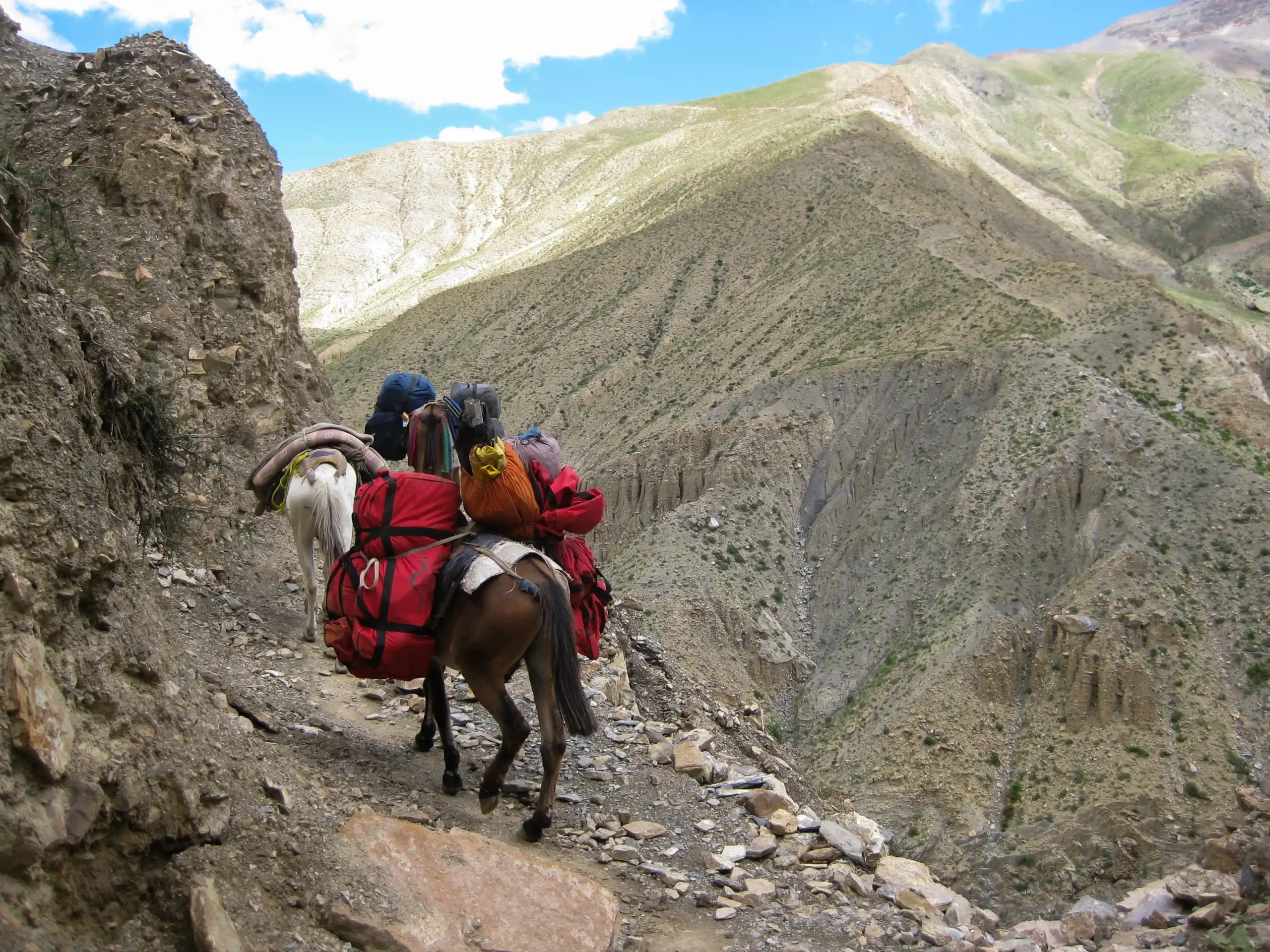
- Mules or porters for luggage on the trekking.
- All meals during the treks
- All camping and cooking equipments.
- All camping Charges.
- Clients Airfare Kathmandu-Nepalgunj-Juphal-Kathmandu
- Dolpo restricted area permit fee.
- National Park fees
- All travel expenses for Nepali staffs.
- All local official donations if any.
- Sightseeing in Kathmandu (Boudhanath, Pashupatinath and Bhaktapur) with tour guide with vehicle
- First AID kit
Cost Excludes
- Insurance for Clients and Emergency Rescue and medicines and medicals.
- Sightseeing entrance fees in Kathmandu.
- Personal beverages bill.
- Lunch and dinner in Kathmandu.
- Domestic access baggage charge (Kathmandu to Nepalgunj weight limit is 20 kg and Nepalgunj to Juphal weight limit is 15 kg).
- Sleeping bag & mattress during trip.
- International flights.
- Flight cancelations & its further more expenses
- Tips
Additional Informations
How Difficult Is the Upper Dolpo Trek? An Honest Assessment
The Upper Dolpo Trek is rated Difficult to Strenuous. You will cross multiple passes above 5,000 m and spend many days above 4,000 meters. Daily trekking hours range between 5 and 8 hours over rugged terrain with no teahouses available.
This trek is best suited for experienced trekkers who have:
- Prior high-altitude experience (ideally above 4,500 m)
- Good cardiovascular fitness from consistent training
- Mental readiness for remote camping conditions
- Flexibility due to possible weather-related flight delays
Best Seasons:
May to June (Spring) and September to October (Autumn) offer the most stable weather and clearest views.
Upper Dolpo Restricted Area Permit: What You Need to Know
Upper Dolpo requires a Restricted Area Permit (RAP) costing USD 500 per person for the first 10 days, plus USD 50 per extra day. Firante Treks includes all permit costs in the package and handles the complete process. Independent trekking is not permitted.
Why Trek Upper Dolpo with Firante Treks?
With over 15 years of experience organizing Upper Dolpo expeditions, Firante Treks is one of the most reliable operators for this challenging route. Our senior guides have led this trek many times and maintain strong relationships with local communities in Shey Gompa, Saldang, and Dho Tarap.
We provide full camping support with an experienced cook, kitchen crew, quality tents, and reliable logistics designed for high-altitude conditions. You can focus entirely on the journey while we take care of permits, safety, and all practical details.
Accommodation
Firante Treks and Expedition Manages for best and comfortable accommodation and also provides you hygienic food. Standard (3 Star) are booked in the cities such as Kathmandu and Pokhara, whereas a tyical trek lodge will be booked on remote areas.
Luxurious rooms from 5 Star hotels are also made avaiable on demand in the cities on additional cost but remote regionss dont have such facilities.
Trip Gallery
Trip FAQs
1. How difficult is the Upper Dolpo Trek?
The Upper Dolpo Trek is rated Difficult to Strenuous. It involves crossing three high passes above 5,000 meters, long trekking days (5–8 hours), and many consecutive nights above 4,000 meters with no teahouses available. It is only recommended for experienced trekkers who have previous high-altitude experience and good physical fitness.
2. What is the best season for the Upper Dolpo Trek?
The best times are May to June (Spring) and September to October (Autumn). These months offer clearer skies, better visibility of the mountains, and more stable weather for crossing the high passes. Winter is not possible due to heavy snow, and monsoon months increase the risk of flight delays.
3. Do I need a special permit for Upper Dolpo?
Yes. Upper Dolpo is a restricted area. You need a Restricted Area Permit (RAP), which currently costs USD 500 per person for the first 10 days, plus USD 50 per additional day. Firante Treks arranges all permits, including the Shey Phoksundo National Park entry fee.
4. Is independent trekking allowed in Upper Dolpo?
No. Independent trekking is strictly prohibited. You must travel with a registered Nepali trekking agency, a licensed guide, and proper permits.
5. Is the Upper Dolpo Trek a teahouse trek or camping trek?
This is a full camping trek. There are no lodges or teahouses in the Upper Dolpo region. We provide high-quality tents, a dining tent, kitchen setup, and an experienced cook who prepares all meals.
6. What is the maximum altitude reached on this trek?
The highest point is Nagdalo La (Kang La Pass) at 5,350 meters. You will spend a significant amount of time above 4,000 meters, so proper acclimatization is very important.
7. How long is the Upper Dolpo Trek?
Our standard itinerary is 25 days (including arrival and departure days in Kathmandu). The actual trekking portion is approximately 18–20 days. We can customize the duration based on your preference.
8. What kind of physical preparation do I need?
You should have strong cardiovascular fitness and previous high-altitude trekking experience (ideally above 4,500 m). We recommend training with long hikes, uphill walking, and carrying a backpack for several months before the trip.
9. What happens if there is bad weather or flight delays?
Flights to Jhuphal are often affected by weather. In case of delays or cancellations, we have contingency plans and can adjust the itinerary. Our experienced team will manage the situation to keep your trek safe and as smooth as possible.
10. Will I see wildlife during the trek?
Yes. Shey Phoksundo National Park is home to blue sheep, Himalayan tahr, musk deer, marmots, and rarely snow leopards. Birdlife is also rich in the lower sections.
11. How do you handle altitude sickness on this trek?
Our guides are well-trained to recognize early symptoms. We build proper acclimatization days into the itinerary, carry oxygen and a comprehensive first aid kit, and follow the “climb high, sleep low” principle. If needed, we can arrange immediate descent.
12. Can the itinerary be customized?
Yes, absolutely. Many clients request extra rest days, more cultural exploration time, or slight route modifications. Just share your fitness level and preferences, and we will create a personalized plan for you.
You may also like

Everest Base Camp Trek
Everest Base Camp Trek: Experience the ultimate Himalayan adventure with breathtaking views of Mount Everest, Sherpa culture, and iconic monasteries. Perfect for thrill-seekers and nature lovers. Trek safely with proper acclimatization, expert guides, and essential gear.

Lukla to Namche Trek
The Lukla to Namche Trek is where many Everest journeys begin, but it is also a complete journey on its own. You fly into...

Nepal Has Two Faces. Most Trekkers Only See One. Everyone knows Everest Base Camp. Everyone has seen the photos of the Annapurna Circuit. They...

The Humla Limi Valley Trek is a 21-day remote camping trek in northwestern Nepal that follows ancient Tibetan trade routes through Halji, Til, and Jang villages. This restricted area trek crosses Nara La Pass (4,580m) and Nyalu La Pass (5,000m), offering authentic Tibetan Buddhist culture, Himalayan wilderness, and rare views toward Mount Kailash.

Kailash & Upper Humla Circuit Trek 2026: Start your spiritual journey to Mount Kailash and the remote Upper Humla region. Experience breathtaking Himalayan landscapes, unique Tibetan culture, and untouched wilderness. Trek safely with proper acclimatization, local guides, and essential gear for an unforgettable Kailash Yatra 2026.
