Koti Himal Expeditions

Koti Himal is a remote and largely unexplored peak located in the Limi Valley of Humla, Nepal. Standing at approximately 6,194 meters, it lies near the Tibetan border and remains one of the few unclimbed or rarely attempted peaks in the region. Surrounded by stunning Himalayan landscapes and ancient Tibetan Buddhist villages, Koti Himal offers a raw and untouched experience for adventurous climbers and trekkers seeking off-the-beaten-path exploration.

ITINERARY OVERVIEW

Day-01  Arrive to Kathmandu

Day-02 Fly Kathmandu to Nepalgunj

Day-03 Fly Nepalgunj to Simikot

Day-04 Trek to Dharapori

Day-05 Trek to Kermi

Day-06 Trek to Singjungma

Day-07 Trek to Tsongsa

Day-08 Trek to Talung via Nyalu la pass

Day-09 Trek to Takchi

Day-10 Trek to Chortenkarbu

Day-11 Trek to Base camp at 4850m/15,912’ BC at 30 12 46N, 81 49 30E

Day-12 Acclimatize at BC

Day-13 Trek to HC, 5375m, return to Base Camp

Day-14 Rest Day at Base Camp

Day-15 Trek to High Camp

Day-16 Climb Limi Koti, 6194m and return to
HC Limi Koti

Day-17 to Day- 19(3, days)  Rest/spare days

Day-20 Trek back to Takchi

Day-21 Drive back to Simikot

Day-22 Fly back to Nepalgunj and to Kathmandu

Day-23  Fly back to home

Changwatang Himal Expedition

East spur and northwest ridge of Changwatang (6,130m) is located in the Far West in Nepal near Chinese border. Changwatang has more to offer than its low elevation suggests. The mountain provides some nice surprises, including an alpine-style climbing path. This massif is a call to all those seeking peace and quiet, to all those seeking to discover a Nepal other than the well-known massifs of the Khumbu and Annapurna’s, a Nepal that is still untamed. Here you must plan your journey, choose your valley to climb, your top to climb and learn everything there is to know about the area.

Western Nepal is a largely unknown territory. As a result, the massif’s name is somewhat ambiguous. It is no longer Dolpo, nor is it the Tibetan plateau, but the Limi region, located in the center of the massif. Many peaks exceed 6000 m. Magnificent, very alpine peaks, with slender, glacial paces, and others more debonair. Huge potential for those who want to climb, trek and explore. The starting point for these mountains is the small village of Simikot (capital of the district of Humla) which can be reached by plane from Nepalgunj. Otherwise, you will need 24 hours by bus and 6 days of walking from Nepalgunj.

Changwatang was not formally opened until 2002, but four Japanese and two Sherpas led by Tamotsu Ohnishi had made the ascent two years prior. This party is thought to have climbed the northwest ridge in its entirety, approaching from the west and setting up a high camp at 5,730 meters. The second ascent, along the south ridge, was made by Michihiro Honda’s Japanese expedition in 2008.

The Limi massif, which stretches between Simikot and Changwatang, boasts more than 16 peaks above 6,000 meters, as well as numerous glaciated lower peaks and nameless passes. Every one of these peaks is unclimbed, and a high-altitude trip from here north to Changwatang is possible. Aside from alpinism, Changwatang offers a gateway to another universe. It’s a good excuse to travel to a part of Nepal that’s rarely visited, where youngsters don’t bother you for pens or pencils as you pass.

The Limi Valley, tucked away in northwest Nepal, is a magical spot. Three ethnic Tibetan villages—Jang, Waljie and Til—make up the community. These villages are difficult to reach from Nepal and are shut off totally during the winter months. A valley that has been forgotten.

ITINERARY OVERVIEW

Day-01-  ArriveKathmandu(KTM),stay Hotel

Day-02-  Rest visit Ministry of Culture, Tourism & Civil Aviation for permit

Day-03-  Fly to Nepalgunj

Day-04-  Fly to Simikot

Day-05 to 11  Trek to BC,302002N,81 5559E,4950m/16,240’

Day-12- Trek to Changwatang ABC,  back to BC

Day-13-  Trek to Changwatang HC set up high-altitude tents, drop food & fuel, return to ABC

Day-14-  Trek to Changwatang HC with guide,stay at HC

Day-15-  Summit Changwatang Himal, 6130m return to HC, dismantle HC and return to ABC

Day-16-  Return to BC

Day-17 to 18- Spare/restdays

Day-19 – 20 Spare/restdays

Day-20-  Helicopter flight back to Kathmandu/ or Day 20- 25 trek back to Simikot and fly back to KTM

Chandi Himal and Changwatang Expedition

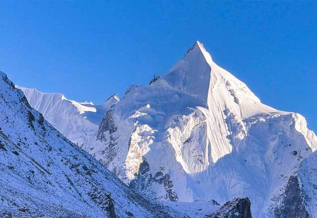
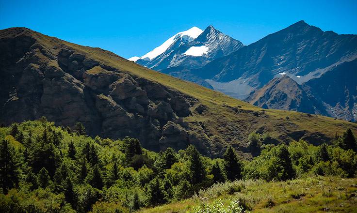
Chandi Himal is located north of Changwatang, towards the western extremity of the Nepalese Himalayas. It is one of Nepal’s unclimbed peaks that has recently been accessible to expeditions. It is a climbing peak in Nepal’s Chandi mountain range, which is part of the Chandi Himal municipality of the Humla district. The mountain top is 6096 meters high and is located in latitude 30.3592 and longitude 81.9514. Mount Api (7132m), Mt Saipal (7031m), Dhaulagiri, Mt Chandi and other peaks can be seen from the summit of Chandi Himal Peak.

At higher elevations, the region’s vegetation includes Pine and Hemlock woods, White Fir, Juniper, Birch, and Rhododendron, scrub and alpine plant communities. The Red Panda, Snow Leopard, Musk Deer, Himalayan Thar, Marten, Himalayan Mouse Hare (Pika), and over 118 species of birds, including the Impeyan Pheasant, Snow Cock, Blood Pheasant, and Red-billed Cough, can all be found in the park.

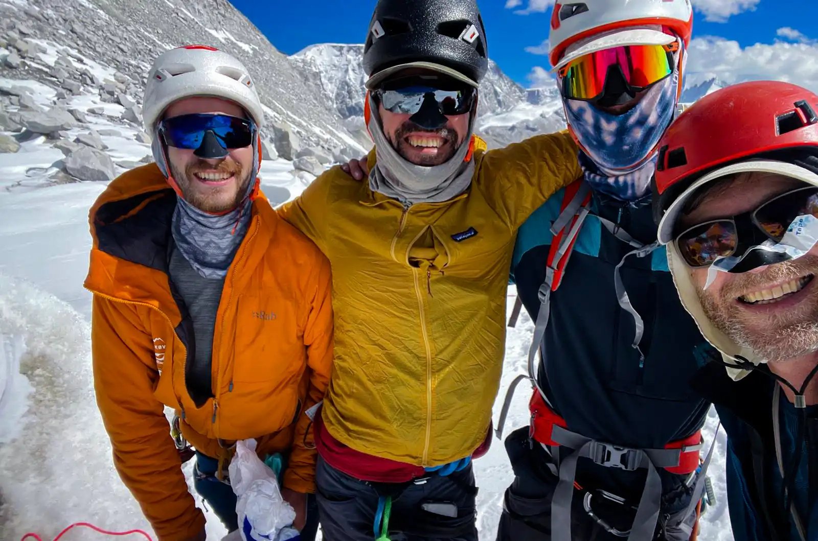
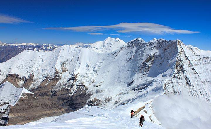
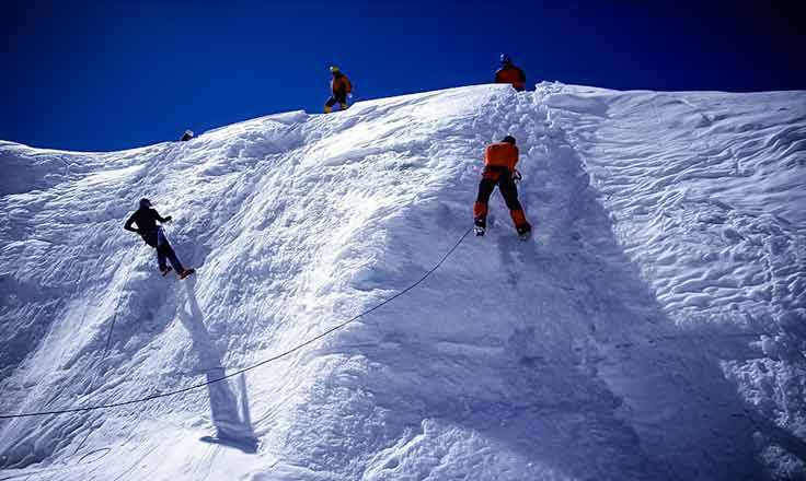
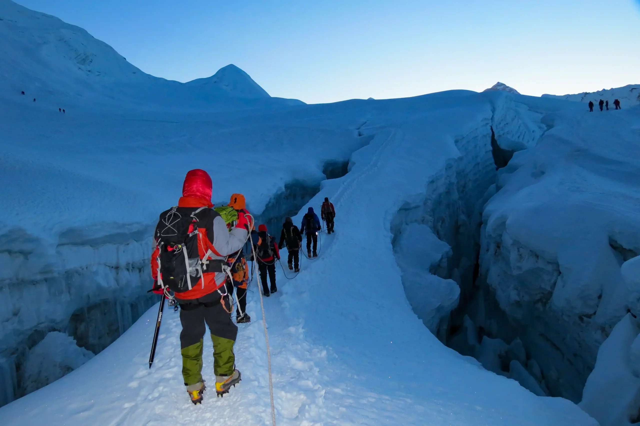
Climbing the Chandi Himal Peak is a 45-day difficult adventure excursion. The excursion begins in Kathmandu, where you will backpack and prepare for the journey. Your guide will provide you with all of the relevant trip information. The trail to the peak of Chandi Himal Peak runs through Simikot, Kharpunath, Thehe, Dojam and Thara Sangu and is 38 kilometers long, with a climbing route of 32.6 kilometers.

ITINERARY OVERVIEW

Day 01: Arrive in Kathmandu (KTM) – Transfer to Hotel

Day 02: Rest Day – Visit the Ministry of Culture, Tourism & Civil Aviation for permits

Day 03: Fly to Nepalgunj – 150m (492ft)

Day 04: Fly to Simikot – 2,910m (9,550ft)

Day 05 to Day 11: Trek to Base Camp – 4,950m (16,240ft)

Day 12: Trek to Chandi ABC – 5,365m (17,603ft)

Day 13: Trek to Chandi High Camp (HC) – 5,750m (18,865ft)

Day 14: Trek to Chandi HC – Stay at High Camp

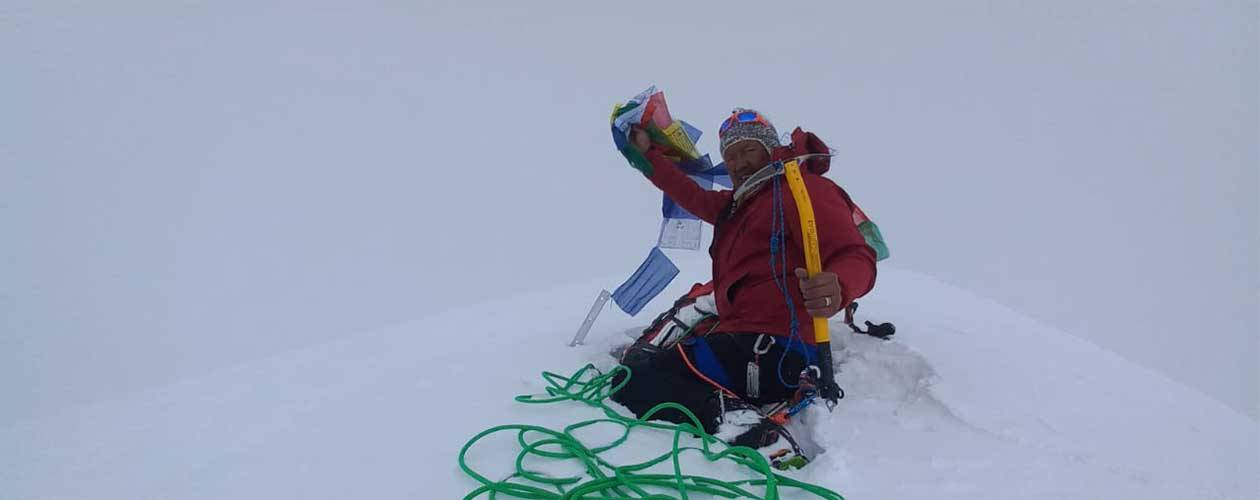
Day 15: Summit Chandi Himal – 6,142m (20,151ft) via NE ridge – Return to HC, dismantle HC, and return to ABC

Day 16: Return to Base Camp

Day 17 to Day 18: Spare/Rest Days

Day 19: Trek to Changwatang High Camp (HC) – 5,500m (18,045ft)

Day 20: Summit Changwatang – 6,130m (20,112ft) via E ridge – Return to HC

Day 21: Return to Base Camp

Day 22: Trek back to Sumna

Day 23: Trek from Sumna to Gurukpa

Day 24: Trek from Gurukpa to Dhukling Khola

Day 25: Trek from Dhukling Khola to Shambakong

Day 26: Trek from Shambakong to Dojam

Day 27: Trek from Dojam to Simikot

Day 28: Fly from Simikot to NepalgunjFly from Nepalgunj to Kathmandu

Saipal Expedition

Mount Saipal is the second highest mountain in Nepal’s Sudurpashchim Province, rising beyond 7,031 meters above sea level. These majestic peaks have yet to be climbed because most of the northern part of the province is yet undiscovered. Mt. Saipal, which is part of the Gurans Himal range, one of the Himalayan sub-ranges, provides adventurers with plenty of thrills and wilderness. While the mountain is not particularly high in elevation, its challenging topography and challenging climbing route make it a difficult climb for even experienced mountaineers. The peak is located in Bajhang district, some 1,000 kilometers from Kathmandu and is where the Seti River originates.

When viewed from the east or north, Saipal is a magnificent peak. Simikot is the starting point for a trek to East Saipal and North Saipal Base Camp, which may be done separately or as part of the Limi Valley circuit. The path from Simikot to the East Base Camp takes a detour through steep-sided forested territory. Mt. Saipal Expedition is a once-in-a-lifetime opportunity to immerse yourself in less-known, distant, off-the-beaten-path, exotic terrain, which includes many of Western Nepal’s snowcapped summits. The Saipal region is a less busy and pristine destination. Our skilled climbing guide Sherpa has carefully planned the Saipal Himal adventure schedule to allow for a steady ascent and sufficient acclimatization for climbers.

In this excursion, we fly to Simikot from Nepalgunj, a western Nepalese hub city which will take around 55 minutes to reach there. We then travel through Thakuris and Bhotia villages (Dharapori, Kermi, and Yalbang), following the Humla Karnali river gorges and experiencing their way of life. The trail heads north from Yalbang to Chala and the Karan Khola valley, which is home to Northern Saipal Base Camp. This adventure journey passes via rugged cliffs, defended settlements and herders’ camps, jungles and provides a deep understanding of Himalayan wonderful sentiments. We will acclimate for a few days at Saipal Base Camp, practice expeditions, then summit Mt. Saipal. We will return to Base Camp after a successful summit ascent and resume back our trek to Simikot.
The Saipal region is rich in cultural and natural features in addition to the peaks.

It can also provide an exciting excursion for individuals who enjoy hiking in the woods. While the lower part has challenging geography, making life tough for locals, the alpine area boasts wide grasslands. Yarsagumba, GuchheChyau, Jatamasi, Panchaunle, Padmachal and SetakChini are among the medicinal herbs found in these grasslands. Many people living below alpine areas relies on these medical herbs as a source of income. The entire area is covered in a carpet of numerous wild flowers in the spring, while the land is covered in a thick covering of snow in the winter. Several wildlife species, including Blue Sheep and the elusive Snow Leopard can be found in the area. The encounter with beautiful flora and fauna, walking through dense forest and untainted rivers and witnessing beautiful rituals and festivals of the local people, as well as their unique songs and music, will provide a “Once in a Lifetime Experience” for climbers from all over the world.

ITINEARY OVERVIEW

Day 1: Arrival in Kathmandu
Day 2: Preparation Day
Day 3: Sightseeing in Kathmandu
Day 4: Flight from Kathmandu – Nepalgunj
Day 5: Flight from Nepalgunj – Simikot
Day 6: Trek from Simikot – Dharapori
Day 7: Trek from Dharapori – Yalbang
Day 8: Trek from Yalbang – Choila/Chala
Day 9: Trek from Chala – North Base Camp via Karang Khola
Day 10: Trek from North Base Camp – Saipal Base Camp
Day 11 – Day 22 : Climbing period of Mt. Saipal
Day 23: Trek from Saipal Base Camp – Labuk Depsa
Day 24: Trek from Labuk Depsa – Yalbang
Day 25: Trek from Yalbang – Kermi
Day 26: Trek from Kermi – Simkot
Day 27: Flight from Simikot – Kathmandu via Nepalgunj
Day 28: Rest Day
Day 29: Departure

Mount Kanjirowa Expedition

Mount Kanjirowa Expedition (Unclimbed) is located at an elevation of 6612 m in the Dolpa area of Shey Phoksundo national park, with latitude 28°14’00” and longitude 82°52’35”. This Himal is also known in Dolpa by its local name, Gangchhen Ralwa Himal. Gangchhen means “Big Mountain,” and Ralwa means “Horse’s Mane,” according to the name’s meaning. It got its name because when you look at the mountain, you can see the horse’s neck and some straight lines on the mountain that seem like the horse’s mane.

Kanjirowa Himal is the second tallest peak in Dolpa and is located right on the Phoksundo Lake. However, the lack of accurate information about this peak has left climbers perplexed and has discouraged climbers from attempting the peak. According to a local source, the Japanese were the first to attempt to reach the peak of this Himal, however numerous foreign and national climbers followed suit subsequently. To date, no evidence of any climbers reaching the summit has been recorded.

The Firante Team’s Kanjirowa Expedition begins with flight from Kathmandu to Nepalgunj. Then it’s on to Juphal. After landing at Juphal’s airstrip, we will start our trek with Sherpa Guides in a remote area with stunning scenery, sub-tropical and low alpine woods. Similarly, until we reach the Base Camp, we will have the option to visit religious and culturally interesting villages. Several endangered kinds of wildlife are likely to be encountered throughout our expedition. Furthermore, we will be exposed to the genuine culture of kind, accepting and hospitable locals.

We will gradually ascend from Kanjirowa Base Camp by setting up a large number of high camps and taking plenty of time for safe acclimatization. At first, we will choose a non-technical trail that often takes us through snow-covered walls. As we approach the peak of Kanjirowa Peak, 6,883m, our ascent gets more technical and difficult. Following a successful summit ascent, we will securely return to base camp and then hike back to Juphal. Our Kanjirowa Expedition Nepal adventure comes to a close with a connecting flight from Juphal to Nepalgunj and then returning back to Kathmandu.

We provide a Kanjirowa Expedition Package that includes logistical support, transportation, lodging and a professional mountain guide – everything we need to climb Kanjirowa Peak at a fair price. Kanjirowa Expedition prices are competitive in the sense that we ensure you get the best of everything. In Nepal, we would like to explore the Himalayas and engage in professional peak climbing. All climbers who wish to reach the top of Kanjirowa in Nepal should contact Firante to realize their most cherished ambition. We feel we are capable of handling any difficulty flawlessly and effectively during our excursion in Nepal.


ITINERARY OVERVIEW

Day 1: Arrival in Kathmandu

Day 2: Fight from Kathmandu – Nepalgunj

Day 3: Flight from Nepalgunj – Jhuphal then trek to Tripurakot

Day 4: Trek from Tripurakot – Ghodakhor

Day 5: Trek from Ghodakhor – Hurikot

Day 6: Trek from Hurikot – Takpoche

Day 7: Trek from Takpoche – Gau Chaur

Day 8: Rest Day

Day 9: Trek from Gau Chaur – Thulo Palat

Day 10: Trek from Thulo Palat – Bahiri Pudwa Khola Camp

Day 11: Trek from Bahiri Pudwa Khola Camp – Bhitti Puduwa

Day 12: Trek from Bhitti Puduwa – Kanjirowa Base Camp

Day 13: Rest Day

Day 14: Base Camp – High Camp

Day 15: Acclimatization Day

Day 16: Trek to Camp I

Day 17: Summit Day

Day 18: Reserve Day

Day 19: Trek from Mt. Kanjirowa – Bahiri Puduwa

Day 20: Trek from Bahiri Puduwa – Tallo Jagdul

Day 21: Trek from Tallo Jagdul – Kaigaon

Day 22: Trek from Kaigaon – Tripurakot

Day 23: Trek from Tripurakot – Jhuphal

Day 24: Flu from Jhuphal – Kathmandu via Nepalgunj

Day 25: Final Departure


Putha Hiunchuli Expedition

Putha Hiunchuli is a beautiful peak in the wonderful and mysterious Dolpo region. This wornderful mountain stands in Nepal’s northwestern region. As part of the Dhaulagiri Himalayan Ranges, it is between the massifs of Dhaulagiri and Kanjiroba Himal. Dhaulagiri VI is another name for it. The Putha Hiunchuli is a unique and lonesome mountain which is rarely climbed.

In comparison to other technical mountain excursions, this peak has fewer technical obstacles. However, for the Putha Hiunchuli Expedition, good physical condition and previous peak climbing expertise are highly advised. In 1954, Jimmy Roberts and a British Expedition team became the first to reach the summit of Mt. Putha Hiunchuli. The Putha Hiunchuli Expedition is a fantastic opportunity for experienced climbers to explore the lesser-known Dolpo region while getting a once-in-a-lifetime experience of reaching the top of Mt. Putha Hiunchuli.

We’ll take a short flight to Nepalgunj, a southern town city in western Nepal, after a full day of touring in Kathmandu. We’ll take another spectacular flight from Nepalgunj to Jhuphal in the lower Dolpo. Then we will begin our trip by following the trail to Dunai, which takes us past cultural communities and highly forested areas. Lower Dolpo’s administrative and commerce centers are both located in Dunai. We continue on the path for a few days, passing through Tarakot, Musikhola, Kakot, and Phedi villages on our way to Putha Hiunchuli Base Camp.

Our Sherpa crew will inspect our climbing equipment and health status as soon as we arrive at base camp. Our experienced climbing professionals gave the directions and we started towards the summit of Mount Putha Hiunchuli, fully equipped and acclimatized. Our strenuous ascent to the summit is rewarded with beautiful views of the Dolpo region’s valleys and high peaks.

Roped-up glacier climbing including crevasse crossings is part of the Mt. Putha Hiunchuli Expedition. The snow slopes reach a maximum of 40 degrees. On the tougher areas of the climb, fixed ropes will be used, however most of the climbing will be done in roped teams. Despite the fact that our Sherpa team will set up camps on the mountain and transport food and fuel, we expect our team members to bring their own equipment. The climbing session will last two weeks, giving you plenty of time to acclimate and prepare for the peak. Above base camp, we plan to use three camps: Camp 1 at 5,400 meters, Camp 2 at 6,200 meters and Camp 3 at 6,600 meters.

Pisang Peak Climbing

Pisang Peak rises above the Marshyangdi valley. It was first ascended by J. Wellenkamp as part of German expedition in 1955. This trekking peak is a uniform slope of ice and snow to the final summit pyramid. Pisang peak is also considered one of the easy peaks among the trekking peaks in Nepal. The path ascends through sparse wood and pasture to a Kharka at (4,380m) which is considered the best place for setting up the base camp. High Camp is set up at (5,400m) climbing to a shoulder on the South-West Ridge. Normally there will be snow at the high camp from the end of November to the end of March.

ITINERARY OVERVIEW

Day 01: Arrival in Kathmandu and met our staff and transfer to hotel.
Day 02: Kathmandu.
Day 03: Kathmandu – Beshi Sahar and trek to Khudi (790m) by bus.
Day 04: Trek to Jagat (1310m)
Day 05: Trek to Dharapani (1860m)
Day 06: Trek to Chame (2700m)
Day 07: Trek to Upper Pisang (3300m)
Day 08: Trek to Kharka Base Camp (4370m)
Day 09: Trek to South West Ridge High Camp (5420m)
Day 10: Pisang Peak Summit (6091m)
Day 11: Trek to Kharka Base Camp (4370m)
Day 12: Trek to Pisang (3200m)
Day 13: Trek to Manang (3440m)
Day 14: Trek to Thorong Phedi (4500m)
Day 15: Trek to Muktinath (3800m) via Thorong – La (5416m)
Day 16: Trek to Marpha via Kagbeni (2620m)
Day 17: Trek to Kalapani (2500m)
Day 18: Trek to Tatopani (1183m) hot spring.
Day 19: Trek to Ghorepani (2900m) Poon Hill (3200m)
Day 20: Trek to Ghandrung (2000m)
Day 21: Trek Nayapul and drive to Pokhara
Day 22: Pokhara drive back to Kathmandu by tourist bus.

Yala Peak Climbing

Yala peak is a part of the Langtang Himal which lies just to the north of Kathmandu in the Langtang region. The base camp of Yala Peak is Kyangjin Gompa (3749m/12300 ft). Yala Peak, considered one of Nepal’s easier trekking peaks, is a fantastic beginner’s mountaineering trip. This beautiful peak affords surprising views of Shishapang 8012 m, which is the only solo mountain in Tibet with a height above 8000 m.

The climb is easy and suited for anyone with trekking experience. We start in Syabrubesi after a 5 hour drive from Kathmandu and spend five days hiking up the beautiful Langtang valley to Kyanjin Gompa at 3800 m. Kyanjin Gompa is situated below Langtang Lirung (7246 m) and we spend three days acclimatizing taking day-hikes in spectacular surroundings. The last 400 m is on ice so we will be using crampons, ice axe and rope.

ITINERARY OVERVIEW

Day 01:     Arrival in Kathmandu and met our staff and transfer to hotel.
Day 02:     Half day guided sightseeing tour of Kathmandu valley.
Day 03:     Drive to Dhunche (1950m) and stay at camp.
Day 04:     Trek to Syabru (2200m)
Day 05:     Trek to Lama Hotel (2500m)
Day 06:     Trek to Langtang (3100m)
Day 07:     Trek to Kyangching Gompa (3750m)
Day 08:     Excursion to Tserko Ri (5033m)
Day 09:     Trek to Yala Peak Base Camp (4800m)
Day 10:     Yala Peak summit (5500m)
Day 11:     Reserve day.
Day 12:     Trek to Ghora Tabela (3050m)
Day 13:     Trek to Syabru (2200m)
Day 14:     Trek to Sing Gompa (3300m)
Day 15:     Trek to Dhunche (1950m)
Day 16:     Dhunche drive back to Kathmandu by bus.
Day 17:     Free day in Kathmandu.
Day 18:     Transfer to airport to return to home.

Mera Peak Climbing

The first ascent of Mera was made by Jimmy Roberts and Sen Tenzing on 20 May 1953, who appeared to have climbed the central summit. The next recorded ascent was not until 1975 when French Climbers Jolly, Baus and Honills climbed the north summit. Mera is among the highest of Nepal’s official trekking Peak.

This superb trek takes us right through the Khumbu region with some wonderful views of the major peaks in the area including Everest itself. Whether you want to attempt the summit or just go alone for trek, you will feel as though you have taken part in a real Himalayan expedition. The climb is not technical, but you will need good adaptation to altitude and basic knowledge of ice axe and crampon techniques.

Island peak Climbing

Island peak stands at 6189 m (20,305 ft). This trekking peak offer great potential for climbing and provide a challenging but achievable alternative to full scale mountaineering expeditions with a chance to stand on top of a Himalayan peak.

Trekking peaks do vary in terms of difficulty from non-technical plods to very technical climbs. Island peak is mostly a plod up but does require the use of ice axe and crampons and there is one part where a rope is needed.

Subscribe for
travel stories & fresh trails:

chat-in-website
Need Help? Chat with us
chat-in-website
Need Help? Chat with us