
Hidden Valleys in Nepal: A Field Guide to Western Nepal’s Remote Landscapes and Living Cultures
 Firante
Blog Read Time
Hidden Valleys in Nepal
Nepal is usually introduced through a handful of famous names, Everest, Annapurna, Langtang. These places have earned their reputation. But travel further west and the character of the Himalaya changes completely. Roads get rougher, passes decide whether a journey continues, and villages can hold on to ways of life that have barely changed in generations, or, in some cases, are disappearing within a single lifetime.
This guide covers Hidden Valleys in Nepal region by region: Humla (Limi, Nyin, Changla, Namkha Tukchhulung, Saipal), Dolpa (Upper Dolpo and Dho Tarap), and Mugu (Rara Lake). Where a detail is confirmed, it’s stated plainly. Where something still needs verification, it’s marked, because getting the facts right matters more than making every place sound equally mysterious.
Many of these Hidden Valleys in Nepal remain far from the country’s busiest trekking routes, offering a very different experience of the Himalaya. This guide explores some of the most remarkable Hidden Valleys in Nepal while focusing on real places, real communities, and verified information.
Why Western Nepal Is Different
Western Nepal isn’t one landscape. It stretches from the mid-hill river valleys of Karnali to the high Himalayan country of Humla and Dolpo. What connects all of it is infrastructure, or the lack of it. In Everest and Annapurna, established routes come with regular teahouses and predictable services. In Western Nepal, those expectations can disappear within a day’s ride. A journey might involve flights followed by long, rough road stretches, walking sections, restricted-area permits, basic homestays, and real weather-related delays. That’s part of the experience, and it’s exactly why local knowledge matters more here than almost anywhere else in Nepal.
Humla Region
Humla is Nepal’s most remote district, tucked into the far northwest corner of Karnali Province against the Tibetan border. Nearly everything in this district routes through Simikot, Humla’s headquarters, sitting at 2,910m with the district’s only airport and the checkpoint where restricted-area permits are checked before travel continues north. From Simikot, five distinct valleys branch out, Limi, Nyin, Changla, Namkha, and Saipal, each with its own character but sharing the same underlying rhythm: Tibetan-influenced Buddhist culture, high passes, and a landscape shaped by the Himalayan rain shadow.
Limi Valley, Humla
Key Passes: Nara La (4,580m), Nyalu La (approx. 5,000m) | Main Villages: Halji, Til, Jang | Culture: Tibetan Buddhism | Best Suited To: Cultural travelers, anthropology-minded trekkers
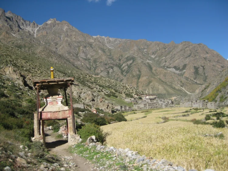
Limi sits deep in Humla’s rain shadow, arid, high, and closer in feel to the Tibetan Plateau than to the rest of Nepal. Villages here are built the traditional way: stone walls, flat rooftops, designed for a landscape with little rain and long winters. The route from Simikot climbs through Nara La (4,580m) and Nyalu La (approx. 5,000m), moving from highland farmland into terrain that looks and feels like Tibet before the border is technically reached.
Of the three historic Limi villages, Halji is the best-preserved, built around the 11th-century Rinchenling Monastery, founded by the translator Rinchen Zangpo and one of the oldest religious sites in western Nepal; it currently follows the Drikung Kagyu tradition. Til sits in front of Mendung Himal, part of the Gurla Mandhata range, and from the top of Nyalu La, the Talung Valley opens up below, with Mount Kailash and Lake Mansarovar visible on a clear day from the Lapcha Syar viewpoint. A hot spring near Jang village, with views toward Ardang La, is a lesser-known stop along the way.
Limi’s population picture has changed sharply recently. Jang village once held 63 households; by 2025 only two families remained, and both have since left for Kathmandu, leaving the village empty and its monasteries no longer in active use. Til is following a similar path, and now faces a direct physical threat as well: a glacial-lake-fed river running near the village flooded in 2025, and flooded again in July 2026, this time sweeping away the village bridge. Of the three villages, only Halji currently retains a stable resident population.
Highlights of Limi Valley
- Nara La (4,580m) and Nyalu La (approx. 5,000m), the two defining passes on the route
- Lapcha Syar viewpoint: Mount Kailash and Lake Mansarovar visible without crossing into Tibet
- Rinchenling Monastery in Halji, 11th century, Drikung Kagyu tradition
- Til village, set against the Gurla Mandhata range, its bridge swept away by flooding in July 2026
- Jang village, now empty after its last two families left for Kathmandu in 2025
- A hot spring near Jang, with views of Ardang La
Best Season: Spring and autumn, the same high-pass windows that apply across most of Humla.
Nyin Valley, Humla
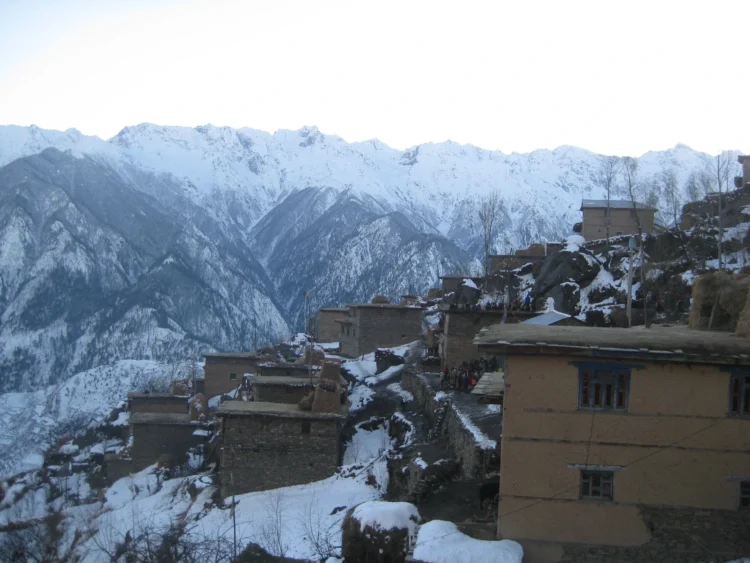
Access: Flight (Nepalgunj–Simikot) or road (Surkhet–Kalikot–Simikot) | Main Villages: Buraunse, Bargaun, Torpa, Langdu, Hutik, Nimatang | Culture: Shamanism, Bon, Nyingma Buddhism | Best Suited To: Travelers wanting deep cultural immersion, ideally timed to a festival
Buraunse is the first major village reached from Simikot and the largest village in the valley; Bargaun is the next biggest. Together with Torpa, Langdu, Hutik, and Nimatang, these villages practice a mix of shamanism and Bon tradition, visible in dress, ritual, and daily life. Buraunse alone holds the valley’s Mane festival, next celebrated on January 21, 2027; the other villages don’t share that date, each holds its own festival, generally in March or April. Nyinba people also celebrate Losar as their new year.
To the northeast, Panchamukhi is the valley’s standout peak, with two small lakes, locally called Dudhe Daha and Ladhe Daha, sitting above roughly 4,000m. The route typically crosses the Ghatte Khola river near Buraunse, fed by Panchamukhi Himal, a river that also supplies roughly 500 kilowatts of hydropower to Simikot valley and surrounding villages. From there, the trail reaches Bagachalna (Changla) for views over Simikot valley and the snow-capped Riboche Himal, before continuing toward Raling, where Changla Peak comes into view. The path passes through Bargau and Torpa villages, with the Humla Karnali River running below near Dojam village, and Selmugang, locally called the “crystal peak,” standing over Raling Monastery in the distance.
Raling Monastery carries serious weight in local belief: tradition holds that Guru Padmasambhava meditated there in the 8th century, and the yogi Milarepa in the 11th, with the site’s significance resting in its sacred meditation caves rather than its architecture. During Saga Dawa, the community marks the occasion in traditional dress with traditional songs.
Traditional houses here are built from stone with flat rooftops, though that’s changing: many households are shifting to inclined tin roofs, as most young people leave for education and work, leaving mainly older residents in the villages. Fraternal polyandry was historically practiced across the valley; by 2026 it’s declining, though some households still maintain it. That same generational shift shows in how the valley is reached: what was once a walk of an hour or more between villages is now a short jeep ride, Simikot to Buraunse now takes around 15 minutes by road, Bargaun about 35 minutes, and Torpa roughly 45, with the full Nyin Valley loop by jeep taking about an hour and a half.
Highlights of Nyin Valley
- Raling Gompa (approx. 4,000m), linked to Guru Padmasambhava and Milarepa
- Panchamukhi Himal and its two lakes, Dudhe Daha and Ladhe Daha (approx. 4,000m)
- Ghatte Khola river crossing near Buraunse, source of hydropower for Simikot valley
- Mane festival, unique to Buraunse village (most recently January 21, 2027); other villages celebrate their own festivals in March–April, plus Losar
- A living mix of shamanism and Bon tradition, alongside a fading fraternal polyandry tradition
- Traditional stone, flat-roof architecture, now shifting to inclined tin roofing
Best Season: Time it around a festival if possible, Saga Dawa and the Mane festival both offer a far deeper experience than a standard trekking window.
Changla Valley, Humla
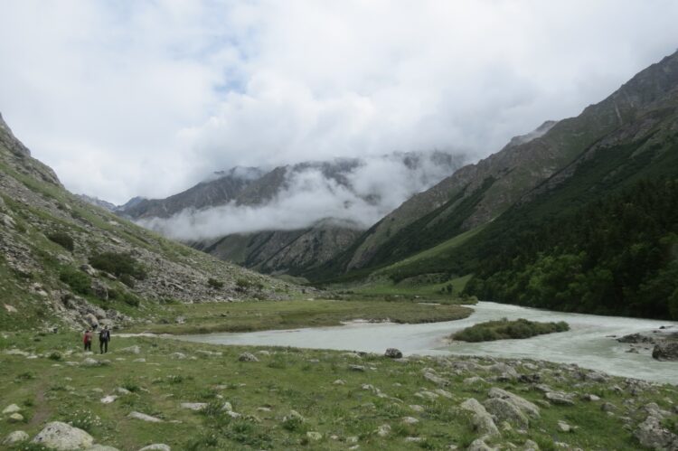
Key Pass: Phyajang La, 5,496m | Main Landmarks: Changla Himal, Chwatang, Chandi Himal | Best Suited To: Highly enthusiastic, wildlife-focused travelers
The route runs from Simikot through Nyin Valley to Thehe, one of the largest villages in Humla, where shamanist and Hindu communities live side by side. A jeep track now links Dojam to Shambayok, but past Dojam, the character of the trek changes completely: no more villages for long stretches, no lodges of any kind. From here it’s a full camping expedition, tents, cook crew, open valleys, rocky slopes, and high pastures scattered with seasonal herders and their animals.
The stretch between Takchi and Chhorten Chhobu is the strongest wildlife-viewing ground on this entire route; blue sheep move across the steep cliffs, wild yaks graze the meadows, and herds of kyang (Tibetan wild ass) cross the open ground in view of the trail. Crossing Phyajang La (5,496m) is the hardest single stretch of the journey, opening into the valley’s widest, most dramatic scenery, framed by Changla Himal, Chwatang, and Chandi Himal. The route also connects through to Limi Valley, and from parts of this connection, there’s an opportunity for a distant darshan of Mount Kailash.
Highlights of Changla Valley
- Phyajang La, 5,496m, the most demanding crossing on this route
- Takchi to Chhorten Chhobu: blue sheep, wild yak, and herds of kyang (Tibetan wild ass)
- Wide, open valley scenery framed by Changla Himal, Chwatang, and Chandi Himal
- Thehe village, one of Humla’s largest, with shamanist and Hindu communities
- A full camping expedition beyond Dojam, no lodges, no villages, open wilderness
- A route connection through to Limi Valley, with a chance to view Mount Kailash from a distance
Best Season: Spring and autumn, the same general Humla window; this route demands strong physical preparation regardless of season.
Namkha Tukchhulung Valley, Humla
Village Clusters: Tukchhulung (Hyapka, Tangin, Dhiga, Chyadok, Khagalgaun, Kermi) and Hyultsodun (Chala, Yalbang, Yangar, Muchu, Tumkot, Yari Longoi, Yari Jyangoi) | Culture: Buddhist | Best Suited To: Travelers who want a region, not a single attraction
Namkha Tukchhulung Valley is a wide cultural landscape spread across two village clusters of monasteries, pasture, rivers, and old inter-village trade routes. It functions as the gateway to Limi Valley, and the Buddhist communities here share much of the same cultural rhythm found in Nyin and Limi further along the route.
Saipal Base Camp is within this valley system. One of the main routes to Saipal Base Camp runs from Simikot via Kermi, Chala Khola, and Ranikharka. People from Khagalgaun and other Tukchhulung villages move their yaks up to Ranikharka each season, where the high pastures (kharka) have long been used for summer grazing. The herders set up temporary shelters, move livestock through the open meadows, and return when the weather turns. This seasonal pattern still shapes daily life in the valley and links the lower villages directly to the higher Saipal country.
Tourist traffic here is minimal. Namkha Tukchhulung sees more organized tours than independent trekkers, largely because there is not a well-worn trekking circuit through it. What stands out most is the quality of daily life: communities that come across as settled, content, and self-sufficient, alongside the connection to Saipal Base Camp and its seasonal herding grounds.
Highlights of Namkha Tukchhulung Valley
- The gateway route into Limi Valley
- Two distinct village clusters offering a region-wide view of Humla rather than one stop
- One of the main routes to Saipal Base Camp via Kermi, Chala Khola, and Ranikharka
- Seasonal yak herding at Ranikharka by people from Khagalgaun and other Tukchhulung villages
- Genuinely low visitor numbers, among the least-touristed areas on this list
- Shared Buddhist culture with neighboring Nyin and Limi valleys
Best Season: Spring and autumn, consistent with the rest of Humla’s high country.
Saipal Region and Saipal Base Camp
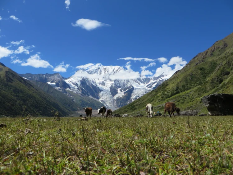
Peak Altitude: Saipal Himal, 7,031m / 23,064ft | Base Camp Altitude: 3,900m | Nunkharka: approx. 4,000m | Best Suited To: Serious trekkers comfortable with camping and logistics
Saipal Himal rises to 7,031m, one of western Nepal’s most striking peaks, sitting on the border between Humla and Bajhang. The Saipal Base Camp trek is still a developing route rather than an established circuit, and there’s more than one way in: one option runs from Nyin Valley through Kharpunath municipality, Yaghchu, Ripghat, Kheta, and Lampata to Saipal Base Camp; another runs from Simikot via Kermi, Chala Khola, and Ranikharka; other combinations are possible depending on season and conditions.
The landscape moves through deep forest thick with medicinal herbs, past communities where Buddhist, Hindu, and shamanist traditions genuinely coexist. Nomadic Khampa people, originally from Bajura and practicing Buddhism, move through the wider Saipal region, while at Ranikharka specifically, herders from Namkha Rural Municipality, including people from Khagalgaun and Kermi, set up seasonal kharka and graze yak, cattle, and other livestock. Saipal Base Camp itself sits at 3,900m, with Nunkharka, and its glacier lake, roughly 4,000m higher up the route.
Highlights of Saipal Region
- Saipal Himal, 7,031m, one of western Nepal’s highest peaks
- Multiple route options via Nyin Valley or via Simikot and Kermi
- Ranikharka Base Camp area and the walk up to Nunkharka Glacier Lake
- Nomadic Khampa (Buddhist) communities from Bajura moving through the region
- Deep forest terrain rich in medicinal plants
- Real logistical demands: altitude, food, and hygiene management all require preparation
Best Season: Spring and autumn; this is expedition-grade travel, and conditions should be checked closely before departure.
Dolpa Region: Upper Dolpo
Dolpa sits in Karnali Province, hidden behind the Dhaulagiri and Annapurna ranges, and the high mountain walls that create that shelter also create Upper Dolpo’s defining feature: a complete rain shadow, producing a barren, high-altitude desert above 4,000m unlike anywhere else in Nepal. The region was closed to foreigners until 1989, and it remains restricted today, entry requires a Restricted Area Permit and travel with a registered agency. The Dolpo-pa people here have preserved a Tibetan-influenced way of life for centuries: their own dialects, seasonal yak migration, barley terraces, and a blended practice of Tibetan Buddhism and the older Bon religion.
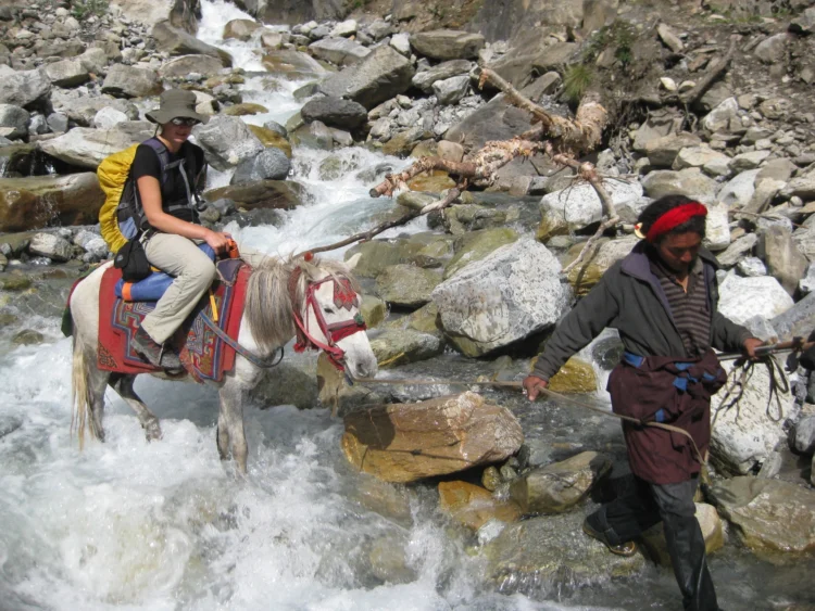
Upper Dolpo: Shey Phoksundo Lake & Shey Gompa
Region: Dolpa | Max Altitude: 5,350m (Kang La / Nagdalo La) | Best Suited To: Experienced, high-altitude trekkers comfortable with full camping
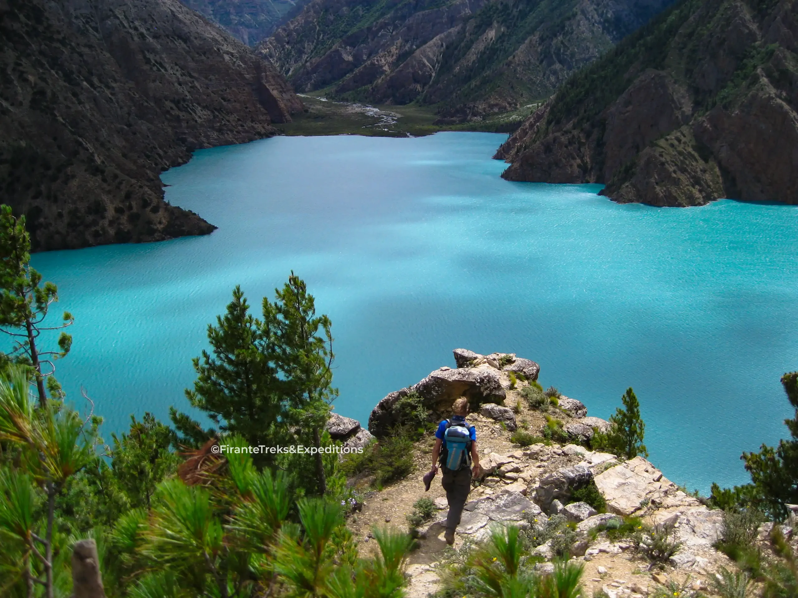
The approach to Shey Phoksundo Lake (3,611m), Nepal’s deepest lake, runs through the narrow Suli Ghat gorge, passing Nepal’s tallest waterfall at 167m, before the turquoise water comes into view against the arid, rocky surroundings. Ringmo village, on the lake’s edge, holds a small Bon monastery.
Deeper into the region, Shey Gompa, an 11th-century monastery founded by the Tibetan master Drotob Senge Yeshe, sits at the base of Crystal Mountain (Ribo Drukta), around 4,200m. Dolpo’s own version of Mount Kailash, Crystal Mountain, draws pilgrims who walk a kora (circumambulation) around it to cleanse karma. Every 12 years, in the Tibetan Year of the Dragon, Shey Gompa hosts the Shey Festival, most recently held in 2024, with the next expected in 2036.
The trek crosses three passes above 5,000m: Nagdalo La, also called Kang La (5,350m), marking the entry into inner Upper Dolpo with views of Crystal Mountain; Shey La (5,000–5,200m), a gradual high-plateau crossing with views toward Mustang and Tibet; and Jeng La (5,110m), often the most challenging of the three, with possible snow and ice. Saldang, spread across a 2km slope with roughly 80 houses across five villages, is the largest settlement in inner Dolpo, its position on the old Tibet trade route explaining its size. Yangze Gompa, a lesser-known Bon monastery at nearly 4,960m, sits on an open plateau, isolated enough that the sound of monks chanting carries across it undisturbed.
Highlights of Upper Dolpo
- Shey Phoksundo Lake (3,611m), Nepal’s deepest, reached via Suli Ghat gorge and Nepal’s tallest waterfall (167m)
- Shey Gompa, 11th century, at the base of sacred Crystal Mountain (Ribo Drukta)
- Three passes above 5,000m: Kang La (5,350m), Shey La (5,000–5,200m), Jeng La (5,110m)
- Saldang, inner Dolpo’s largest village, on the historic Tibet trade route
- Yangze Gompa, a remote Bon monastery near 4,960m
- Full camping trek, restricted area, closed to foreigners until 1989
Best Season: May-June (spring) and September-October (autumn).
Dho Tarap Valley, Dolpo
Region: Dolpa | Key Passes: Two passes above 5,000m | Best Suited To: Experienced trekkers prepared for high-altitude, flight-dependent logistics
The Dho Tarap route runs from Juphal to Dunai, through Chepka, Rechi, and Phoksundo, over Bagala and Numala base camps, through Tokyu village into Dho Tarap valley (4,070m), then on to Nawarpani, Laini, Wodar, and Tarakot before looping back through Dunai to Juphal. Dho Dho Tarap itself holds roughly 40 houses, mostly Magar families alongside some Tibetans, with Buddhism still central to daily life and a Bon gompa a short walk from the village.
The defining stretch of the route is crossing two passes above 5,000 meters back to back on the way into Dho Dho Tarap valley. The main practical constraint isn’t the trekking itself, it’s getting there, access depends entirely on flying into Juphal, and weather can delay that considerably.
Highlights of Dho Tarap Valley
- Two consecutive passes above 5,000m, one of the route’s defining challenges
- Dho Dho Tarap (4,070m): among the highest continuously inhabited villages on earth, roughly 40 houses
- Mixed Magar, Tibetan, Buddhist, and Bon community life
- Flight-dependent access via Juphal, weather is the main planning risk
Best Season: March-May and September-October.
Mugu Region
Rara Lake and Mugu
Elevation: 2,990m | Access: Flight, road, or trekking | Best Suited To: Travelers who want remote scenery without expedition-level commitment
Rara can be reached by flight, road, or on foot, three genuinely different routes to the same lake. The road route runs from Surkhet through Kalikot, Jumla, and Mugu to the lake, passing through the Jumla Khalanga Valley, Guthi Chaur, and Dafe Lagna before reaching Mugu Gamgadhi, with views of Chankheli Himal and the Jumla valley opening up along the way.
What makes Rara stand apart isn’t just that it’s Nepal’s largest lake, it’s the cultural shift travelers notice once they’re here, distinct from eastern Nepal in both landscape and community life.
Highlights of Rara Lake and Mugu
- Nepal’s largest lake at 2,990m, inside Rara National Park
- Multiple approach options: flight, road, or trekking, each offering a different experience
- Dafe Lagna pass and views of Chankheli Himal en route from Jumla
- A cultural character distinct from eastern Nepal’s more familiar trekking regions
- Mugu district itself extends well beyond the lake for travelers with time to explore further
Best Season: February-April and October-November tend to offer the most reliable conditions.
Comparison at a Glance
| Region | Key Pass / Altitude | Access | Difficulty | Best Suited To |
| Limi Valley (Humla) | Nara La 4,580m / Nyalu La ~5,000m | Road + walking from Simikot | Moderate-Hard | Cultural/anthropology travelers |
| Nyin Valley (Humla) | Raling Gompa, ~4,000m | Road/jeep from Simikot | Moderate | Deep cultural immersion |
| Changla Valley (Humla) | Phyajang La, 5,496m | Trekking from Simikot | Hard | Wildlife-focused, highly enthusiastic trekkers |
| Namkha Valley (Humla) | N/A (regional) | Road/tour-based | Easy-Moderate | Travelers wanting a region, not one site |
| Saipal Region (Humla/Bajhang) | Peak 7,031m / Base camp 3,900m | Trekking loop from Simikot or Nyin Valley | Expedition-grade | Serious, camping-comfortable trekkers |
| Upper Dolpo (Dolpa) | Kang La, 5,350m | Flight into Juphal + full camping trek | Hard | Experienced, high-altitude trekkers |
| Dho Tarap Valley (Dolpa) | Two passes above 5,000m | Flight into Juphal + trekking | Hard | Experienced, high-altitude trekkers |
| Rara Lake & Mugu | Lake at 2,990m | Flight, road, or trek | Easy-Moderate | Remote scenery without expedition demands |
What You Should Know Before Traveling to These Valleys
Permits. Several of these routes fall within restricted areas requiring specific permits and registered arrangements. Requirements should always be confirmed against the exact itinerary before departure.
Accommodation. Expect real variety, some routes offer basic homestays, others require camping outright. The farther west you go, the less useful it becomes to expect Everest or Annapurna circuit standards.
Altitude. Difficulty varies dramatically across this list. Rara is not the same undertaking as crossing two 5,000m+ passes in Dho Tarap or Upper Dolpo. Match the itinerary to the traveler, not the other way around.
Access. Road conditions change quickly, flights can be delayed by weather, and a road on a map doesn’t guarantee a smooth drive. Buffer days matter more here than almost anywhere else in Nepal.
Why This Region Deserves a Closer Look
Remote travel can’t be planned properly from behind a desk. A map can’t tell you which ford is passable after rain, which village has emptied out since the last edition of a guidebook, or when the weather window for a 5,000m pass is actually closing rather than just looking rough. These places aren’t being sold here as untouched fantasy. They’re remote, genuinely beautiful, culturally rich, difficult in places, and changing fast, sometimes within a single year, and that honest picture is worth more to a real traveler than a polished myth.